- Chipping Warden
-
Coordinates: 52°08′10″N 1°16′19″W / 52.136°N 1.272°W
Chipping Warden 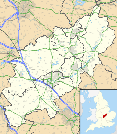
 Chipping Warden
Chipping Warden shown within NorthamptonshirePopulation 529 (2001 census)[1] OS grid reference SP4948 - London 70 miles (113 km) Parish Thorpe Mandeville District South Northamptonshire Shire county Northamptonshire Region East Midlands Country England Sovereign state United Kingdom Post town Banbury Postcode district OX17 Dialling code 01295 Police Northamptonshire Fire Northamptonshire Ambulance East Midlands EU Parliament East Midlands UK Parliament Daventry Website Welcome to the Chipping Warden Parish Web Site List of places: UK • England • Northamptonshire Chipping Warden is a village in Northamptonshire, England about 6 miles (10 km) northeast of the Oxfordshire town of Banbury. The parish is bounded to the east and south by the River Cherwell, to the west by the boundary with Oxfordshire and to the north by field boundaries.
The 2001 Census recorded a parish population of 529[1] in 234 households.
Contents
Archaeology
Just south of Chipping Warden village is Arbury Banks, the remains of an Iron Age hill fort. It is about 200 yards (180 m) in diameter[2] and has been heavily damaged by centuries of ploughing.[3]
At Blackgrounds about 3⁄4 miles (1.2 km) east of the village are the remains of a Roman villa beside the River Cherwell.[2] An investigation in 1849 found a Roman bathhouse 36 feet (11 m) long by 18 feet (5.5 m) wide, and four human burials have been found that may be related to the settlement.[2] Roman coins found at the site indicate that it was inhabited in the 3rd and 4th centuries AD.[2] English Heritage has placed the villa on its Heritage at Risk Register, citing threats from ploughing and a risk of collapse.[4]
Geology
2 miles (3 km) east of the village is the confluence of the river Cherwell and Eydon Brook which is designated as a SSSI due to its importance in the development of the theory of underfit streams.[5]
Manor
The Domesday Book records that in 1086 the manor of Chipping Warden was the caput of the estates of Guy de Raimbeaucourt (or Reimbercourt,[6] Reinbuedcurth[7] or Reinbuedcurt), a baron from Raimbeaucourt in northern France. There was also a Hundred of Chipping Warden that administered the southern part of Northamptonshire.
Guy was succeeded by his son Richard de Raimbeaucourt (circa 1093–1120).[8] Richard left no male heir so the barony of Chipping Warden passed via his daughter Margaret (born 1121) to his son-in-law Robert Foliot (circa 1118–1172),[9] to whom Henry II conceded the barony of Chipping Warden in the middle of the 12th century.[10] As Robert had a wife and son, presumably he is not the Robert Foliot who was Archdeacon of Oxford and later Bishop of Hereford.
The toponym "Chipping" is derived from the Old English cēping meaning "market". In 1238 Robert Grosseteste, Bishop of Lincoln obtained royal letters from Henry III revoking Chipping Warden's right to hold a market.[11] This was because the Bishops of Lincoln controlled the market at Banbury and earned tolls from it, and Grosseteste feared that Chipping Warden was drawing trade away from Banbury.[11]
Parish church
In the Church of England parish church of St. Peter and St. Paul the north wall of the chancel contains two blocked-up Norman arches that suggest the building may date from about 1200.[12] The chancel contains a window that pre-dates 1300, but is probably not in its original position.[13] Other features from the Decorated Gothic period include the windows of the south aisle[13] and the east window of a room to the north of the chancel.[2] The east window of the chancel and the four-bay arcades between the nave and the north and south aisles are from the early part of the Perpendicular Gothic period.[13] The bell tower is also Perpendicular Gothic.[13] The parish is now part of the Church of England benefice of Culworth with Sulgrave and Thorpe Mandeville and Chipping Warden with Edgcote and Moreton Pinkney.[14]
Social and economic history
An open field system of farming prevailed in the parish until an Act of Parliament was passed in May 1733 enabling Chipping Warden's common lands to be enclosed.[15]
In May 1744 a bill was moved in the House of Lords to dissolve the marriage between Henry Scudamore, 3rd Duke of Beaufort and Frances Scudamore.[16] Among witnesses who testified under oath before their Lordships was John Pargiter, a farmer of Chipping Warden, who stated:
"That, in the Beginning of June, 1741, he observed a Man (whom he described), and afterwards found it was Lord Talbot, to meet the Dutchess as she was walking alone in the Fields near that Place; and thereupon mentioned adulterous Familiarities which passed between them."[16]
Witnesses William Douglas and Thomas Bonham corroborated Pargiter's evidence.[16] The Journal of the House of Lords delicately omits the details of the "adulterous Familiarities" but records that subsequent witnesses testified "as to the sending for a Midwise to the Dutchess; her being delivered or brought to Bed of a Daughter".[16] After hearing this and evidence of the Duchess's further adultery with Lord Talbot, their Lordships passed the Bill for the Duke and Duchess to be divorced.[16]
RAF Chipping Warden, just northwest of the village, was built during the Second World War and commissioned in either 1941[17] or 1943[18][19] as a Bomber Command Operational Training Unit. It was decommissioned in 1946.[17][18] Its buildings are now an industrial estate.
Amenities
Chipping Warden has two public houses: The Rose and Crown (Hook Norton Brewery)[20] and The Griffin. The village has a primary school.[21]
References
- ^ a b "Area selected: South Northamptonshire (Non-Metropolitan District)". Neighbourhood Statistics: Full Dataset View. Office for National Statistics. http://neighbourhood.statistics.gov.uk/dissemination/viewFullDataset.do?instanceSelection=03070&productId=779&$ph=60_61&datasetInstanceId=3070&startColumn=1&numberOfColumns=4&containerAreaId=790474. Retrieved 11 July 2011.
- ^ a b c d e Pevsner & Cherry, 1973, page 149
- ^ English Heritage: Arbury Banks, Northamptonshire (NMR 21405/25)
- ^ English Heritage: Heritage at Risk: Roman villa, Chipping Warden, South Northamptonshire, Northamptonshire
- ^ Natural England Citation for Upper Cherwell at Trafford House
- ^ Wright & Lewis, 1983, pages 223-224
- ^ Salzman, 1939, pages 373-395
- ^ Ancestors of Bob & Robyn Bray: Richard de Raimbeaucourt
- ^ Ancestors of Bob & Robyn Bray: Robert Foliot
- ^ Mason, 1988, pages 93-107
- ^ a b Crossley, 1972, pages 49-71
- ^ Pevsner & Cherry, 1973, pages 148-149
- ^ a b c d Pevsner & Cherry, 1973, page 148
- ^ Archbishops' Council (2011). "Benefice of Culworth with Sulgrave and Thorpe Mandeville and Chipping Warden with Edgcote and Moreton Pinkney". A Church Near You. Church of England. http://www.achurchnearyou.com/benefice.php?B=28/058DH&V=16393. Retrieved 11 July 2011.
- ^ Journal of the House of Lords, 24, pages 267-273
- ^ a b c d e Journal of the House of Lords, 26, pages 286-287
- ^ a b The Wartime Memories Project - RAF Chipping Warden
- ^ a b Control Towers – RAF Chipping Warden
- ^ Old Airfields: The Disused Airfields of Eastern England And other military installations: Northamptonshire. RAF Chipping Warden
- ^ The Rose and Crown
- ^ Chipping Warden School
Sources
- Crossley, Alan (ed.); Colvin, Christina; Cooper, Janet; Cooper, N.H.; Harvey, P.D.A.; Hollings, Marjory; Hook, Judith; Jessup, Mary et al. (1972). A History of the County of Oxford, Volume 10. Victoria County History. pp. 49–71.
- Journal of the House of Lords 24: 267–273. 1732-37.
- Journal of the House of Lords 26: 286–287. 1741-46.
- Mason, Emma (ed.); Bray, Jennifer (1988). "Westminster Abbey Charters, 1066-c.1214". London Record Society 25: 93–107.
- Pevsner, Nikolaus; Cherry, Bridget (1973) [1961]. Northamptonshire. The Buildings of England (revised ed.). Harmondsworth: Penguin Books. pp. 148–149. ISBN 0 14 071022 1.
- Salzman, L.F., ed (1939). A History of the County of Oxford: Volume 1. Victoria County History. pp. 373–395.
- Wright, A.P.M.; Lewis, C.P. (1989). A History of the County of Cambridge and the Isle of Ely: Volume 9: Chesterton, Northstowe, and Papworth Hundreds. Victoria County History. pp. 223–224.
External links
 Media related to Chipping Warden at Wikimedia CommonsCategories:
- Villages in Northamptonshire

Wikimedia Foundation. 2010.