- Chacombe
-
Coordinates: 52°05′17″N 1°16′44″W / 52.088°N 1.279°W
Chacombe 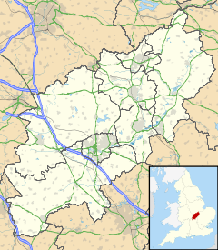
 Chacombe
Chacombe shown within NorthamptonshirePopulation 659 (2001 census)[1]
671 (2010 est)[2]OS grid reference SP4943 Parish Chacombe District South Northamptonshire Shire county Northamptonshire Region East Midlands Country England Sovereign state United Kingdom Post town Banbury Postcode district OX17 Dialling code 01295 Police Northamptonshire Fire Northamptonshire Ambulance East Midlands EU Parliament East Midlands UK Parliament Daventry Website Chacombe List of places: UK • England • Northamptonshire Chacombe is a village and civil parish in South Northamptonshire, about 3 miles (5 km) northeast of Banbury in neighbouring Oxfordshire. It has sometimes been spelt Chalcombe.[3] The parish is bounded to the west by the River Cherwell, to the north by a tributary of the Cherwell and to the southeast by the main road between Banbury and Syresham.
Contents
Priory
In the reign of Henry II (1154–1189) Hugh de Chacombe, lord of the manor of Chacombe, founded a priory of Augustinian canons[4] on low-lying land just west of the village close to the stream. Hugh de Chacombe gave the priory endowments including a yardland at South Newington.[5] In about 1225 the priory's property included eight tenements in Banbury, seven of which it retained until the Dissolution of the Monasteries in the 1530's.[6] By the time of the Hundred Rolls in 1279 the priory owned a tenement in Warwick, where it expanded its holdings until it owned a substantial number of tenements and cottages by the time of the Dissolution.[7]
On 27 September 1535 Sir John Tregonwell reported to Thomas Cromwell:
At Chacombe the prior is newly come, and is competently well learned in Holy Scripture. He is bringing into some order his canons, who are rude and unlearned. I am only afraid that he is too familiar and easy with them.[8]
When the priory was suppressed in 1536[4] its property included land at Boddington, Northamptonshire,[9] Rotherby, Leicestershire[10] and Wardington, Oxfordshire,[11] and a tenement at Thorpe Mandeville.[12] Today the only visible remains of the priory are a small chapel apparently built in the 13th century[13] and a set of mediaeval fishponds.[4]
Part of the priory site is now occupied by a house, also called Chacombe Priory. The house has a large Elizabethan porch and a late 17th century staircase, and was remodelled in the Georgian era.[13]
Parish church
The earliest part of the Church of England parish church of Saints Peter and Paul is the Norman font.[13] The current building is essentially Decorated Gothic from the early part of the 14th century, including the three-bay arcades either side of the nave.[13] The north aisle has a 14th century wall painting of Saint Peter being crucified upside-down.[14] It is one of only two wall paintings of Saint Peter's crucifixion known in England, the other being in the parish church at Ickleton in Cambridgeshire.
The bell tower has a ring of six bells.[15] William Bagley of Chacombe[16] cast four of them including the treble bell in 1694.[17] John Briant of Hertford[16] cast the present fifth bell in 1790[17] and the Whitechapel Bell Foundry cast the present tenor bell in 2009.[17]
The parish of SS. Peter and Paul is now a member of the Chenderit benefice.[18]
Social and economic history
From 1605 until 1785 the Bagley family of Chacombe were bellfounders, casting more than 440 bells for churches in England[19] including the four 1694 bells in Chacombe parish church.[15] Master-founders at Chacombe included Henry I Bagley (active 1630-84), Matthew I Bagley (active 1679-90), Henry II Bagley (active 1679-1703), William Bagley (active 1687-1712), Henry III Bagley (active 1706-46) and Matthew III Bagley (active 1740-82).[16] Henry II Bagley also ran another foundry at Ecton and Henry III Bagley also ran one at Witney.[16]
Chacombe's village school was founded in 1868.[20] It is now Chacombe Church of England (Aided) Primary School.[21]
In 1900 the Great Central Railway's branch line between Culworth and Banbury was built through the northern edge of Chacombe parish. In 1911 the railway opened Chalcombe Road Halt just north of the village on Wardington Road. British Railways closed the halt in 1956 and the line in 1966.
Amenities
The village has a public house, the George and Dragon, controlled by Everards Brewery.[22] Chacombe has a village hall.[23]
The Cherwell Edge Golf Course lies in the parish to the south-east of the village.[24]
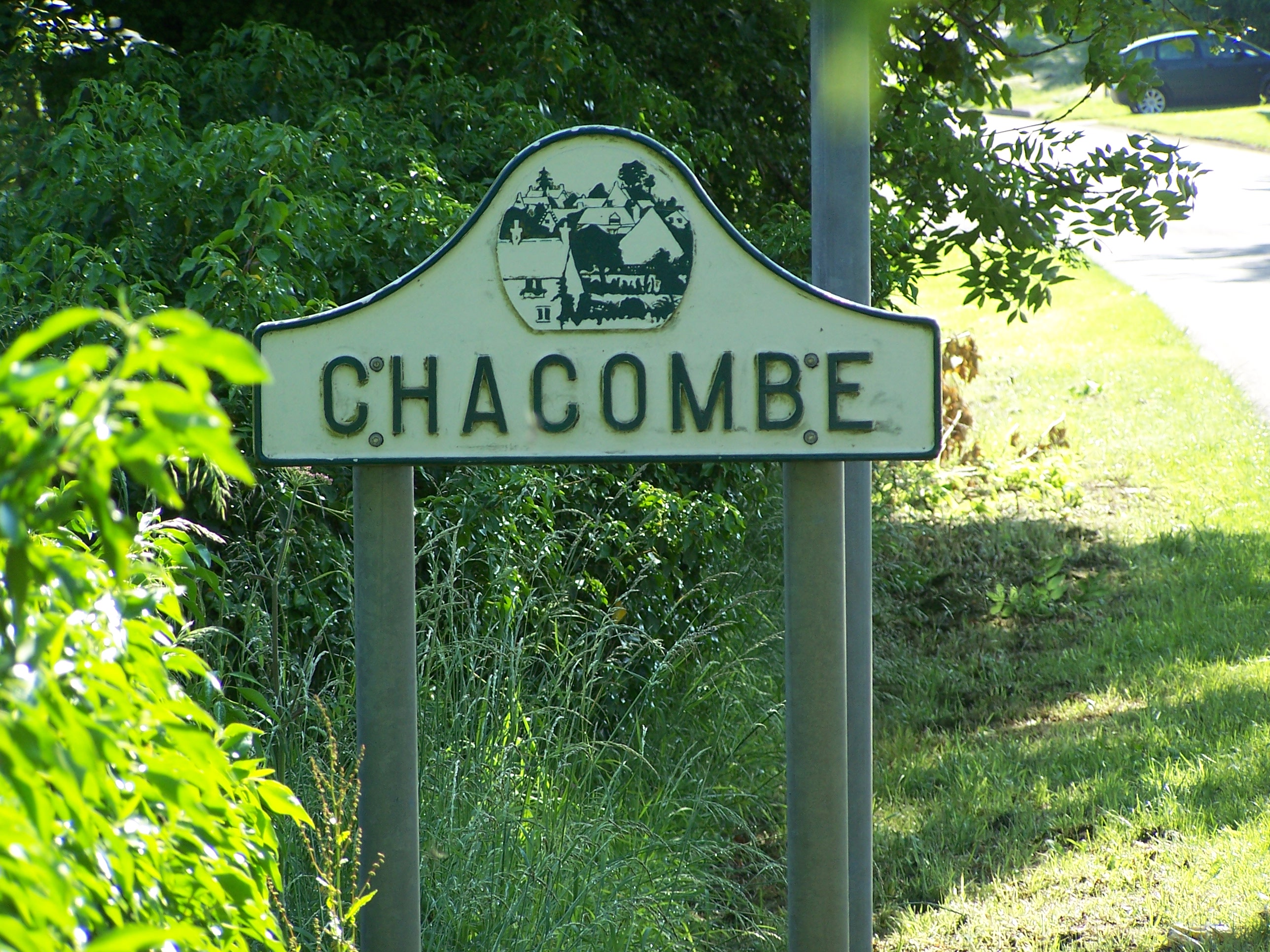
 Approaching Chacombe.
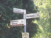 Local destinations.
References
- ^ "Area: Chacombe CP (Parish): Parish Headcounts". Neighbourhood Statistics. Office for National Statistics. http://neighbourhood.statistics.gov.uk/dissemination/LeadTableView.do?a=7&b=797335&c=chacombe&d=16&e=15&g=473927&i=1001x1003x1004&m=0&r=1&s=1260546243988&enc=1&dsFamilyId=779. Retrieved 11 December 2009.
- ^ SNC (2010). South Northamptonshire Council Year Book 2010-2011. Towcester. pp. 39.
- ^ Lewis, 1848, pages 242-245
- ^ a b c "Chacombe Priory". Pastscape. English Heritage. http://pastscape.english-heritage.org.uk/hob.aspx?hob_id=337211&search=all&criteria=chacombe%20priory. Retrieved 13 December 2009.
- ^ Crossley, 1983, pages 143-159
- ^ Crossley, 1972, pages 42-49
- ^ Stephens, 1969, pages 480-489
- ^ Gairdner, 1886, pages 143-165
- ^ Gairdner & Brodie, 1898, pages 315-331
- ^ Gairdner & Brodie, 1902, pages 227-244
- ^ Gairdner, 1890, pages 239-254
- ^ Gairdner & Brodie, 1901, pages 272-287
- ^ a b c d Pevsner & Cherry, 1973, page 146
- ^ Medieval Wall Painting in the English Parish Church: Martyrdom of St. Peter: Chacombe, Northants (Peterborough) C.14
- ^ a b Chacombe: Church Guide
- ^ a b c d "Bell Founders". Dove's Guide for Church Bell Ringers. http://dove.cccbr.org.uk/founders.php. Retrieved 24 April 2011.
- ^ a b c "Chacombe SS Peter & Paul". Dove's Guide for Church Bell Ringers. http://dove.cccbr.org.uk/detail.php?searchString=Chacombe&numPerPage=10&Submit=Go&searchAmount=%3D&searchMetric=cwt&sortBy=Place&sortDir=Asc&DoveID=CHACOMBE. Retrieved 24 April 2011.
- ^ Chenderit Benefice
- ^ Chacombe: Church Guide: Bagley bell-founders
- ^ Chacombe: Timeline
- ^ Chacombe: Chacombe School
- ^ Everards: George & Dragon, Chacombe
- ^ Chacombe: Village Hall
- ^ Cherwell Edge Golf Couse website
Sources
- Crossley, Alan (ed.); Colvin, Christina; Cooper, Janet; Cooper, N.H.; Harvey, P.D.A.; Hollings, Marjory; Hook, Judith; Jessup, Mary et al. (1972). A History of the County of Oxford, Volume 10. Victoria County History. pp. 5–18. http://www.british-history.ac.uk/report.aspx?compid=63788.
- Crossley, Alan (ed.); Colvin, Christina; Cooper, Janet; Cooper, N.H.; Harvey, P.D.A.; Hollings, Marjory; Hook, Judith; Jessup, Mary et al. (1972). A History of the County of Oxford, Volume 10. Victoria County History. pp. 42–49. http://www.british-history.ac.uk/report.aspx?compid=63791.
- Crossley, Alan (ed.); Baggs, A.P.; Colvin, Christina; Colvin, H.M.; Cooper, Janet; Day, C.J.; Selwyn, Nesta; Tomkinson, A. (1983). A History of the County of Oxford, Volume 11: Wootton Hundred (northern part). Victoria County History. http://www.british-history.ac.uk/report.aspx?compid=101858.
- Gairdner, James (1886). Letters and Papers, Foreign and Domestic, Henry VIII, Volume 9 – August–December 1535. Institute of Historical Research. pp. 143–165.
- Gairdner, James (1890). Letters and Papers, Foreign and Domestic, Henry VIII, Volume 12 Part 1 – February 1537. Institute of Historical Research. pp. 239–254.
- Gairdner, James; Brodie, R.H. (1898). Letters and Papers, Foreign and Domestic, Henry VIII, Volume 16 – 1540–1541. Institute of Historical Research. pp. 315–331.
- Gairdner, James; Brodie, R.H. (1901). Letters and Papers, Foreign and Domestic, Henry VIII, Volume 18 part 1 – January–July 1543. Institute of Historical Research. pp. 272–287.
- Gairdner, James; Brodie, R.H. (1902). Letters and Papers, Foreign and Domestic, Henry VIII, Volume 18 part 2 – August–December 1543. Institute of Historical Research. pp. 227–244.
- Lewis, Samuel (1848). A Topographical Dictionary of England (7th ed.). London: Samuel Lewis. pp. 242–245. http://www.british-history.ac.uk/report.aspx?compid=50864#s17.
- Pevsner, Nikolaus; Cherry, Bridget (1973) [1961]. Northamptonshire. The Buildings of England. Harmondsworth: Penguin Books. p. 146. ISBN 0 14 071022 1.
- Serjeantson, R.M.; Adkins, W.R.D., eds (1906). A History of the County of Northampton, Volume 2. Victoria County History. Archibald Constable & Co. pp. 133–135. http://www.british-history.ac.uk/report.aspx?compid=40233.
- Stephens, W.B., ed (1969). A History of the County of Warwick, Volume 8: The City of Coventry and Borough of Warwick. Victoria County History. pp. 480–489.
Town Villages Adderbury · Aynho · Bloxham · Bodicote · Broughton · Chacombe · Cropredy · Deddington · Great Bourton · Hanwell · Horley · Kineton · King's Sutton · Little Bourton · Middleton Cheney · North Newington · Shotteswell · Wardington · Warmington · WroxtonSchools Categories:- Villages in Northamptonshire
- Banburyshire


Wikimedia Foundation. 2010.