- Orote Field
-
Orote Field
 Center of runway looking west
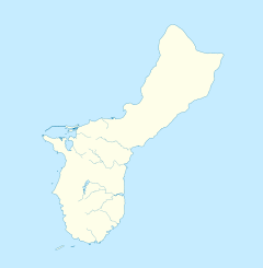
Nearest city: Agat, Guam Coordinates: 13°26′13″N 144°38′30″E / 13.43694°N 144.64167°ECoordinates: 13°26′13″N 144°38′30″E / 13.43694°N 144.64167°E Built: 1921 Governing body: US Navy NRHP Reference#: 75002149 Added to NRHP: June 18, 1975 Orote Field is a former air base in Guam built by the United States Marine Corps and the United States Navy (1921-1931). It was captured by the Imperial Japanese Navy at the start of World War II and remained under Japanese control until the end of July 1944, when it was taken back by the USMC. The airfield itself, built on the western tip of the island, was one of many on Guam, and was closed for good in 1946, but still sees some use as a touch-and-go training strip used by C-130 Hercules crews located nearby on Andersen Air Force Base.
U.S. National Register of Historic Places Topics Lists by states Alabama • Alaska • Arizona • Arkansas • California • Colorado • Connecticut • Delaware • Florida • Georgia • Hawaii • Idaho • Illinois • Indiana • Iowa • Kansas • Kentucky • Louisiana • Maine • Maryland • Massachusetts • Michigan • Minnesota • Mississippi • Missouri • Montana • Nebraska • Nevada • New Hampshire • New Jersey • New Mexico • New York • North Carolina • North Dakota • Ohio • Oklahoma • Oregon • Pennsylvania • Rhode Island • South Carolina • South Dakota • Tennessee • Texas • Utah • Vermont • Virginia • Washington • West Virginia • Wisconsin • WyomingLists by territories Lists by associated states Other  Category:National Register of Historic Places •
  Portal:National Register of Historic PlacesCategories:
- Airports in Guam
- Military facilities of the United States in Guam
- National Register of Historic Places in Guam
- Aviation-related listings on the National Register of Historic Places
- Guam geography stubs
Wikimedia Foundation. 2010.

