- Ocieka
-
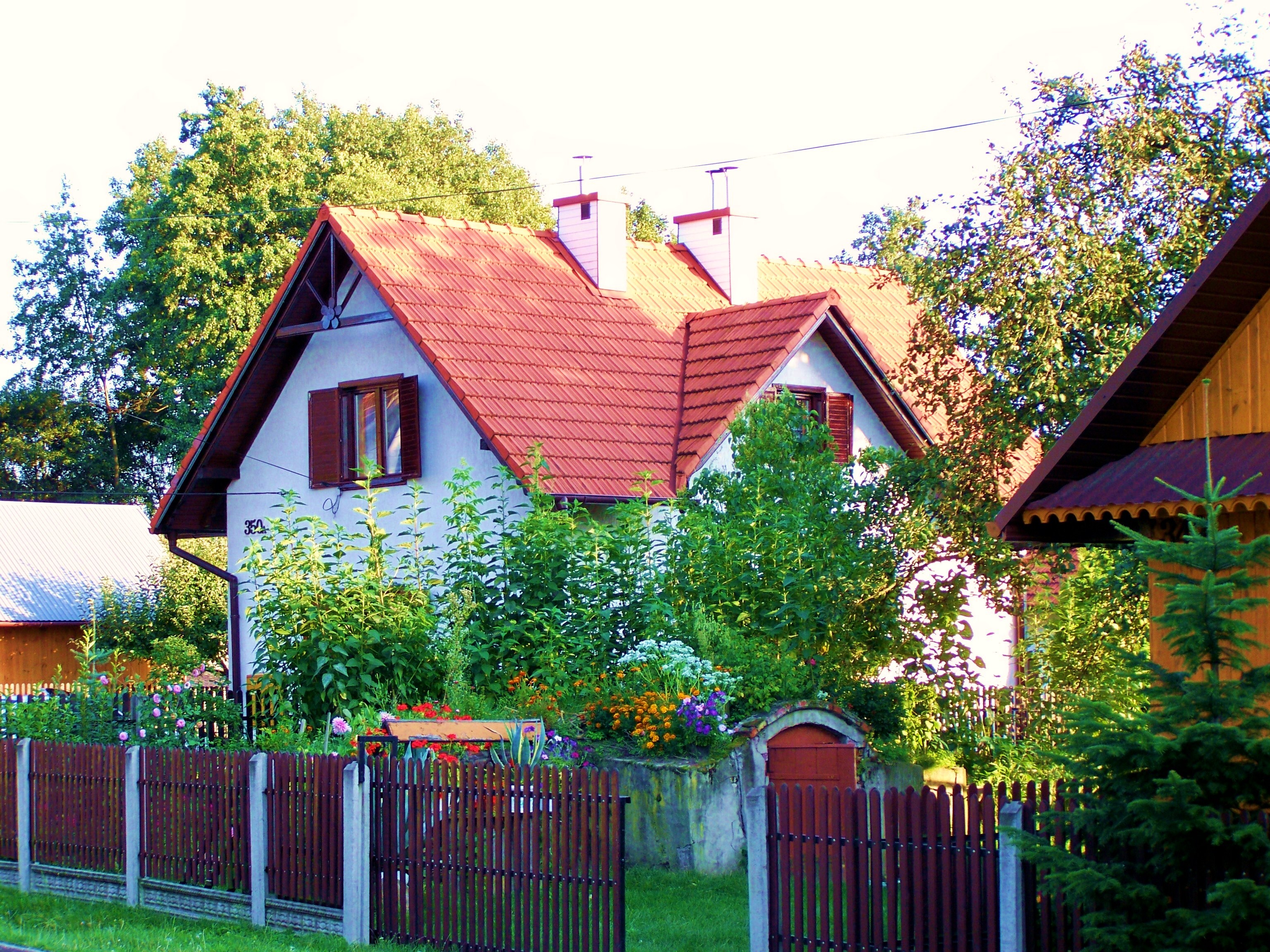
Ocieka — Village — Traditional House in Ocieka Village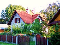

 Ocieka
Coordinates: 50°8′N 21°35′E / 50.133°N 21.583°E Country  Poland
Voivodeship  Subcarpathian
County  Ropczyce-Sędziszów
Gmina Ostrów Population 1,233 Ocieka [ɔˈt͡ɕeka] is a village in the administrative district of Gmina Ostrów, within Ropczyce-Sędziszów County, Subcarpathian Voivodeship, in south-eastern Poland. It lies approximately 6 kilometres (4 mi) north of Ostrów, 7 km (4 mi) north-west of Ropczyce, and 33 km (21 mi) west of the regional capital Rzeszów.[1]
(Between 1975-1998 Ocieka was in the Rzeszów Voivodeship). The village has a population of 1,233 and lies on the main road between Ropczyce and Mielec. It is situated in the Sandomierz Wilderness (Polish: Puszcza Sandomierska), one of the biggest forests in southern Poland, which covers large parts of the Sandomierz Basin, an areas was once popular with Polish nobility (Polish: Szlachta) for hunting and fishing. Ocieka lies on the Tuszymka river, a tributary of the Wisłoka river. In the past this area was known for iron smelting and iron goods.[2]
Contents
History
Since its formation in the late 15th century Ocieka has been known by several different names; although these appear to be phonetic variations of the same name. Parish documents and chronicles show it as ‘Otsijeka’, ‘Odszycha’ and ‘Ucieka’.[3] The village was named by Anna née Ocieska Mielecka and it is probably the ancestral seat of the ‘Ocieskis’, who also owned Rzemień, a village to the north of Ocieka.[2] In the 15th century the area was popular with Polish nobility (Polish: Szlachta) for hunting. The Polish king Władysław II Jagiełło was said to be a frequent visitior to the area, listing it as one of his ‘favourite’ places for ‘hunting and recuperation’.[4] According to a local legend, in the region near Ocieka there occurred a battle against the Tatars. The Polish knights achieved a resounding victory. To commemorate this, a hill close by became known as ‘Góra Tatarska’ (Tatar Hill).[3] In 1531 the Grand Crown Hetman, Jan Amor Tarnowski led a Polish army against the Moldavian Prince (‘Hospodar’) Petru IV Rareş (Polish: ‘Piotr Raresz’) in the Battle of Obertyn. Despite being outnumbered four to one, the battle ended with a Polish victory, a complete Tatar surrender, and the reconquest of Pokuttya or ‘Pokuttia’ (Ukrainian: Покуття, Romanian: Pocuţia, Polish: Pokucie). Tarnowski brought his Tatar prisoners-of-war back to Ocieka. These prisoners became the first occupants of a new settlement near Ocieka called ‘Sadykierz’. The name ‘Sadykierz’ has distinct Tatar origins, just as do today's inhabitants of the same village (The original settlement of ‘Sadykierz’ was located by a post-glacial lake, home to a rare species of white water-lily.)[3]
Ocieka became an independent parish in 1610.[5] At this time, Ocieka had a very industrial character; tar and wood charcoal was manufactured here, as was iron. In the 17th and 18th centuries there was a glass foundry nearby. At this time the ownership of the village passed from the ‘Ocieski’ family to the ‘Romerów’ (or ‘Romer’) family.[3]
“ "Ocieka, a village on the stream Ocieka or Ociecki (part of the Tuszymka river), in the county (‘powiat’) of Ropczyce, lies in a sandy lowland (206 m), along with Wola Ocieska and Zadzikierz. To the north it is surrounded by a large pine forest, the southern part of which is called ‘Spalony las′ (‘burnt forest′), the northern part ‘Sokolny las′ (‘falcon forest′); to the east is the forest of the village of Kamionka, and to the south part of the forests of the village of Ostrów, ‘Duży las′ (‘large forest′), Saszczyński and Sarni (‘deer's’) las. In the middle of the village, near the church, runs the Kolbuszowa-Ropczyce highway, from which a branch runs west, and in Dąbie (8 km (5 mi) away) on the Wisłoka river, it joins the main highway from Rzochów to Dębica. The outlying settlement of Zadzikierz lies to the northeast (3 km), near the forest on the northeast flank of a hill (245 m) (this now appears to be the place now called Sadykierz). Wola Ocieska (today called Wola Ociecka), which has a beautiful manor house, is northwest of Ocieka, on the road to Dąbie, on the northwest flank of the wooded Łysa górka (211 m). Between Ocieka and Zadzikierz there are four small ponds, and on the stream a watermill and a windmill." [2][6] ” “ "With these outlying settlements the village has 1,465 Roman Catholic inhabitants, of whom 127 live on the grounds of the major estate, owned by Count Władyslaw Romer. The major estate has 756 mórgs of farmland (1 mórg ≈ 0.56 ha), 52 of meadows and gardens, 89 of pastures, and 1,678 of forests; the minor estate has 1,948 mórgs of farmland, 388 of meadows, 479 of pastures, and 343 of forests. The pastures are mostly sandy waste-land. The parish church is old and made of wood, of unknown funding, and contains sacramental registers dating from 1785. The parish includes Blizna, with 233 inhabitants; there are 37 Jews in the parish. There is a people's school here, and a fund for the poor, which has 500 zł. in austrian currency." [2] "The Reverend Franciszek Siarczyński (in a manuscript in the Ossolineum library, N°. 1826), says that this village belonged to Rzemień and that Anna née Ocieska Mielecka named it, but adds that it is probably the ancestral seat of the Ocieskis, who also owned Rzemień. The villages nearest Ocieka are, to the east, Zdżary and Kamionka, to the south Ostrów, to the west Pustków-Krownice and Dąbie, to the north Blizna." [2] (extracts translated from the 1886 edition of ‘Słownik Geograficzny Królestwa Polskiego’)
” World War II
During the Second World War, the church in Ocieka was converted into a warehouse, for the storage of specialist test-rocket construction materials.[3] From 5 November 1943 until early July 1944, a team of German scientists, led by Wernher von Braun, built and tested V-2 rockets in the nearby village of Blizna.[3][7][8]
Gallery
-
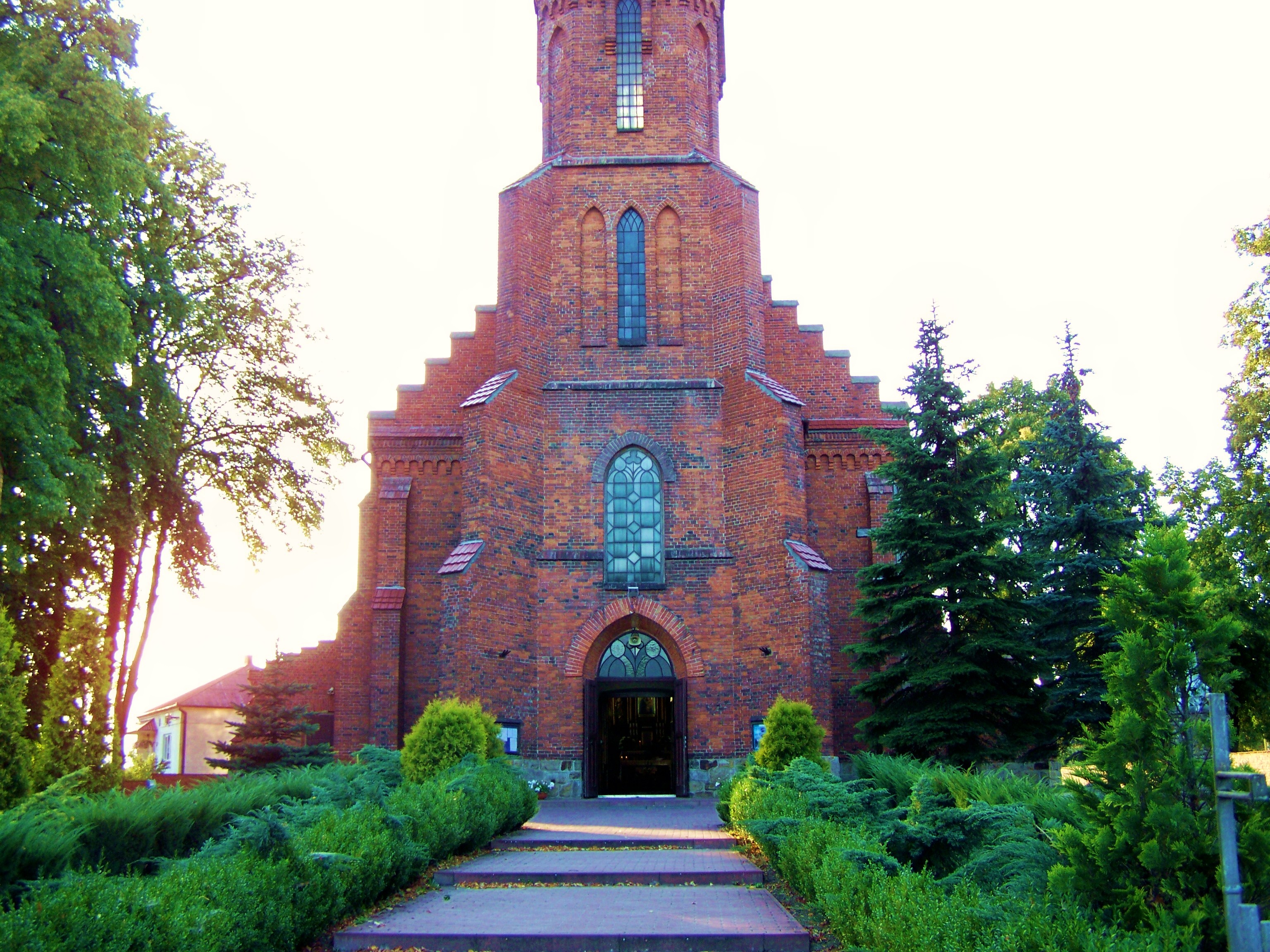
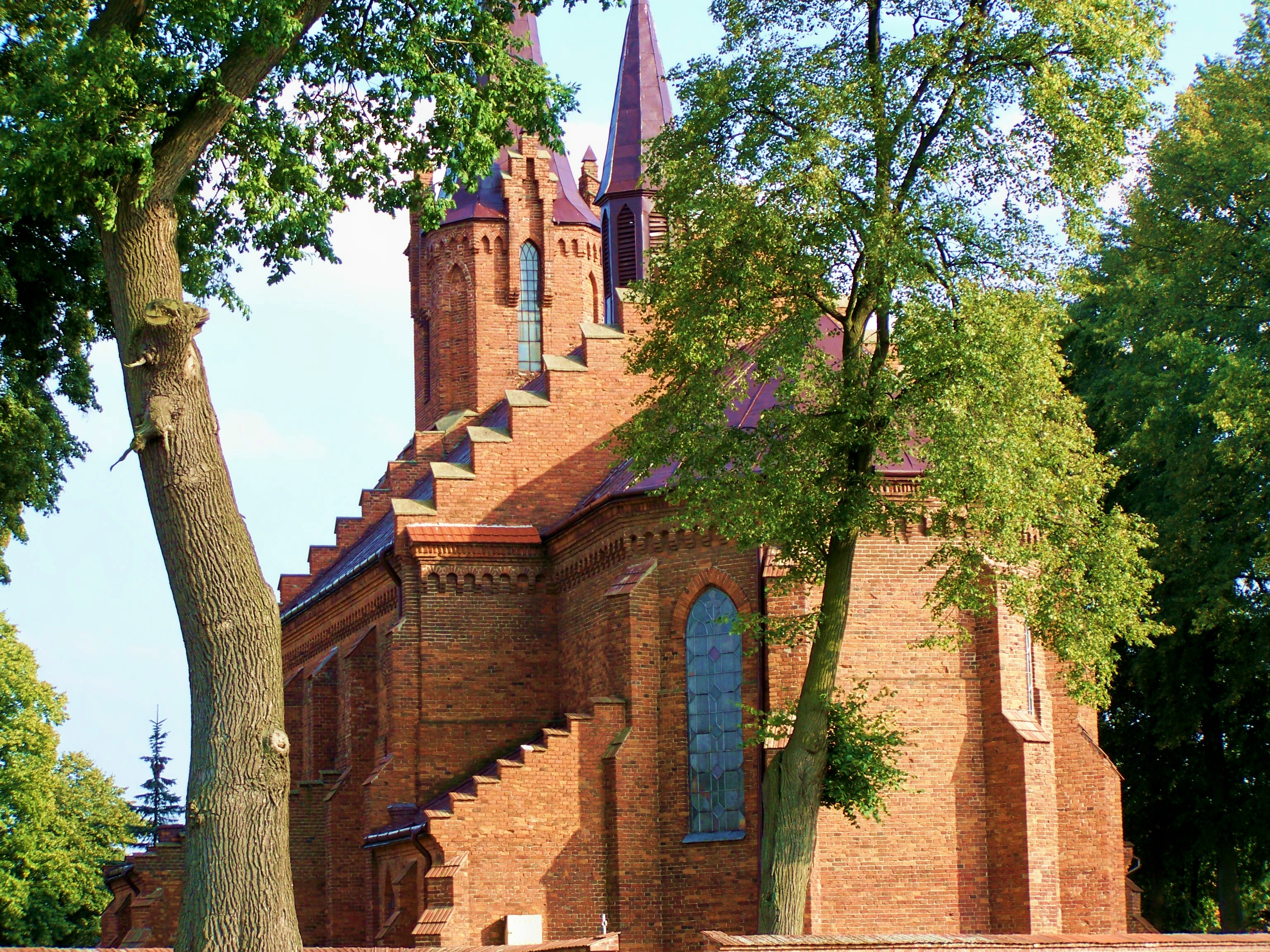
Church of Saint Catherine in Ocieka
-

Church of Saint Catherine in Ocieka
-
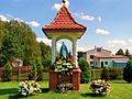
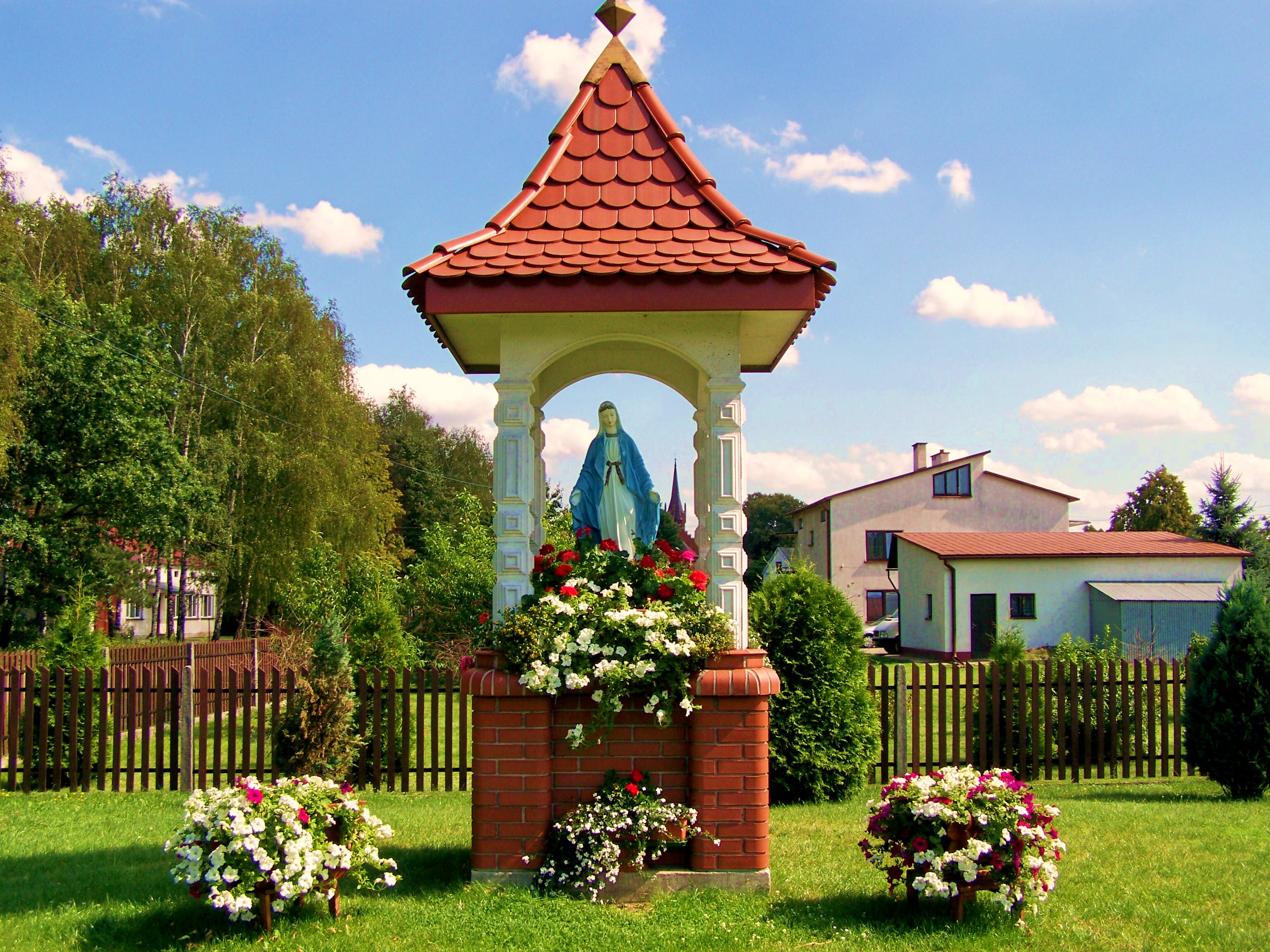
Shrine to the Virgin Mary in Ocieka
-
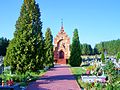
Cemetery in Ocieka
See also
Notes
- ^ "Central Statistical Office(GUS) – TERYT(National Register of Territorial Land Apportionment Journal)".
 (in Polish). 2008-09-01. http://www.stat.gov.pl/broker/access/prefile/listPreFiles.jspa. Retrieved 2008-09-10.
 - ^ a b c d e "Slownik Geograficzny Królestwa Polskiego". - Warsaw (1886, vol. 7, page 370) (in Polish). http://dir.icm.edu.pl/pl/Slownik_geograficzny/. Retrieved 2008-09-18.
- ^ a b c d e f 'Bociek, Jan. "Parafia św. Katarzyny Aleksandryjskiej PM w Ociece". © 2007.(in Polish). http://jbociek.webpark.pl/strony/ocieka.html. Retrieved 2008-10-21.
- ^ Kłos, Stanisław. "Wojewodztwo Rzeszowskie Przewodnik", page 178 © Sport i Turystyka, 1969.
- ^ Benarz, Dennis. "Parafia Ocieka". © 2005-2006 Chicagoland USA. http://spuscizna.org/spuscizna/ocieka.html. Retrieved 2008-09-18.
- ^ Kłos, Stanisław. "Wojewodztwo Rzeszowskie Przewodnik", page 176 © Sport i Turystyka, 1969.
- ^ Zak, Anatoly: RussianSpaceWeb.Com: 2009
- ^ Gatland, Kenneth William: Project Satellite: 1958 p82
References
- "Slownik Geograficzny Królestwa Polskiego". - Warsaw (1886-1914)
 (in Polish) A publication now in the public domain. http://dir.icm.edu.pl/pl/Slownik_geograficzny/.
 - Zak, Anatoly (9 March 2009). "V-2 tests in Poland" (in Moscow). © 2009 RussianSpaceWeb.Com. http://www.russianspaceweb.com/a4_poland.html. Retrieved 2009-10-23.
- Gatland, Kenneth William (1958). Project Satellite. John W. Wood (First ed.). London: Wingate. pp. 169. OCLC 1183846. http://openlibrary.org/b/OL6241939M/Project_satellite.. Retrieved 24 October 2009.
External links
- "The Parish of Ocieka". http://spuscizna.org/spuscizna/ocieka.html.
- "Battle of Obertyn 1531 AD". http://myweb.tiscali.co.uk/matthaywood/main/Battle_of_Obertyn.htm.
Seat Other villages  This article incorporates text from a publication now in the public domain: Chisholm, Hugh, ed (1911). Encyclopædia Britannica (11th ed.). Cambridge University Press.Categories:
- Villages in Ropczyce-Sędziszów County
-


Wikimedia Foundation. 2010.