- Morh Kfarsghab
-
This article is about the village inhabited in the winter. For the summer village, see Kfarsghab.
Morh Kfarsghab
مرح كفرصغاب— City — Location within Lebanon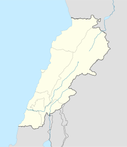
 Morh Kfarsghab
Coordinates: 34°20′11″N 35°54′12″E / 34.33639°N 35.90333°ECoordinates: 34°20′11″N 35°54′12″E / 34.33639°N 35.90333°E Country  Lebanon
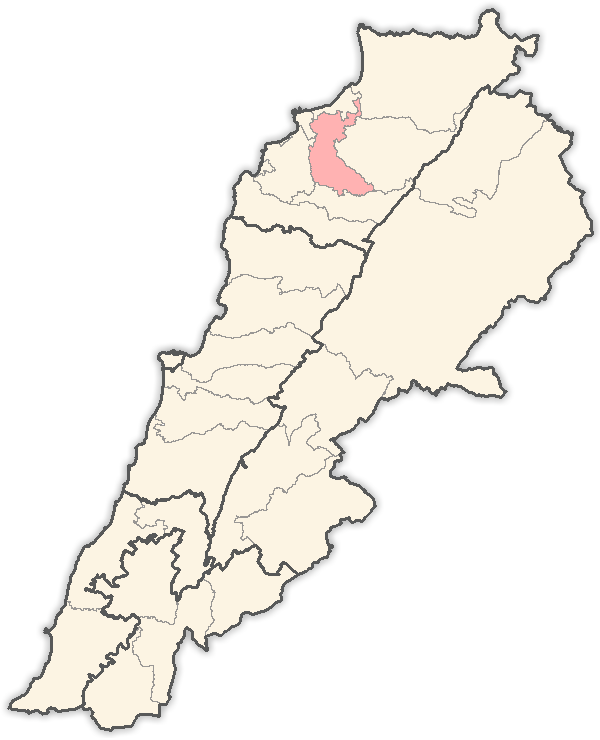
Governorate North Governorate District Zgharta District Elevation 280 m (919 ft) Time zone EET (UTC+2) – Summer (DST) EEST (UTC+3) Postal code Dialing code +961 Morh Kfarsghab ( known also as Morh Kfar Sghab, Murh Kafarsghab or Mrah Kfarseghab; Arabic: مرح كفرصغاب, pronounced [ˈmurħ kafarsˤiˈɣaːb] (
 listen)) is a village located in the Zgharta District in the North Governorate of Lebanon.
Murh Kfarsghab is the winter dwellings of the people of the mountain village of Kfarsghab. It is a typical organization of pastoral and agricultural Mediterranean communities where seasonal fixed transhumance is still practised.
Contents
Etymology
For the etymology of Kfarsghab, see Kfarsghab.Morh (Arabic: مرح, pronounced [ˈmurħ]) is derived from the Semitic root mrh. It is one form of mrah which according to Elie Wardini,
is almost exclusively in Lebanon a spread place name appellation. It signifies stable, hurdle, resting place (for livestock), besides also building in which the silk caterpillar is pulled (reeling of cocoons)…[1]
It gives an indication as to the historical destination of this place during wintertime for the mountain people of Kfarsghab.
As cattle breeding was never a main source of income for Kfarsghab, it is possible that Morh Kfarsghab was used in winter for the Mullberry silkworms which represented a major activity in the region.
For the local people, Morh Kfarsghab is called sahil (Arabic: ساحل [saːħil]) which literally means sea coast in Arabic.
History
Main article: History of KfarsghabGeography
Morh Kfarsghab, the winter village, is located on the north-western slope of the Joueit valley separating Miziara from Bnachii. On average, it sits at 280 meters above sea levelgives an estimation which is slightly higher (298 meters) than measured average altitude (280 meters). A written document mentioning Morh Kfarsghab is dated to October / November 1748 AD (Thu'l-Qa'dah 1161 Hijri)[2].
Climate
Morh Kfarsghab is a typical Mediterranean plain settlement. There are four seasons, with winters being mild with moderate to heavy rainfall while summers are hot, arid and dry. The highest average temperature is in August at 86 °F (30 °C) while the lowest average temperature is in January at 46 °F (8 °C). However, summer temperatures can top 104 °F (40 °C), and winter temperatures can drop below 35 °F (2 °C)[3].Total yearly precipitation is in the range of 33 inches (810 mm), with the heaviest occurring from late November to early April. Rainfall is exceptional between mid June and mid September.
Climate data for Morh Kfarsghab, Lebanon Month Jan Feb Mar Apr May Jun Jul Aug Sep Oct Nov Dec Year Average high °F (°C) 61
(16)61
(16)66
(19)71
(22)77
(25)80
(27)84
(29)86
(30)84
(29)80
(27)71
(22)64
(18)73.8
(23.3)Average low °F (°C) 46
(8)48
(9)50
(10)55
(13)61
(16)66
(19)71
(22)73
(23)68
(20)62
(17)55
(13)50
(10)58.8
(15.0)Source: Kfarsghab.net[4] Economy
For a comprehensive presentation, see the main article on the economy of KfarsghabAgriculture
The major issue is scarcity of water. Agricultural activities privileged crops that do not need irrigation, such as olive, grape and fig. The main culture is however olive harvested typically from November to January.[citation needed]In this part of the Mediterranean, a full crop of olive is only occurring every other year. There are in the village around six olive presses for olive oil extraction, most of them using the traditional first cold pressed method ensuring an excellent oil quality. Green olives and black olives are also produced as well as olive oil soap. There is also in Morh Kfarsghab an important production of grape used mainly to produce the national aniseed-flavoured distilled alcoholic drink, the Arak. Grape is harvested in July / August usually [5]. In the recent years, fig lost of its importance as it needs continuous care during summertime when most of the people are in the summer village, some 25 kilometers away. Finally, there is also a modest culture of almonds, citrus trees such as orange and lemon. For citrus, as it needs irrigation, it is cultivated in the valley of Joueit where water is available, at least during winters.
The land owned by the Kfarsghab people extends on a large area in the Zgharta District, Bsharri District as well as Koura District. Land was acquired mostly at the beginning of the 20th Century thanks to the funds sent by emigrants [6]. The revenues derived from agriculture would have been comfortable if , since the Seventies, the agriculture in Kfarsghab was not plagued by several problems. The main difficulties faced by agriculture are the lack of manpower due to emigration [7], the unfair competition of foreign products at lower dumped prices especially for olive oil [8], apple diseases and parasites, the weakness of the Lebanese pound increasing the prices of fertilizers and pesticides, the closing of some important foreign outlets for Lebanese products like Irak, the Lebanese Civil War[9].
Notes
- ^ Wardini, Elie (June 1994). "A project proposal". A Glimpse of Yesterday - A Typology of Regional Variation and Cultural Continuity in Lebanese Place-Names. Department of East European and Oriental Studies - University of Oslo. http://almashriq.hiof.no/lebanon/400/410/412/elies_project/glimse_of_yesterday.html. Retrieved 2007-10-30.
- ^ "Title of Property of Morh Kfarsghab". http://www.labans.com/morhproperty.htm. Retrieved 2007-10-30.
- ^ On Friday, January 11, 2008, the Lebanese newspaper Daily Star, reported that temperatures in the region of Morh Kfarsghab dropped to -4 °C. Cited by Zgharta.com, Zgharta.com, last retrieved on 2 August 2008
- ^ "Geography of Kfarsghab". Kfarsghab.net. 2006. http://www.labans.com/kfarsghabgeo.htm. Retrieved 2008-06-04.
- ^ Eat the seasons - grapes, last retrieved August 8, 2008.
- ^ An article on Kfarsghab land owning by the Lebanese newspaper Daily Star dated of 10 June 2004 by Adnan Al Ghoul, Kfar Sghab: Village stays close to its expatriate sons and daughters - Residents are so close-knit they don't sell land to strangers, last retrieved on August 4, 2008.
- ^ Loubnanouna.org citing an article by Gregory Katz of the Houston Chronicle of 13 February 2007, last retrieved August 5, 2008
- ^ Fita page on Lebanon - Agriculture chapter, last accessed on August 6, 2008.
- ^ Countrystudies - U.S. Library of Congress, last accessed on August 6, 2008.
External links
- (English)/(French) kfarsghab.net, useful information
- (English) The Australian Kfarsghabian community website
- (English) The American Kfarsghabian community website
- MSN Map
Capital: ZghartaTowns and villages Aarjes · Aintourine · Aitou · Alma · Arbet Kozhaya · Ardeh · Ashashe · Aslout · Asnoun · Basloukit · Bchennine · Beit Awkar · Beit Obeid · Besbeel · Bhairet Toula · Bnachii · Bousit · Daraya · Ehden · Ejbeh · Fraydiss · Haret Al Fawar · Harf Ardeh · Harf Miziara · Hawqa · Hilan · Houmeiss · Iaal · Jdaydeh · Kadrieh · Karahbache · Karmsaddeh · Kfardlakos · Kfarfou · Kfarhawra · Kfarsghab · Kfarshakhna · Kfarhata · Kfaryachit · Kfarzeina · Khaldieh · Kifraya · Mazraat Al Nahr · Mazraat Al Toufah · Mazraat Hraikis · Mejdlaya · Miriata · Miziara · Sakhra · Morh Kfarsghab · Rachiine · Raskifa · Sebhel · Sereel · Toula · Zgharta

Notable landmarks Kadisha Valley · Monastery of Qozhaya · Mar Sarkis, Ehden · Iaal Fortress
History Notable people Suleiman Frangieh · Rene Moawad · Hamid Frangieh · Nayla Moawad · Estephan El Douaihy · Tony Frangieh · Youssef Karam · Youakim Moubarac · Father Estephan Frangieh
Categories:- Populated places in the North Governorate
- Zgharta District

Wikimedia Foundation. 2010.