- Koura District
Infobox Settlement
name =Koura District
settlement_type =District
official_name =الكورة
nickname =
motto =
imagesize = 300px
image_caption = Plains of Koura
flag_size =
image_
seal_size =
image_shield =
shield_size =
image_blank_emblem =
blank_emblem_type =
blank_emblem_size =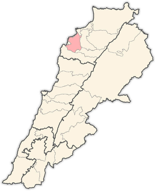
mapsize = 250px
map_caption = Location in Lebanon
mapsize1 =
map_caption1 =
image_dot_
dot_mapsize =
dot_map_caption =
dot_x = |dot_y =
pushpin_
pushpin_label_position =bottom
pushpin_mapsize =300
pushpin_map_caption =Location in Lebanon
subdivision_type = Country
subdivision_name = Flag|Lebanon
subdivision_type1 = Governorate
subdivision_name1 =North Governorate
subdivision_type2 =Capital
subdivision_name2 =Koura
subdivision_type3 =
subdivision_name3 =
subdivision_type4 =
subdivision_name4 =
government_footnotes =
government_type =
leader_title =
leader_name =
leader_title1 =
leader_name1 =
leader_title2 =
leader_name2 =
leader_title3 =
leader_name3 =
leader_title4 =
leader_name4 =
established_title =
established_date =
established_title2 =
established_date2 =
established_title3 =
established_date3 =
area_magnitude =
unit_pref =Imperial
area_footnotes =
area_total_km2 = 173
area_land_km2 =
area_water_km2 =
area_total_sq_mi =
area_land_sq_mi =
area_water_sq_mi =
area_water_percent =
area_urban_km2 =
area_urban_sq_mi =
area_metro_km2 =
area_metro_sq_mi =
area_blank1_title =
area_blank1_km2 =
area_blank1_sq_mi =
population_as_of =
population_footnotes =
population_note =
population_total =48,000
population_density_km2 =
population_density_sq_mi =
population_metro =
population_density_metro_km2 =
population_density_metro_sq_mi =
population_urban =
population_density_urban_km2 =
population_density_urban_sq_mi =
population_blank1_title =Ethnicities
population_blank1 =
population_blank2_title =Religions
population_blank2 =
population_density_blank1_km2 =
population_density_blank1_sq_mi =
timezone = EST
utc_offset = +2
timezone_DST = +3
utc_offset_DST =
latd=|latm=|lats=|latNS=N
longd=|longm=|longs=|longEW=E
elevation_footnotes =
elevation_m =
elevation_ft =
postal_code_type =
postal_code =
area_code =
blank_name =
blank_info =
blank1_name =
blank1_info =
website =
footnotes =Koura or El Koura ( _ar. الكورة) is a district ("in Arabic"
qadaa ) in the North Governorate,Lebanon .Koura is one of the 26 districts of Lebanon, which is very popular for the
olive tree cultivation. It is known by its green color.A total of 52 villages make up the Koura area. Koura's capital is the town of
Amioun , (14000 official inhabitant, statistics of 2006, but less than 4000 permanent residents).It is geographically diversified, so present 3 types of land, a costal side to the
Mediterranean sea , a largeolive plain and include some villages in the mountains.Kfarhata, one of Koura's villages, is stated by many international figures to be "Heaven on Earth". It is mainly an Orthodox Christian district.The olive plains of El Koura are estimated to be the largest olive plains in the world.
Kouranian people were living for centuries from this kind of
agriculture . It has been known that the olive crop in the area is of very fine quality.The importance of kouranian olive trees is that they offer an excellent quality of
olive oil , extracted through the "cold manner".It is also known in Lebanon, that El-Koura is the “human-cistern” of highly educated people, mostly because during the 20th century, major changes impacted local population at this district (which was based on agriculture of olive,
olive oil and olivesoap production, and with lesser extent on cultivation of grapes and silkworm cocoon), and modified it into a now highy educated society in Lebanon.Cities and towns:
*
Amioun
*Bishmizzine
*Darbechtar
*Enfeh
*Kfarhata
*Kaftoun See also
*
Halim Abi Chahine
*University of Balamand External links
* http://www.amioun.org/ Official site
* http://www.lebweb.com/site/lebanon-amioun-42222
Wikimedia Foundation. 2010.