- Bsharri District
Infobox Settlement
name =Bsharri District
settlement_type =District
official_name =
nickname =
motto =
imagesize =
image_caption =
flag_size =
image_
seal_size =
image_shield =
shield_size =
image_blank_emblem =
blank_emblem_type =
blank_emblem_size =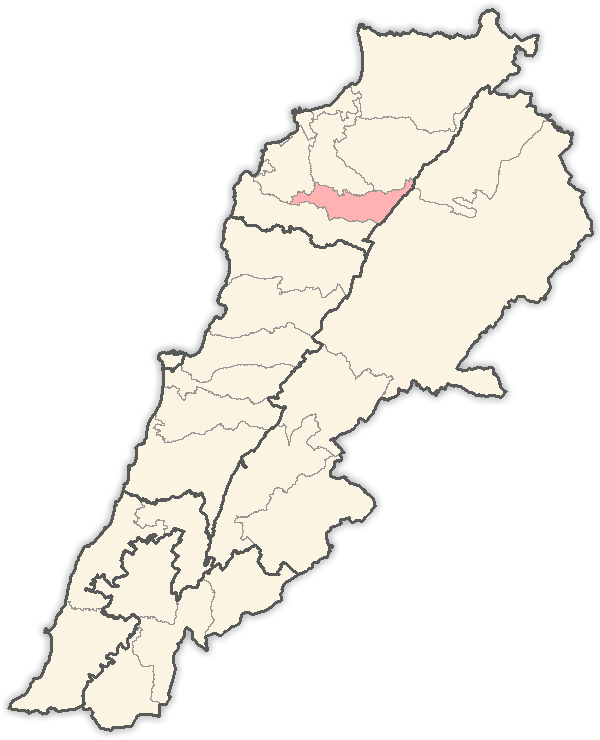
mapsize = 250px
map_caption = Location in Lebanon
mapsize1 =
map_caption1 =
image_dot_
dot_mapsize =
dot_map_caption =
dot_x = |dot_y =
pushpin_
pushpin_label_position =bottom
pushpin_mapsize =300
pushpin_map_caption =Location in Lebanon
subdivision_type = Country
subdivision_name = Flag|Lebanon
subdivision_type1 = Governorate
subdivision_name1 =North Governorate
subdivision_type2 =Capital
subdivision_name2 =Bsharri
subdivision_type3 =
subdivision_name3 =
subdivision_type4 =
subdivision_name4 =
government_footnotes =
government_type =
leader_title =
leader_name =
leader_title1 =
leader_name1 =
leader_title2 =
leader_name2 =
leader_title3 =
leader_name3 =
leader_title4 =
leader_name4 =
established_title =
established_date =
established_title2 =
established_date2 =
established_title3 =
established_date3 =
area_magnitude =
unit_pref =Imperial
area_footnotes =
area_total_km2 = 158
area_land_km2 =
area_water_km2 =
area_total_sq_mi =
area_land_sq_mi =
area_water_sq_mi =
area_water_percent =
area_urban_km2 =
area_urban_sq_mi =
area_metro_km2 =
area_metro_sq_mi =
area_blank1_title =
area_blank1_km2 =
area_blank1_sq_mi =
population_as_of =
population_footnotes =
population_note =
population_total =17,000
population_density_km2 =
population_density_sq_mi =
population_metro =
population_density_metro_km2 =
population_density_metro_sq_mi =
population_urban =
population_density_urban_km2 =
population_density_urban_sq_mi =
population_blank1_title =Ethnicities
population_blank1 =
population_blank2_title =Religions
population_blank2 =
population_density_blank1_km2 =
population_density_blank1_sq_mi =
timezone = EST
utc_offset = +2
timezone_DST = +3
utc_offset_DST =
latd=|latm=|lats=|latNS=N
longd=|longm=|longs=|longEW=E
elevation_footnotes =
elevation_m =
elevation_ft =
postal_code_type =
postal_code =
area_code =
blank_name =
blank_info =
blank1_name =
blank1_info =
website =
footnotes =Bsharri District is one of the 7
district s ("qadaa ") of the North Governorate,Lebanon .Geography
The Bsharri District is a mountainous district. Most of the 26 villages composing it are at an elevation higher than 1.000
meter s. The district is bordered by the Zgharta and Minieh-Dinnieh Districts to the north, the Koura District to the west, the Baalbek District to the east and the Batroun District to the south.This district is a grouping of 26 villages. It has also one of the important landmark of
Eastern Christianity andMaronite history, the major part of theKadisha Valley, the Qannoubin valley whereHermits have resided since around the year 600 C.E., the last being FatherAntonios Torbey whose file in the Vatican is progressing toward beatification. He lived most of his life in the ancient monastery of Saint Elisha located in a grotto deep in theQannoubin Valley. In this valley there is more than 26 monasteries all more than 1000 years old. At the top of this valley, sits the legendary cedar forest.Population
The population of the district was estimated to be 16,831 by the Ministry of Social Affairs. [ [http://www.moe.gov.lb/NR/rdonlyres/2B3E4CAE-BD18-4106-A6B3-F42DDD72AAC9/0/Chap1Population.pdf Lebanese Ministry of Environment: "Lebanon State of the Environment Report", Chapter 1, page 13, 2001.] ] The capital of the district is
Bsharri . The Ministry's estimate lacks credibility. According to the Daily Star, an English language Lebanese newspaper, a total of 20,000 people in the district voted in the 2005 elections. In addition the Ministry of Social Affairs [ [http://www.moe.gov.lb/NR/rdonlyres/2B3E4CAE-BD18-4106-A6B3-F42DDD72AAC9/0/Chap1Population.pdf Lebanese Ministry of Environment: "Lebanon State of the Environment Report", Chapter 1, page 14, 2001.] ] estimates that 39% of the Lebanese population was under 20 years of age which meant they were not eligible to vote and a 60% participation rate. Considering these factors the population may be more realistically estimated at 50,000 people.The six main clans of the village Bsharri are: Taouk, Sukkar, Fakhri, Geagea, Rahme, Kairouz (Saade). Many other families stem into sub-branches from the main six. A reason for this is differentiation of emmigrants after the Second World War.Other small Families are: Shoubay'aa, Arida, Shidya' ...
The Bsharri district is predominantly Maronite Catholic, from here, 5 great priest were canonized and declared Saint, the most prominent is Saint Charbel from Beqa'a Kafra, well known all over the world for his many miracles. From here also the philosopher
Gibran Khalil Gibran started his early life before he emigrated toUSA .The Abi Saab family has resided in the Bsharri District since the 14th century, they were "protectors" of the
Maronite area, then governors of the area of Kouwaiteh and then the area of Jebbeh of Bsharri and [http://www.zgharta.com/cgi-bin/znews/page.cgi?g=Detailed%2F1015.html&t=2display Zghorta] during the period of the Directorates.Towns and villages
* Abdeen
*Bane
*Bani Saab ( [http://www.announcexpress.com/MazraatBaniSaab.htm Mazra'at Bani Sa'ab] )
* Bazoun
* Barhalyoun
* Beit Minzer
* Beqa'a Kefra (Saint Charbel Village)
* Bolla
*Blaouza
* Bqarqacha
* Brisat
*Bsharri
*Dimane
* El-Arz
*Hadath El Jebbeh
* Hadchit
*Hasroun
*Kadisha Valley
* Kanate
* Kanyour
* Mazraat Assaf
* Metrit
* Qnat
* Shira
* Tourza
* Wadi Qannoubine(incomplete)ee also
*
Districts of Lebanon References
REPUBLIC OF LEBANONLEGISLATIVE ELECTIONS OF MAY – JUNE 2005
Wikimedia Foundation. 2010.