- Zgharta District
Infobox Settlement
name =Zgharta District
settlement_type =District
official_name = زغرتا
nickname =
motto =
imagesize =
image_caption =
flag_size =
image_
seal_size =
image_shield =
shield_size =
image_blank_emblem =
blank_emblem_type =
blank_emblem_size =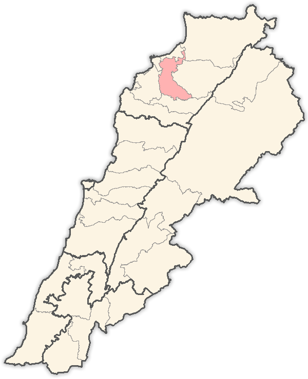
mapsize = 250px
map_caption = Location in Lebanon
mapsize1 =
map_caption1 =
image_dot_
dot_mapsize =
dot_map_caption =
dot_x = |dot_y =
pushpin_
pushpin_label_position =bottom
pushpin_mapsize =300
pushpin_map_caption =Location in Lebanon
subdivision_type = Country
subdivision_name = Flag|Lebanon
subdivision_type1 = Governorate
subdivision_name1 =North Governorate
subdivision_type2 =Capital
subdivision_name2 =Zgharta
subdivision_type3 =
subdivision_name3 =
subdivision_type4 =
subdivision_name4 =
government_footnotes =
government_type =
leader_title =
leader_name =
leader_title1 =
leader_name1 =
leader_title2 =
leader_name2 =
leader_title3 =
leader_name3 =
leader_title4 =
leader_name4 =
established_title =
established_date =
established_title2 =
established_date2 =
established_title3 =
established_date3 =
area_magnitude =
unit_pref =Imperial
area_footnotes =
area_total_km2 = 182
area_land_km2 =
area_water_km2 =
area_total_sq_mi =
area_land_sq_mi =
area_water_sq_mi =
area_water_percent =
area_urban_km2 =
area_urban_sq_mi =
area_metro_km2 =
area_metro_sq_mi =
area_blank1_title =
area_blank1_km2 =
area_blank1_sq_mi =
population_as_of =
population_footnotes =
population_note =
population_total =
population_density_km2 =
population_density_sq_mi =
population_metro =
population_density_metro_km2 =
population_density_metro_sq_mi =
population_urban =
population_density_urban_km2 =
population_density_urban_sq_mi =
population_blank1_title =Ethnicities
population_blank1 =
population_blank2_title =Religions
population_blank2 =
population_density_blank1_km2 =
population_density_blank1_sq_mi =
timezone = EST
utc_offset = +2
timezone_DST = +3
utc_offset_DST =
latd=|latm=|lats=|latNS=N
longd=|longm=|longs=|longEW=E
elevation_footnotes =
elevation_m =
elevation_ft =
postal_code_type =
postal_code =
area_code =
blank_name =
blank_info =
blank1_name =
blank1_info =
website =
footnotes =Zgharta District ( _ar. زغرتا) is a
district ("qadaa ") of the North Governorate,Lebanon .The administrative center is the town of
Zgharta . The district has 57 populated areas with 30 municipalities covering 37 villages. Some areas share the same municipality such asEhden /Zgharta ,Kfarsghab /Morh Kfarsghab orMiziara /Harf Miziara. And there is one Municipalities Union.The district spreads from near the coast at 40
meters above sea level up to 2,800meters of altitude at its highest point. The highest populated part of the district is overlooking theQozhaya Valley, the northern branch of the Holy Valley,Qadisha , a UNESCO Heritage Site. The district has also the Horsh Ehden Nature Reserve. This part of the district is highly touristic, especially the area around the Monastery ofMar Sarkis, Ehden and the Monastery ofQozhaya .Agriculture stays the main activity of the district with an important olive oil production in the coastal area and fruits (apple and pears) in the mountain area. The recent years saw the development of a modest
service sector around the economic pole ofZgharta . The officially registered persons in the district are estimated to 90,000 (est. 1998). Around 50% of the district population lives in the economic pole of Zgharta:Zgharta ,Rachiine ,Kfardlakos , Kfarhata,Mijdlayiah ,Ardeh ,Harf Ardeh . The majority of the population isMaronite Catholics, with a minority of Greek Orthodox,Armenians ,Sunnite Muslims and others.Towns and villages
Wikimedia Foundation. 2010.