- Bauchi State
-
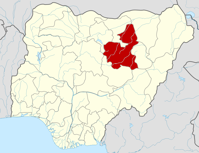
Bauchi State — State — Nickname(s): Pearl of Tourism Location of Bauchi State in Nigeria
Coordinates: 10°30′N 10°00′E / 10.5°N 10°ECoordinates: 10°30′N 10°00′E / 10.5°N 10°E Country  Nigeria
Date created 3 February 1976 Capital Bauchi Government – Governor[1] Isa Yuguda (PDP) – Senators - Mohammed A. Muhammed-Central
- Sulaiman Nazif-North
- Adamu Ibrahim Gumba-South
– Representatives List Area – Total 49,119 km2 (18,965 sq mi) Area rank 5th of 36 Population (2006 census) – Total 4,653,066 – Rank 11th of 36 – Density 94.7/km2 (245.4/sq mi) GDP (PPP) – Year 2007 – Total $4.71 billion[2] – Per capita $983[2] Time zone WAT (UTC+01) ISO 3166 code NG-BA Website bauchistategov.org Bauchi State is a State in northern Nigeria. Its capital is the city of Bauchi. The state was formed in 1976 when the former North-Eastern State was broken up. It originally included the area now in Gombe State, which became a distinct state in 1996.
The Abubakar Tafawa Balewa University is located in the capital city Bauchi.
Contents
History
What is now known as Bauchi was until 1976 a province in the then North-Eastern State of Nigeria. According to the 2006 census, the state has a population of 4,653,066.
Bauchi state has gone through tremendous transformation over the years. During the colonial era up to independence, it formed part of the Bauchi-Plateau of the then Northern Region, until the 1967 state creation exercise, when the Bauchi, Borno, and Adamawa provinces constituted the former North-Eastern State.
With the creation of Bauchi state in 1976, then comprising present Bauchi and Gombe states, it included 16 Local Government Areas. The number of Local Government Areas in the then Bauchi state was increased to 20 and later to 23. However, in 1997 when Gombe state was created out of Bauchi and additional local governments were created in the country, Bauchi state was left with 20 Local Government Areas as shown below.
Sharia law was adopted in June 2001.[3]
Local government areas
Bauchi State is divided into 20 Local Government Areas (LGAs). They are:
LGA Area (km2) Census 2006
populationAdministrative capital Postal
codeBauchi 3,687 493,810 Bauchi 740 Tafawa Balewa 2,515 219,988 Tafawa Balewa 740 Dass 535 89,943 Dass 740 Toro 6,932 350,404 Toro 740 Bogoro 894 84,215 Bogoro 741 Ningi 4,625 387,192 Ningi 742 Warji 625 114,720 Warji 742 Ganjuwa 5,059 280,468 Kafin Madaki 742 Kirfi 2,371 147,618 Kirfi 743 Alkaleri 5,918 329,424 Alkaleri 743 Southern region totals 33,161 2,497,782 Darazo 3,015 251,597 Darazo 750 Misau 1,226 263,487 Misau 750 Giade 668 156,969 Giade 750 Shira 1,321 234,014 Yana 750 Jama'are 493 117,883 Jama'are 751 Katagum 1,436 295,970 Azare 751 Itas/Gadau 1,398 229,996 Itas 751 Zaki 1,476 191,457 Katagum 752 Gamawa 2,925 286,388 Gamawa 752 Damban 1,077 150,922 Damban 752 Northern region totals 15,035 2,178,683 Geography
Bauchi state occupies a total land area of 49,119 km² representing about 5.3% of Nigeria’s total land mass and is located between latitudes 9° 3' and 12° 3' north of the equator. Longitudinally, the state lies between 8° 50' and 11° east of the Greenwich meridian.
The state is bordered by seven states, Kano and Jigawa to the north, Taraba and Plateau to the south, Gombe and Yobe to the east and Kaduna to the west.
Bauchi state is one of the states in the northern part of Nigeria that span two distinctive vegetation zones, namely, the Sudan savannah and the Sahel savannah. The Sudan savannah type of vegetation covers the southern part of the state. Here, the vegetation gets richer and richer towards the south, especially along water sources or rivers, but generally the vegetation is less uniform and grasses are shorter than what grows even farther south, that is, in the forest zone of the middle belt.
The Sahel type of the savannah, which is also known as the semi-desert vegetation, becomes manifest from the middle of the state as one moves from the state's south to its north. This type of vegetation comprises isolated stands of thorny shrubs.
On the other hand, the southwestern part of the state is mountainous as a result of the continuation of the Jos Plateau, while the northern part is generally sandy.
The vegetation types as described above are conditioned by the climatic factors, which in turn determine the amount of rainfall received in the area. For instance, the rainfall in Bauchi state ranges between 1300 mm per annum in the south and only 700 mm per annum in the extreme north. This pattern is because in the West Africa sub-region, rains generally come from the south as they are carried by the southwesterlies. There is therefore a progressive dryness towards the north, culminating in the desert condition in the far north. So also is the case in Bauchi state.
Consequently, rains start earlier in the southern part of the state, where rain is heaviest and lasts longer. Here the rains start in April with the highest record amount of 1300 mm per annum. In contrast, the northern part of the state receives the rains late, usually around June or July, and records the highest amount of 700 mm per annum.
In the same vein, the weather experienced in the south and the north varies considerably. While it is humidly hot during the early part of the rainy season in the south, the hot, dry and dusty weather lingers up north.
In addition to rainfall, Bauchi state is watered by a number of rivers. They include the Gongola and Jama'are rivers.
The Gongola River crosses Bauchi state in Tafawa Balewa Local Government Area in the south and in Kirfi and Alkaleri Local Government Areas in the eastern part of the state, while the Jama’are River cuts across a number of Local Government Areas in the northern part of the state. Moreover, a substantial part of the Hadeja-Jama'are River basin lies in Bauchi state, which along with various fadama (floodplain) areas in the state provides suitable land for agricultural activities. These are further supported by the number of dams meant for irrigation and other purposes. These include the Gubi and Tilde-Fulani dams. There also lakes such as the Maladumba Lake in Misau Local Government Area that further provide the necessary conditions to support agriculture.
Population
Bauchi State has a total of 55 tribal groups in which Hausa, Fulani, Gerawa, Sayawa, Jarawa, Bolewa, Karekare, Kanuri, Fa'awa, Butawa, Warjawa, Zulawa, and Badawa are the main tribes. This means that they have backgrounds, occupational patterns, beliefs and many other things that form part of the existence of the people of the state.
There are cultural similarities in the people's language, occupational practices, festivals, dress and there is a high degree of ethnic interaction especially in marriage and economic existence. Some of the ethnic groups have joking relationships that exist between them, e.g. Fulani and Kanuri, Jarawa and Sayawa, etc.
Name
In Hausa the word Bauchi means the land of slaves.[4] Bauchi and Adamawa were the two main sources of slaves for the Fulani empire of Sokoto.[5]
See also
References
- ^ See List of Governors of Bauchi State for a list of prior governors
- ^ a b "C-GIDD (Canback Global Income Distribution Database)". Canback Dangel. http://www.cgidd.com. Retrieved 2008-08-20.
- ^ "Issue Paper:Nigéria / Protection offerte par l’état". www.irb-cisr.gc.ca. Research Directorate of the Immigration and Refugee Board of Canada, April 2003. http://www.irb-cisr.gc.ca/en/research/publications/index_e.htm?docid=70&cid=161&version=printable&disclaimer=show&sec=CH05. Retrieved 2008-07-08.[dead link]
- ^ Johnston, Hugh A.S. (1967). The Fulani Empire of Sokoto. Oxford University Press. p. 87. ISBN 019-215428-1.
- ^ Johnston, Hugh A.S. (1967). The Fulani Empire of Sokoto. Oxford University Press. p. 161. ISBN 019-215428-1.
External links
Mohammed Kaliel • Garba Duba • Tatari Ali • Mohammed Sani Sami • Chris Abutu Garuba • Joshua Madaki • Abu Ali • Dahiru Mohammed • James Kalau • Rasheed Adisa Raji • Theophilus Bamigboye • Abdul Mshelia • Adamu Mu'azu • Isa Yuguda States of Nigeria
Abia · Abuja Federal Capital Territory · Adamawa · Akwa Ibom · Anambra · Bauchi · Bayelsa · Benue · Borno · Cross River · Delta · Ebonyi · Edo · Ekiti · Enugu · Gombe · Imo · Jigawa · Kaduna · Kano · Katsina · Kebbi · Kogi · Kwara · Lagos · Nasarawa · Niger · Ogun · Ondo · Osun · Oyo · Plateau · Rivers · Sokoto · Taraba · Yobe · Zamfara
Categories:- States of Nigeria
- Bauchi State
- States and territories established in 1976
Wikimedia Foundation. 2010.