- Lagos State
-
Lagos State — State — 
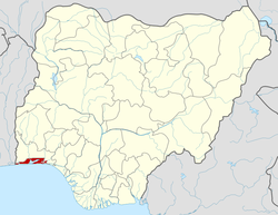
FlagLocation of Lagos State in Nigeria Coordinates: 6°35′N 3°45′E / 6.583°N 3.75°ECoordinates: 6°35′N 3°45′E / 6.583°N 3.75°E Country  Nigeria
Date created May 27, 1967 Capital Ikeja Government – Governor[1] Babatunde Fashola (ACN) – Senators - Munirudeen Muse
- Ganiyu Solomon
- Adeleke Mamora
– Representatives List Area – Total 3,475.1 km2 (1,341.7 sq mi) Population (Lagos State Social Security Exercise 2006 Census)[2] – Total 17,552,942 – Density 5,051.1/km2 (13,082.2/sq mi) GDP (PPP) – Year 2007 – Total $33.68 billion[3] – Per capita $3,649[3] Time zone WAT (UTC+01) ISO 3166 code NG-LA Website lagosstate.gov.ng Lagos State is an administrative division of Nigeria, located in the southwestern part of the country. The smallest in area of Nigeria's states, Lagos State is the most populous state in Nigeria and arguably the most economically important state of the country and west Africa,[4] containing Lagos, the nation's largest urban area. The actual population total is disputed between the official Nigerian Census of 2006, and a much higher figure claimed by the Lagos State Government.
Contents
History
Lagos State was created on May 27, 1967 by virtue of State (Creation and Transitional Provisions) Decree No. 14 of 1967, which restructured Nigeria’s Federation into 12 states. Prior to this, Lagos Municipality had been administered by the Federal Government through the Federal Ministry of Lagos Affairs as the regional authority, while the Lagos City Council (LCC) governed the City of Lagos. Equally, the metropolitan areas (Colony Province) of Ikeja, Agege, Mushin, Ikorodu, Epe and Badagry were administered by the Western Region. The State took off as an administrative entity on April 11, 1968 with Lagos Island serving the dual role of being the State and Federal Capital. However, with the creation of the Federal Capital Territory of Abuja in 1976, Lagos Island ceased to be the capital of the State which was moved to Ikeja. Equally, with the formal relocation of the seat of the Federal Government to Abuja on 12 December 1991, Lagos Island ceased to be Nigeria’s political capital. Nevertheless, Lagos remains the center of commerce for the country.
Government
Main article: Politics of Lagos StateSince its creation in 1967, the state has been administered either by a governor and a House of Assembly in civilian or quasi-civilian (under Ibrahim Badamasi Babangida's administration) federal administrations, or by Sole-Administrators or Military Administrators in military dispensations . Since December 2007, Yoruba has been the second official language of debate and discussion for the House of Assembly after English.
Administrative Divisions and Local Government Areas
Lagos State is divided into five Administrative Divisions, which are further divided into 20 Local Government Areas, or LGAs:[2]
LGA Name Area (sq.km) Census 2006
populationAdministrative capital Postal
CodeAgege 11 459,939 Agege 100 Alimosho 185 1,277,714 Ikotun 100 Ifako-Ijaye 27 427,878 Ifako 100 Ikeja 46 313,196 Ikeja 100 Kosofe 81 665,393 Kosofe 100 Mushin 17 633,009 Mushin 100 Oshodi-Isolo 45 621,509 Oshodi/Isolo 100 Shomolu 12 402,673 Shomolu 101 Ikeja Division 424 4,801,311 Apapa 27 217,362 Apapa 101 Eti-Osa 192 287,785 Ikoyi 101 Lagos Island 9 209,437 Lagos Island 101 Lagos Mainland 19 317,720 Lagos Mainland 101 Surulere 23 503,975 Surulere 101 Lagos Division 270 1,542,279 Ajeromi-Ifelodun 12 684,105 Ajeromi/Ifelodun 102 Amuwo-Odofin 135 318,166 Festac Town 102 Ojo 158 598,071 Ojo 102 Badagry 441 241,093 Badagry 103 Badagry Division 746 1,841,435 Ikorodu 394 535,619 Ikorodu 104 Ikorodu Division 394 535,619 Ibeju-Lekki 455 117,481 Akodo 105 Epe 1,185 181,409 Epe 106 Epe Division 1,640 298,890 The first 16 of the above LGAs comprise the statistical area of Metropolitan Lagos. The remaining four LGAs (Badagry, Ikorodu, Ibeju-Lekki and Epe) are within Lagos State but are not part of Metropolitan Lagos.
In 2003 many of the existing 20 LGAs were split for administrative purposes into Local Council Development Areas. These lower-tier administrative units now number 56: Agbado/Oke-Odo, Agboyi/Ketu, Agege, Ajeromi, Alimosho , Apapa, Apapa-Iganmu, Ayobo/Ipaja, Badagry West, Badagry, Bariga, Coker Aguda, Egbe Idimu, Ejigbo, Epe, Eredo, Eti Osa East, Eti Osa West, Iba, Isolo, Imota, Ikoyi, Ibeju, Ifako-Ijaiye, Ifelodun, Igando/Ikotun, Igbogbo/Bayeku, Ijede, Ikeja, Ikorodu North, Ikorodu West, Ikosi Ejinrin, Ikorodu, Ikorodu West, Iru/Victoria Island, Itire Ikate, Kosofe, Lagos Island West, Lagos Island East, Lagos Mainland, Lekki, Mosan/Okunola, Mushin, Odi Olowo/Ojuwoye, Ojo, Ojodu, Ojokoro, Olorunda, Onigbongbo, Oriade, Orile Agege, Oshodi, Oto-Awori, Shomolu, Surulere and Yaba.[5]
Demography
Lagos State is the smallest state in Nigeria, yet it has the second-highest population (only Kano State had more people enumerated at the last censuses).
According to the 1991 national census, Lagos State had a population of 5,725,116 out of a national total of 88,992,220.[6] However, the results of the 2006 census which should have given an accurate size of the population of Lagos fell short of expectation and has been out-rightly rejected by the Lagos State Government[2] Authorities of Lagos State have consequently attacked the results of the 2006 census, accusing the National Population Commission of having under-counted the population of Lagos State, an accusation strongly denied by the National Population Commission.[7]
Although the 2006 National Census credited the metropolitan area with a population figure of 8,048,430, the figure is consistent with the projections of the United Nations and other population bodies. Contrary to claims by the Lagos State government, it is not true that international agencies have put the population figures of Lagos at 15.5 million. According to the Urban Agglomeration Report issued by the United Nations Department of Economic and Social Affairs (Population Division), the population of Lagos in 2007 was 9.5 million ranking as the second most populous city in the Africa. According to the report, Lagos population would only have risen to 15.8 million in 2025 or the 12th in the World (World Urbanization Prospects, the 2008 Revision, United Nations Department of Economic and Social Affairs, New York, 26 February 2008). Therefore, the figure of 17,553,924 by the Lagos State is not supported by the projections of the UN and other world bodies. A rejoinder to Lagos State Government views[8] concluded that Lagos State "failed to interpret the two most important and fairly representative and reliable secondary data sets already in public domain, the National Identity Card Scheme and the 2003 Voters Registration figures from INEC. The recently released figures for 2007 Voters Registration by INEC were an act subsequent to the release of the provisional census results and comprehensively corroborate, vindicate and validate the population figures in no uncertain terms. The provisional population figure of Lagos State is therefore 9,013,534, and not 17,553,924. No amount of emotional outburst can change this fact as the act of the Lagos State lacks intellectual integrity, transparency and credibility."
The rate of population growth is about 275,000 persons per annum with a population density of 2,594 persons per sq. kilometer. In the urban area of Metropolitan Lagos, the average density is 8,000 persons per square kilometer on average (up to 55,000 inh. per km2. in the densest parts of the urban area). In a UN study of 1999, the city of Lagos was expected to hit the 24.5 million population mark by the year 2015 and thus be among the ten most populous cities in the world.
Universities in Lagos State
- University of Lagos, Lagos
- Lagos State University, Lagos
- Caleb University, Lagos
- Yaba College of Technology, Lagos
- Lagos State Polytechnic, Lagos
- Lagos Business School
People
While the State is essentially a Yoruba-speaking environment, it is a socio-cultural melting pot attracting both Nigerians and foreigners alike.
Indigenous inhabitants include the Aworis and Eguns in Ikeja and Badagry Divisions respectively, with the Eguns being found mainly in Badagry.
There is also an admixture of other pioneer settlers collectively known as the Ekos.
The indigenes of Ikorodu and Epe Divisions are mainly the Ijebus with pockets of Eko-Awori settlers along the coastland and riverine areas.
Transportation
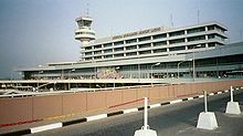
Murtala Mohammed International Airport in Ikeja and is one of Nigeria's 3 major international airports.
See also
References
- ^ See List of Governors of Lagos State for a list of prior governors
- ^ a b c "Lagos State - Population". http://www.lagosstate.gov.ng/index.php?page=subpage&spid=12&mnu=null.
- ^ a b "C-GIDD (Canback Global Income Distribution Database)". Canback Dangel. http://www.cgidd.com. Retrieved 2008-08-20.
- ^ Nigerian Congress - Administrative Division Description
- ^ "Local Government Areas". http://www.lagosstate.gov.ng/index.php?page=ministrylist&mcat=lga&mtitle=Local+Government+Area&mnu=null. Retrieved 2010-03-20.
- ^ GeoHive. "Nigeria - Administrative units". http://www.xist.org/cntry/nigeria.aspx. Retrieved 2007-06-10.
- ^ Government of Nigeria, National Population Commission (8 February 2007). "Lagos State Claim on the Provisional Result of the 2006 Census is Unfounded" (PDF). Archived from the original on June 23, 2007. http://web.archive.org/web/20070623051012/http://www.population.gov.ng/press-02-07.pdf. Retrieved 2007-06-29.
- ^ NATIONAL POPULATION COMMISSION - MISUNDERSTANDING, MISPERCEPTION AND MISREPRESENTATION OF CENSUS 2006 A REJOINDER TO THE PUBLICATION - “The Falsification of Lagos Census Figure” by Lagos State Government
External links
- Lagos State Government Official Site
- Lagos Interactive Maps & Sat Navs to travel around.
- Lagos Digital Street Maps.
- Lagos State Community WebSite.
- http://universitiesofnigeria.com/tag/universities-in-lagos-state/
Administrative
divisions
LGAs Agege · Ajeromi-Ifelodun · Alimosho · Amuwo-Odofin · Apapa · Badagry · Epe · Eti-Osa · Ibeju-Lekki · Ifako-Ijaiye · Ikeja · Ikorodu · Kosofe · Lagos Island · Lagos Mainland · Mushin · Ojo · Oshodi-Isolo · Somolu · Surulere States of Nigeria
Abia · Abuja Federal Capital Territory · Adamawa · Akwa Ibom · Anambra · Bauchi · Bayelsa · Benue · Borno · Cross River · Delta · Ebonyi · Edo · Ekiti · Enugu · Gombe · Imo · Jigawa · Kaduna · Kano · Katsina · Kebbi · Kogi · Kwara · Lagos · Nasarawa · Niger · Ogun · Ondo · Osun · Oyo · Plateau · Rivers · Sokoto · Taraba · Yobe · Zamfara
Mobolaji Johnson • Adekunle Lawal • Ndubuisi Kanu • Ebitu Ukiwe • Lateef Jakande • Gbolahan Mudasiru • Mike Akhigbe • Raji Rasaki • Michael Otedola • Olagunsoye Oyinlola • Mohammed Buba Marwa • Bola Tinubu • Babatunde FasholaYoruba topics History Western Nigeria · Nigeria · Slave tradeSubgroups Politics Geography States: Lagos State · Ogun State · Osun State · Ekiti State · Ondo State · Oyo State · Kwara State
Major cities: Lagos · Ibadan · Abẹokuta · Ọyọ · Ilé-IfẹDemographics Culture Categories:- States of Nigeria
- Lagos State
- States in Yorubaland
- States and territories established in 1967
Wikimedia Foundation. 2010.


