- Ekiti State
-
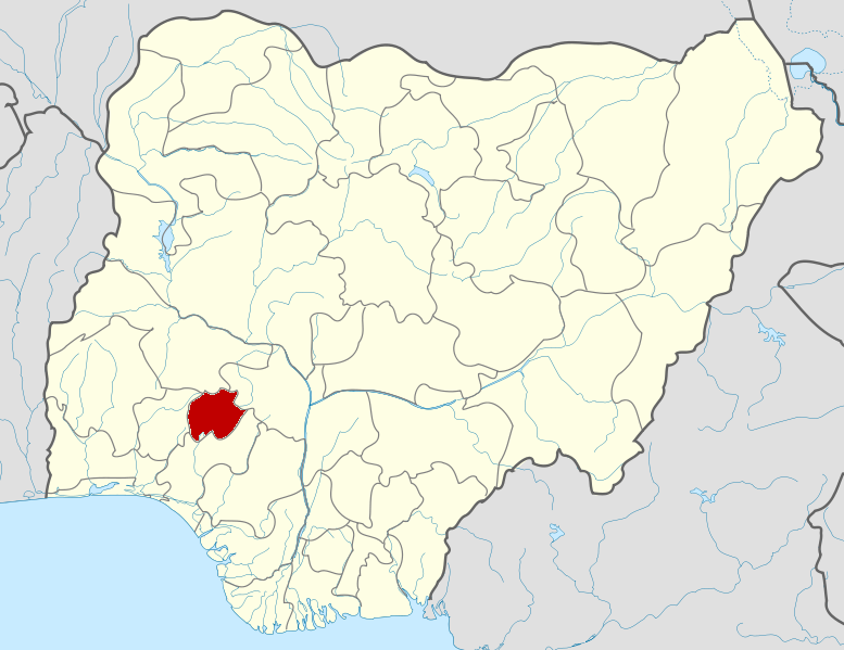
Ekiti State — State — Nickname(s): Fountain of Knowledge Location of Ekiti State in Nigeria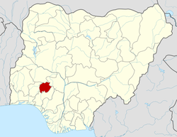
Coordinates: 7°40′N 5°15′E / 7.667°N 5.25°ECoordinates: 7°40′N 5°15′E / 7.667°N 5.25°E Country  Nigeria
Date created 1 October 1996 Capital Ado Ekiti Government – Governor
(List)Kayode Fayemi – Senators – Representatives Area – Total 6,353 km2 (2,452.9 sq mi) Area rank 31st of 36 Population – Estimate (2005) 2,737,186 – Rank 29th of 36 GDP (PPP) – Year 2007 – Total $2.85 billion[1] – Per capita $1,169[1] Time zone WAT (UTC+01) ISO 3166 code NG-EK Ekiti State is a state in southwest Nigeria, created on October 1, 1996 alongside five other new states by military dictator General Sani Abacha. The state, created out of the territory of Ondo State, covered the former twelve local government areas that made up the Ekiti Zone of old Ondo State; however, on creation, it took off with sixteen (16) Local Government Areas (LGAs), having had an additional four carved out of the old ones. Ekiti State is one of the thirty-six states (Federal Capital Territory (Nigeria)) that constitute Nigeria.Ekiti State is reputed to have produced the highest number of Professors in Nigeria. Several pioneers academias are from the state. Pioneers like Profs Adegoke Olubummo(1st Nigeria Professor in the field of Mathematics), Adeyinka Adeyemi(1st Professor of Architecture in West Africa). Others include renowned academics like Profs JF Ade-Ajayi, Niyi Osundare, Sam Aluko, Bolaji Aluko, Peter Bodurin and others too many to mention.
Following a prolonged political crisis, President Olusegun Obasanjo imposed a military administrator (General Tunji Olurin) on Ekiti State in October 2006. On April 27, 2007 Olurin was replaced by Tope Ademiluyi. In the PDP primary of 2006, Yinka Akerele and Prof. Adesegun Ojo were supposed to be in a run-off to determine who would be the nominee of the Nigerian ruling party when President Obasanjo summoned them to Abuja and imposed the candidate who came third - Engineer Segun Oni. He was later elected in the 2007 election as the governor of the state and the AC candidate Kayode Fayemi challenged his election and forced a rerun in May 2009.[2]
Contents
History
Ekiti was an independent state prior to the British conquest. It was one of the many Yoruba states in what is today Nigeria. Ekiti as a nation and districts of Yoruba race had her progeny in Oduduwa, the father and progenitor of Yoruba race. Just like every major subethnic division in Yorubaland. Ekiti has her origin from Ile-Ife (the cradle land of Yorubaland). The Olofin, one of the sons of the Oduduwa had sixteen (16) children and in the means of searching for the new land to develop, they all journeyed out of Ile-Ife as they walked through the Iwo - Eleru(crave) near Akure and had stop over at a place called Igbo-Aka(forest of termites) closer to Ile-Oluji.
The Olofin, the sixteen children and some other beloved people continued with their journey, but when they got to a particular lovely and flat land, the Owa-Obokun(the monachy of Ijesha land) and Orangun of Ila decided to stay in the present Ijesha and Igomina land of in Osun state. While the remaining fourteen (14) children continued with the journey and later settled in the present day of Ekiti land. They discovered that there were many hills in the place and they said in their mother's language that this is 'Ile olokiti' the land of hills. Therefore the Okiti later blended to EkitiI. So Ekiti derived her name through hills.
These are direct children and founder of Ekitiland, Igbominaland and Ijeshaland:
- Alara of Aramoko
- Alaaye of Efon Alaaye Kingdom
- Ajero of Ijero Kingdom
- Arinjale of Ise
- Ewi of Ado
- Elekole of Ikole
- Ogoga of Ikere
- Elemure of Emure
- Oloye of Oye
- Olojudo of Ido
- Onire of Ire
- Onitaji of Itaji
- Onisan of Isan
- Oore of Otun Moba
- Owatapa of Itapa
- Orangun of Ila-Orangun
- Owa -obokun of Ijeshaland
The modern Ekiti state was formed from part of Ondo in 1996.[3]
Geography
The State is mainly an upland zone, rising over 250 meters above sea level. It lies on an area underlain by metamorphic rock. It is generally undulating country with a characteristic landscape that consists of old plains broken by step-sided out-crops that may occur singularly or in groups or ridges. Such rocks out-crops exist mainly at Aramoko, Efon-Alaaye, Ikere-Ekiti,Igbara-odo- ekiti and Okemesi-Ekiti. The State is dotted with rugged hills, notable ones being Ikere-Ekiti Hills in the south, Efon-Alaaye Hills on the western boundary and Ado-Ekiti Hills in the centre.
Climate and vegetation
The State enjoys tropical climate with two distinct seasons. These are the rainy season (April–October) and the dry season (November–March). Temperature ranges between 21° and 28°C with high humidity. The south westerly wind and the northeast trade winds blow in the rainy and dry (Harmattan) seasons respectively. Tropical forest exists in the south, while savannah occupies the northern peripheries.
Towns and administrative divisions
The people of Ekiti State live mainly in towns. These towns include: Ado, Awo-Ekiti, Efon-Alaaye, Aramoko Ekiti, Ikole, Isan, Ikere, Ire, Ijero, Ayetoro, Ipoti, Igogo, Ise, Itapa, Otun,usi, Ido, Emure, Iyin, Igede, Ilawe, Ode, Oye, Omu, Omuo, Ilupeju, Ikoro,Iloro, Ikun, Iye, Ijesa-Isu, Ayedun, Aisegba, Osin, Okemesi, Ifaki, Osan, Erinmope, Asin-Ekiti, Orin, Ilogbo, Osi, Igbole, Ora, Aye, Ikogosi Eyio,and Igbara-Odo.
Local Government Areas
Ekiti State includes 16 of Nigeria's 774 Local Government Areas. They are:
Demographics
The Ekiti, whose ancestors migrated from Ile-Ife as a people, form one of the largest ethnic groups in Yorubaland. Ekitis are culturally homogeneous and they speak a dialect of Yoruba language known as Ekiti. The homogeneous nature of Ekiti confers on the state some uniqueness among the states of the federation. Slight differences are noticeable in the Ekiti dialects of the Yoruba language spoken by the border communities to other states. For example, the people of Ado local government area do not speak exactly the same dialect with the people of Ijero Local government area, while the people of Ikole area speak something different from the people of Ikere area. The communities influenced by their locations include Otun (Moba land) that speaks a dialect close to the one spoken by the Igbominas in Kwara State. The people of Oke-Ako, Irele, Omuo speak a similar dialect to that of Ijesas of Osun State. However, part of the uniqueness of the Ekitis is that where ever is your own part of the state, you will understand well, when the other Ekiti man/woman speaks, in spite of the dialectal variations. In addition, all towns in Ekiti State take a common suffix, “Ekiti,” after their names. The main staple food of the people of Ekiti is pounded yam with vegetable soup. NATURAL RESOURCES Ekiti land is naturally endowed with numerous natural resources. The state is potentially rich in mineral deposits. These include granite, kaolin, columbite, channockete, iron ore, baryte, aquamine, gemstone, phosphate, limestone, among others. They are largely deposited in different towns and villages of Ijero, Ekiti West, Ado - Ekiti, Ikole, Ikere, Ise-Ekiti and other Local Government Areas.
The Land is also blessed with water resources, some of its major rivers are Ero, Osun, Ose, and Ogbese. More so a variety of tourist attractions abound in the state namely, Ikogosi Warm Spring, Ipole - Iloro Water Falls, Olosunta hills, Ikere, Fajuyi Memorial Park Ado - Ekiti and so on. The Ikogosi tourist centre is the most popular and the most developed. The warm spring is a unique natural feature, and supporting facilities are developed in the centre. The spring is at present being processed and packaged into bottled water for commercial purpose by a private company - UAC Nigeria.
Moreover, the land is buoyant in agricultural resources with cocoa as its leading cash crop. It was largely known that Ekiti land constituted well over 40% of the cocoa products of the famous old Western Region. The land is also known for its forest resources, notably timber. Because of the favorable climatic conditions, the land enjoys luxuriant vegetation, thus, it has abundant resources of different species of timber. Food crops like yam, cassava, and also grains like rice and maize are grown in large qualities. Other notable crops like kola nut and varieties of fruits are also cultivated in commercial quantities.
References
- ^ a b "C-GIDD (Canback Global Income Distribution Database)". Canback Dangel. http://www.cgidd.com. Retrieved 2008-08-20.
- ^ "Ekiti: Fayose, Olujimi, Aderemi Lose Out". Nigerian Tribune Online (African Newspapers of Nigeria Plc.). 2007-04-28. Archived from the original on 2007-06-01. http://web.archive.org/web/20070601211209/http://odili.net/news/source/2007/apr/28/551.html. Retrieved 2007-05-02.
- ^ Cohen, Saul B., ed. The Columbia Gazeteer of the World (New York: Columbia University Press, 1998) vol 1, p. 915
Sources
- Adesina Adetola- EKITI KETE: THE VALUE, THE VIRTUE AND THE VISION. ISBN-978-978-086-696-9 ©2008
External links
Mohammed Bawa • Atanda Yusuf • Niyi Adebayo • Ayo Fayose • Tunji Olurin • Tope Ademiluyi • Olusegun Oni • Kayode Fayemi States of Nigeria
Abia · Abuja Federal Capital Territory · Adamawa · Akwa Ibom · Anambra · Bauchi · Bayelsa · Benue · Borno · Cross River · Delta · Ebonyi · Edo · Ekiti · Enugu · Gombe · Imo · Jigawa · Kaduna · Kano · Katsina · Kebbi · Kogi · Kwara · Lagos · Nasarawa · Niger · Ogun · Ondo · Osun · Oyo · Plateau · Rivers · Sokoto · Taraba · Yobe · Zamfara
Categories:- States of Nigeria
- Ekiti State
- States in Yorubaland
- States and territories established in 1991
Wikimedia Foundation. 2010.