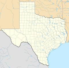
- Main and Military Plazas Historic District
-
Main and Military Plazas Historic District
 Spanish Military Governor's Palace
Location: Roughly bounded by San Antonio River, E. Nueva, Laredo, and Houston Sts., San Antonio, Texas Coordinates: 29°25′27″N 98°29′37″W / 29.42417°N 98.49361°WCoordinates: 29°25′27″N 98°29′37″W / 29.42417°N 98.49361°W Built: 1722 Architect: Multiple Architectural style: Early Commercial, Late Victorian, Colonial Governing body: Local NRHP Reference#: 79002914 Added to NRHP: June 11, 1979[1] Main and Military Plazas Historic District is a historic district in San Antonio, Texas. It was listed on the National Register of Historic Places in 1979.[1].
The area encompasses the old Presidio San Antonio de Bexar[2], where the Spanish troops and the military Governor of Texas were stationed.[3]
It includes the following separately listed Registered Historic Places:
- Spanish Governor's Palace,
- Vogel Belt Building Complex (restored for city offices),
- Church of Nuestra Senora de la Candelaria y Guadalupe, and
- Bexar County Courthouse,
one or more of which are National Historic Landmarks of the U.S.
References
- ^ a b "National Register Information System". National Register of Historic Places. National Park Service. 2008-04-15. http://nrhp.focus.nps.gov/natreg/docs/All_Data.html.
- ^ "SAN ANTONIO DE BEXAR PRESIDIO," Handbook of Texas Online (http://www.tshaonline.org/handbook/online/articles/uqs02), accessed April 23, 2011. Published by the Texas State Historical Association.
- ^ Edmonson (2000), p. 14.
See also
Holiday Inn Express Riverwalk Area, a contributing structure, formerly the Old Bexar County Jail
Citations
- Edmondson, J.R. (2000), The Alamo Story-From History to Current Conflicts, Plano, TX: Republic of Texas Press, ISBN 1-55622-678-0
U.S. National Register of Historic Places Topics Lists by states Alabama • Alaska • Arizona • Arkansas • California • Colorado • Connecticut • Delaware • Florida • Georgia • Hawaii • Idaho • Illinois • Indiana • Iowa • Kansas • Kentucky • Louisiana • Maine • Maryland • Massachusetts • Michigan • Minnesota • Mississippi • Missouri • Montana • Nebraska • Nevada • New Hampshire • New Jersey • New Mexico • New York • North Carolina • North Dakota • Ohio • Oklahoma • Oregon • Pennsylvania • Rhode Island • South Carolina • South Dakota • Tennessee • Texas • Utah • Vermont • Virginia • Washington • West Virginia • Wisconsin • WyomingLists by territories Lists by associated states Other Categories:- Historic districts in Texas
- National Register of Historic Places in Texas
- 1722 architecture
- Texas Registered Historic Place stubs
Wikimedia Foundation. 2010.

