- River Wensum
-
Wensum River 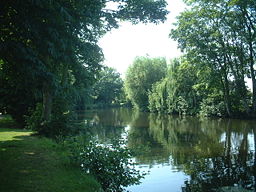
Country England Counties Norfolk Tributaries - left River Tat, River Ainse (or Eyn) - right River Tud Towns Sculthorpe, Fakenham, North Elmham, Lenwade, Norwich Source - location Whissonsett, Norfolk Mouth River Yare - location Whitlingham, Norwich The River Wensum is a chalk fed river [1] in Norfolk, England and a tributary of the River Yare despite being the larger of the two rivers. The complete river is a designated Site of Special Scientific Interest (SSSI) and Special Area of Conservation (SAC).[2]
Contents
Etymology
The river receives its name from the Old English adjective wandsum, wendsum meaning winding.[3]
Course
The source of the Wensum lies between the villages of Colkirk and Whissonsett in north-west Norfolk. The river flows westward initially, close to the villages of South Raynham, West Raynham and East Raynham, passing Raynham Hall, home of the Marquis Townshend. The Wensum then turns and flows north through a number of small villages until it reaches Sculthorpe, where it turns east through the market town of Fakenham. The river then flows in a south-easterly direction, passing through the Pensthorpe Nature Reserve and the village of Great Ryburgh.
The Wensum continues through or close to the villages of Guist, North Elmham, Worthing, Swanton Morley, Lyng, Lenwade and Taverham before entering the City of Norwich from the north-west via Drayton, Costessey and Hellesdon. At New Mills Yard, a former waterworks, the river becomes tidal and navigable by boat. Flowing through the city, the river forms a broad arc which would have influenced the site of the settlement for defensive reasons;[citation needed] remnants of boom towers can be seen near Wensum Park and Carrow Hill which formed part of the city wall and a large defensive tower can be seen on the bank near Barrack Street, called Cow Tower. This dates to the 12th century and was also used for collecting tolls.[4] Evidence of the river's historical use as a means of transport for goods and trade from the continent is still visible: mills, quays and industrial remnants can be found near the station and along King Street, and a slipway at Pulls Ferry marks the start of a canal originally used to transport stone from Caen in Normandy, in the 13th Century, to build Norwich Cathedral. This site was also a public house and used as a River Ferry until the 1950s.
The Wensum flows past Carrow Road football ground and then out of the city via Trowse, to Whitlingham where it merges with the River Yare. The river is navigable from the New Mills Yard in the centre of Norwich to its confluence with the Yare.
Tributaries
- River Tat. Rises on Syderstone Common and merges with the Wensum west of Fakenham
- River Tud. Rises a little south of East Dereham and merges with the Wensum just below Hellesdon mill.
- River Ainse (or Eyn). Merges with the River Wensum at Lenwade.
Watermills
 Bintree Mill, 2005 (photo by Mark Boyer)
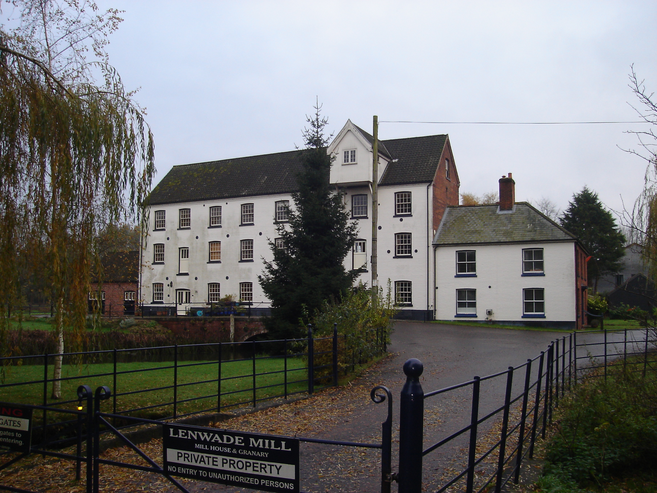
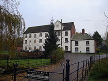 Lenwade mill
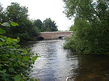
There were a succession of water mills on the Wensum, some of which are still standing and working. From the source these are
- Sculthorpe Mill. The 18th century water mill which bridges the river was converted into a hotel and restaurant in 2003. [1]
- Hempton Mill. The mill became derelict and was demolished in 1954 by the Drainage Board in order to improve control of the river levels. [2]
- Fakenham Mill. The 18th Century water mill bridging the river was in use until 1979. It was converted into homes in 1982. [3]
- Great Ryburgh Mill [4]
- Guist Mill [5]
- Bintry Mill ceased operation in 1980, but the building is still extant. It was used as the location for a film of George Eliot's The Mill on the Floss in 1996. [6]
- North Elmham Mill, known locally as Grint Mill, had two breastshot waterwheels until the early twentieth century when they were replaced by two turbines. By the 1970s the milling machinery was driven by mains electricity while the turbines were used to drive a sack hoist and two mixing machines. The mill continued to produce animal feed into the late twentieth century [7]
- Swanton Morley Mill was demolished in the 1840s. [8]
- Elsing Mill ceased operation in 1970. The building is still extant. [9]
- Lyng Mill was demolished in 1868. [10]
- Lenwade Mill. The Grade II listed building was at risk in the 1990s, but was sympathetically converted into apartments in 2000. [11]
- Taverham Mill. In the 19th century Taverham was a major producer of paper. Some of the paper which was produced at Taverham Mill was used in producing The Times and the Oxford English Dictionary. It also served the University Press at Cambridge. The paper mill closed in 1899. [12]
- Costessey Mill was destroyed by a fire in 1924. [13]
- Hellesdon Mill was demolished for building materials in 1920. [14]
- Norwich New Mills. A corn mill was built in 1430 by public subscription. In 1710, it was rebuilt to grind corn and supply water to the city. In 1897, it became an air compressor station, with three electric and two water powered compressors. The compressed air was used to pump sewage out of the city. Operation ceased in 1972, when the only other Schone Ejector pumps in the country were those under the houses of parliament. Plans for it to become a working museum failed, but all the machinery is still intact. The sluice is now computer operated to control water levels. [15]
Other mills close on tributaries are
- Great Witchingham Mill [16]
- Gressenhall Mill [17]
- Worthing Mill [18]
- Felthorpe Mill [19]
Bridges (Norwich)
River Wensum Legend

Source 
Wissonsett 
A1065 Bridge 

River Tat 
Sculthorpe Mill (extant) A1065 Bridge Site of Hempton Mill (d.1954) Fakenham Mill (extant) 
Site of Gt Ryburgh Mill (d.1925) 
B1110 Bridge, Guist Bintree Mill (extant) North Elmham Mill (extant) B1145 Bridge, Billingford Site of Swanton Morley Mill (d.~1840) B1147 Bridge, Swanton Morley Elsing Mill (extant) Site of Lyng Mill (d.1868) Lenwade Mill (extant) A1067 Bridge River Ainse (or Eyn) A1067 bridge, Attlebridge Site of Tavenham Mill (d.1899) Site of Costessey Mill (d.1924) Site of Hellesdon Mill (d.1920) 

River Tud A140 Bridge A1024 Bridge A147 Barn Road Bridge (Inner ring road) 
New Mills Compressor Station 
New Mill Yard Bridge 
New Mills yard 
Coslany Street Bridge 
Duke Street Bridge St Georges Bridge Fye Bridge Whitefriars Bridge Bishopgate Bridge Foundry Bridge, Norwich 
Novi Sad Friendship Bridge 
A147 Carrow Bridge (Inner ring road) 

Junction with River Yare 
River Yare Bishop Bridge is one of five medieval bridges which span the River Wensum. Built in 1345 it formed part of the defensive structure along the river, with a gatehouse on the city side of bridge which was demolished in 1791. It is positioned on the site of a Roman Ford.
Fye Bridge is arguably the oldest river crossing in Norwich and is the gate to the North of the City known as “Norwich over the water” this bridge was also the site of a cucking stool for ducking lawbreakers and undesirables.
Whitefriars Bridge Named after a former Carmelite (White Friars) monastery. The remains of which can still be seen in a small section of medieval wall and archway.
Foundry Bridge Near the railway station and the Yacht station on Riverside named after a foundry nearby, purported to have been built to take a railway line.
Carrow Bridge near Carrow Road football ground is a more recent cantilevered swing bridge, which can still be opened to allow large or high vessels through. It is positioned in close proximity to the Boom towers which originally had a chain suspended between them and would have been used as part of the citys defences and as a method of collecting tolls on goods travelling up river from Great Yarmouth.
Novi Sad Friendship Bridge is a cable stayed swing footbridge which spans the River Wensum in Norwich. The structure is named in recognition of the twinning ties between Norwich and Novi Sad in Serbia. The bridge was designed by Buro Happold and commissioned by Norfolk County Council.[5]
There are further bridges at Barn Road, Anchor Quay, Duke Street and St. Georges Street.
Conservation
See also River Wensum SSSI
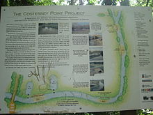 The Costessey Point interpretation board
After many years of decline a survey was commissioned by Natural England in 2002. It showed that the ecological condition of the river had declined. The principal reasons for this were water quality and siltation. Water quality has been addressed and was improving, but the physical character of the river needs to be restored. In 2008, a partnership known as the River Wensum Restoration Strategy (RWRS) was formed between; Environment Agency; Water Management Alliance and Natural England[6] to restore the physical functioning of the Wensum. The 2002 report found that fourteen redundant water mills along the Wensum as having the most significant factor affecting morphology of the river channel, with 67% of the river backed up behind these structures. As a priority, the strategy recommended the lowering, removal or bypassing of these structures to allow more of the river to function naturally.[1] Since 2008, the (RWRS) has made several improvements to the river. The holistic whole river approach with co-operation from land owners, fisheries managers and other organizations has seen ongoing projects ranging from restoring gravel glides to removing silt.[6]
The Norfolk Anglers Conservation Association (NACA) carried out a successful river habitat restoration at their Sayers Meadow fishery at Lyng in the early 1980s.[7] After dredging and a major abstraction pipeline had a detrimental effect on the Costessey Point fishery, the association has taken action to restore this well known water. The ongoing work will be used as a blueprint for future river conservation projects.[8]
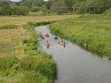
Angling
Between 1940 and the 1970s the river had a national reputation as a roach fishery with specimens exceeding 3 pounds (1.4 kg) being reported.[9] As the river declined through the effects of abstraction, dredging and modern farming methods these fish largely died out.[1] After an earlier introduction of a small amount of barbel - a fish not indigenous to the Wensum - the local river authority stocked the Wensum with over 150 fish in 1971 below Costessey Mill.[9] and subsequently stocked more fish at suitable sections of the Upper Wensum.[7] The fish became established albeit in small numbers at a few favourable locations. Specimens in excess of 20 pounds (9.1 kg) have been caught[10] with a specimen of 21 pounds 2 ounces (9.6 kg) landed in November, 2008 from the Norfolk Anglers' Conservation Association (NACA) fishery at Lyng.[11]
Today (2011), much of the Wensum's upper reaches are privately owned or controlled by syndicates. However, opportunities for individual anglers can be found and as the river passes through the City of Norwich free fishing is available where accessible.
See also
- List of rivers in England
References
- ^ a b c Natural England Retrieved 21 March 2011
- ^ River Wensum-Special area of conservation Retrieved October 13, 2008
- ^ Ekwall,E, The Concise Oxford Dictionary of English Place-names (1974) p496 ISBN 0-19-869103-3 Retrieved 17 October 2008
- ^ Cow Tower Retrieved 15 December 2010
- ^ Design of the Novi Sad Friendship Bridge - A Case Study, accessed 2010-03-14
- ^ a b Environment Agency- River Wensum Restoration Strategy Retrieved 30 March 2011
- ^ a b Norfolk Anglers Conservation Association, Sayers Meadow, NACA Retrieved 23 March 2011
- ^ Costessey Point Retrieved 15 April 2011
- ^ a b Wilson, J Where to Fish in Norfolk and Suffolk (1989) ISBN 0-7117-0183-0 p23, 132. Jarrolds Retrieved 22 March 2011
- ^ Wensum barbel Retrieved 22 March 2011
- ^ News of the World news report March 23 2011
Further reading
- Where to Fish in Norfolk and Suffolk by John Wilson ISBN 0-7117-0183-0
External links
- River Wensum Literary Links
- BBC Norfolk: Watch a film about the River Wensum at Pensthorpe
- Otter predation
 Rivers and watercourses of NorfolkRiver Ainse (or Eyn) • River Ant • River Babingley • Beeston Beck • River Bure • River Burn • River Chet • River Cong • River Gadder • Gaywood River • River Glaven • River Great Ouse • Gur Beck • Hagon Beck • River Heacham • River Hor • River Hun • River Ingol • River Little Ouse • River Mun • River Nar • River Nene • North Walsham & Dilham Canal • Panford Beck • Penny Spot Beck • Scarrow Beck • Spring Beck • River Stiffkey • River Tas • River Tat • River Thet • River Thurne • River Tiffey • River Tud • River Waveney • River Wensum • Wisbech Canal • River Wissey • River YareCategories:
- Rivers of Norfolk
- Sites of Special Scientific Interest in Norfolk
- Bridges in Norfolk
- Norwich


Wikimedia Foundation. 2010.