- Chippewa Falls, Wisconsin
-
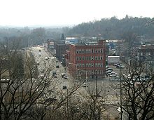
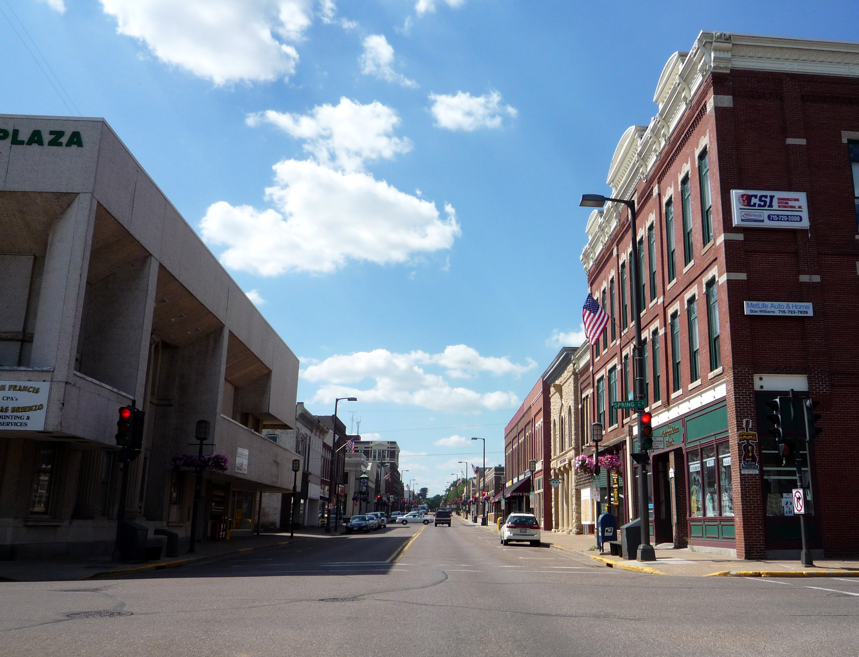
Chippewa Falls, Wisconsin — City — Bridge Street, downtown Chippewa Falls

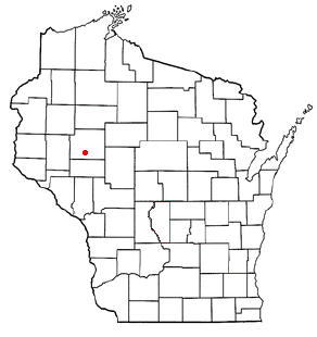
Chippewa Falls logoLocation of Chippewa Falls, Wisconsin
Coordinates: 44°56′3″N 91°23′36″W / 44.93417°N 91.39333°WCoordinates: 44°56′3″N 91°23′36″W / 44.93417°N 91.39333°W Country United States State Wisconsin County Chippewa Government - Mayor Greg Hoffman Area - Total 11.4 sq mi (29.5 km2) - Land 10.9 sq mi (28.1 km2) - Water 0.5 sq mi (1.4 km2) Elevation[1] 840 ft (256 m) Population (2010) - Total 13,661 - Density 1,199.4/sq mi (463.1/km2) Time zone Central (CST) (UTC-6) - Summer (DST) CDT (UTC-5) FIPS code 55-14575[2] GNIS feature ID 1563041[1] Website Official Website Chippewa Falls is a city located on the Chippewa River in Chippewa County in the U.S. state of Wisconsin. The population was 13,661 at the 2010 census. Incorporated as a city in 1869, it is the county seat of Chippewa County.[3]
The city's name originated because of its location on the Chippewa River, which is named after the Ojibwa Native Americans. Chippewa is an alternative rendition of Ojibwa.
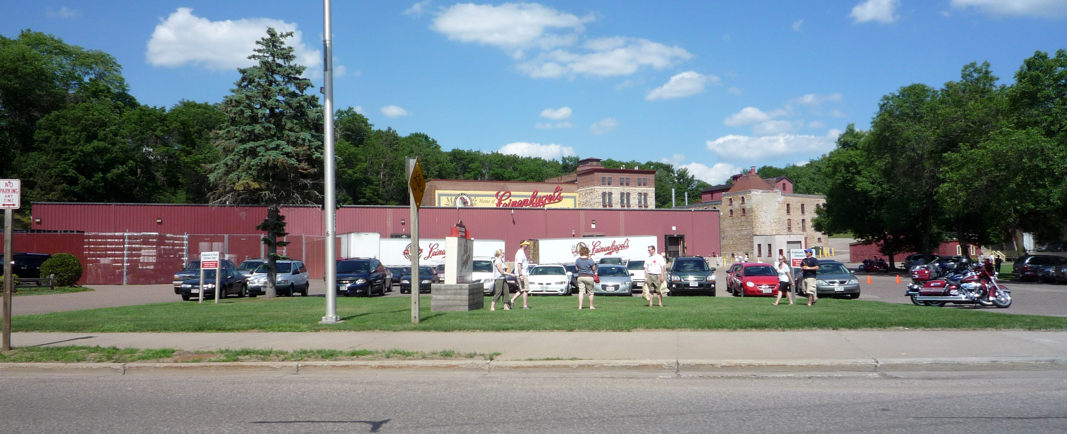
Chippewa Falls is the birthplace of Seymour Cray, and the headquarters for the original Cray Research. It is also the home of the Jacob Leinenkugel Brewing Company, the Heyde Center for the Arts, a showcase venue for artists and performers, Irvine Park, and the annual Northern Wisconsin State Fair. Chippewa Falls is also 15 miles from the annual 4 Day music festivals Country Fest and Rock Fest.
Contents
Geography
Chippewa Falls is located at 44°56′03″N 91°23′36″W / 44.934110°N 91.393228°W (44.934110, -91.393228).[4]
According to the United States Census Bureau, the city has a total area of 11.4 square miles (30 km2), of which 10.9 square miles (28 km2) is land and 0.5 square miles (1.3 km2), or 4.66%, is water.
Demographics
 2000 Census Age Pyramid for Eau Claire County.
Historical populations Census Pop. %± 1990 12,727 — 2000 12,925 1.6% 2010 13,661 5.7% WI Counties 1900-1990  Jacob Leinenkugel Brewing Company brewery.
At the 2000 census[2], there were 12,925 people, 5,638 households and 3,247 families residing in the city. The population density was 1,191.2 per square mile (459.9/km2). There were 5,905 housing units at an average density of 544.2 per square mile (210.1/km2). The racial makeup of the city was 97.62% White, 0.30% African American, 0.46% Native American, 0.67% Asian, 0.01% Pacific Islander, 0.16% from other races, and 0.77% from two or more races. Hispanic or Latino of any race were 0.63% of the population.
There were 5,638 households of which 28.8% had children under the age of 18 living with them, 42.4% were married couples living together, 11.3% had a female householder with no husband present, and 42.4% were non-families. 36.5% of all households were made up of individuals and 16.4% had someone living alone who was 65 years of age or older. The average household size was 2.20 and the average family size was 2.89.
Age distribution was 24.2% under the age of 18, 9.4% from 18 to 24, 28.2% from 25 to 44, 20.3% from 45 to 64, and 17.9% who were 65 years of age or older. The median age was 37 years. For every 100 females there were 89.5 males. For every 100 females age 18 and over, there were 85.2 males.
The median household income was $32,744, and the median family income was $43,519. Males had a median income of $32,016 versus $22,655 for females. The per capita income for the city was $18,366. About 8.7% of families and 10.3% of the population were below the poverty line, including 15.5% of those under age 18 and 5.8% of those age 65 or over.
History
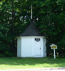 The original Spring House.
Chippewa Falls was originally a lumber town that became a railroad town, even though the main railroad line of the 1870s went through Eau Claire, about 10 miles to the south. In 1870, the West Wisconsin Railway built a line from St. Paul, Minnesota, to Milwaukee through the area at Eau Claire. Following this, the Eau Claire and Chippewa Falls Railway established a line running from Eau Claire to Chippewa Falls. In 1880, the CF&W was joined by the Wisconsin and Minnesota Railway pushing its way west from Abbotsford. This was followed in 1881 by the Chippewa Falls & Northern Railroad, which built a line north from Chippewa Falls to Bloomer, eventually being extended to Superior.
Around 1700, French explorer Pierre-Charles Le Sueur discovered the Chippewa Spring near the river. Politician Thaddeus C. Pound founded the Chippewa Springs Health Club in 1887 and at one point oversaw the company that bottled the water for sale. A Spring House was built over the original spring in 1893 and remains today, across from the modern water bottling plant on Park Ave.[5]
Education
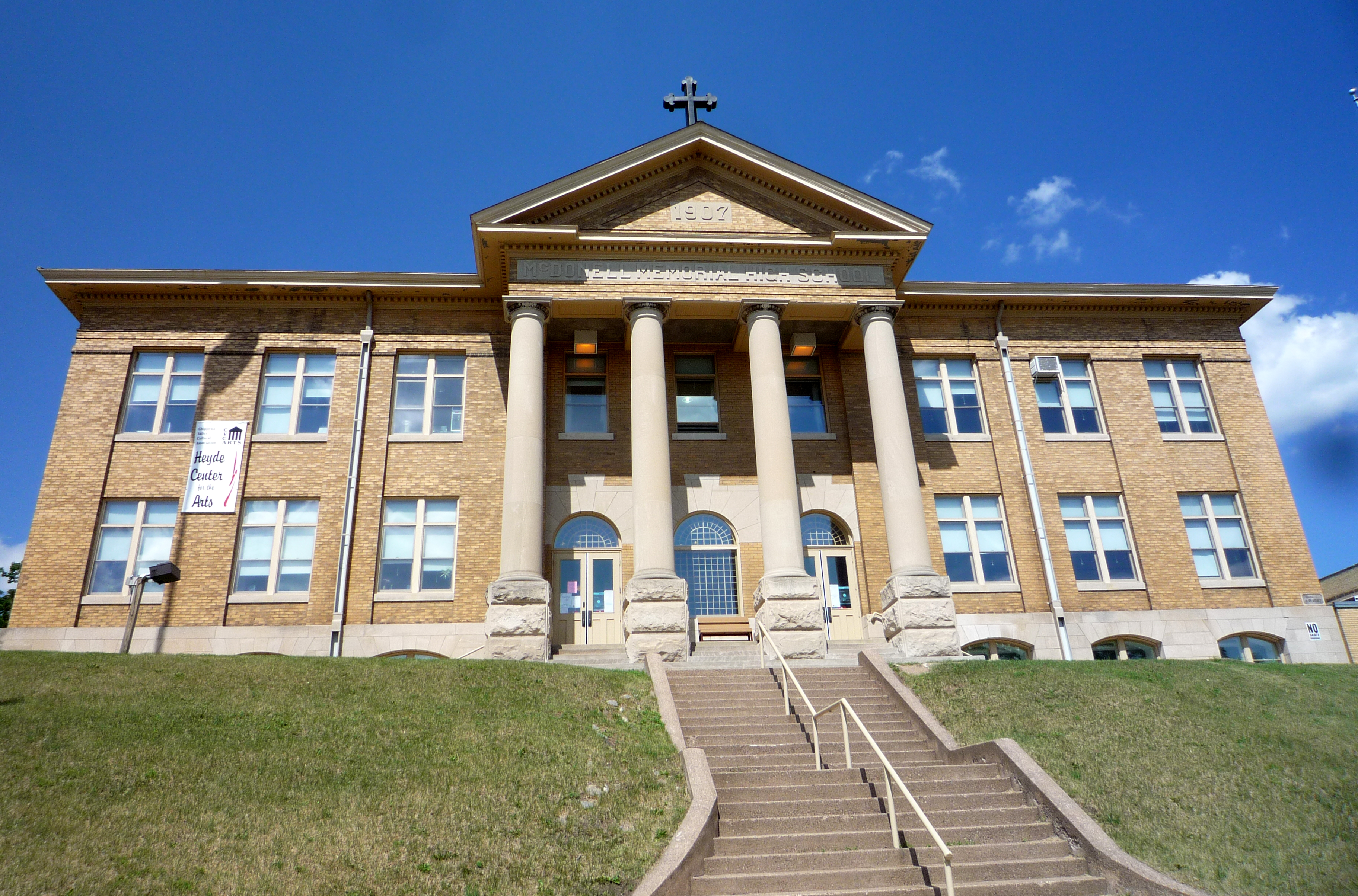
 The original McDonell High School is now a public arts center.
The Chippewa Falls Area School District (CFSD) serves the city of Chippewa Falls. It has two high schools: Chippewa Falls Senior High and Chippewa Falls Alternate High School; two middle schools: Chippewa Falls Middle School, and Chippewa Falls Alternate Middle School; and six elementary schools: Parkview, Hillcrest, Southview, Stillson, Halmstad, and Jim Falls Elementary.
In addition there are several parochial schools: McDonell Central Catholic High School, Notre Dame Middle School, Holy Ghost, St. Charles, and St. Peter Elementary Schools, all of which are part of the Chippewa Area Catholic Schools (CACS).
The original McDonell High School building, sitting at a prominent location above downtown Chippewa Falls, is listed on the State and National Register of Historic Places. The structure was built in 1907 and, after the school moved to a more suburban location, it sat abandoned for a number of years until it was taken over by the Chippewa Valley Cultural Association and converted into the Heyde Center for the Arts in 2000.
In Popular Culture
Chippewa Falls is the birth place and hometown of the fictional characters Jack Dawson in the movie Titanic, and the title character of Annie Hall.
Economy
 Renovated Chippewa Shoe Factory facing the Chippewa River in Chippewa Falls
The largest employers in the city are:[6]
1 TTM Advanced Circuits 2 Chippewa Falls Public Schools 3 Saint Joseph's Hospital 4 Wal-Mart 5 Mason Companies Inc 6 Chippewa County 7 Silicon Graphics International 8 Cooperative Educational Service Agency #10 9 Cray Inc 10 Wissota Healthcare Regional Vent CT Notable natives and residents
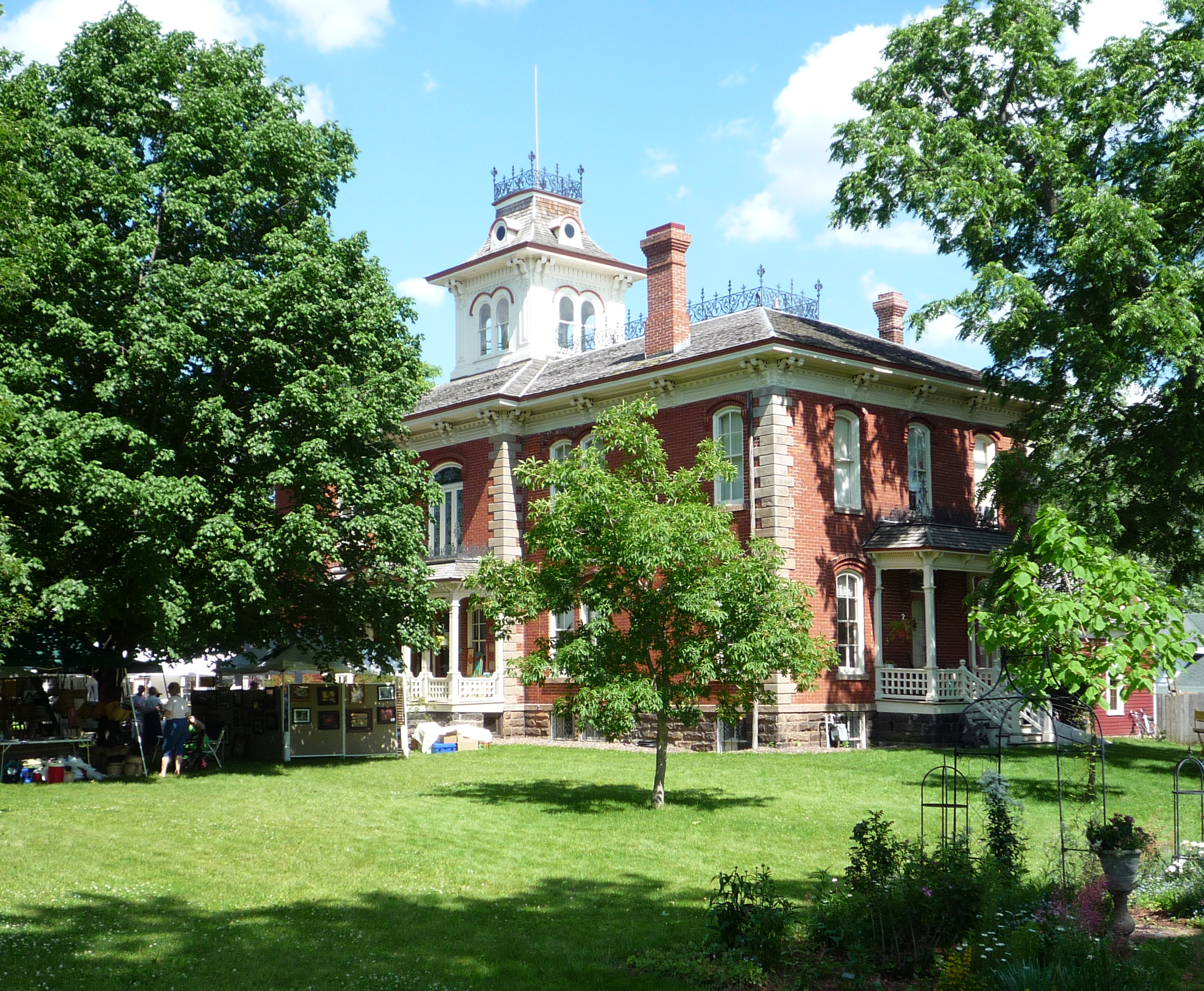
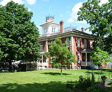 The Cook-Rutledge Mansion is on the National Register of Historic Places.
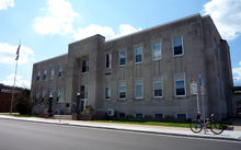 Municipal Building
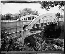 Spring Street Bridge Chippewa Falls, WI
- Robert Anderson - Navy Cross recipient[7]
- Moose Baxter - John Morris Baxter, former Major League Baseball player.
- Irving J. Carr - U.S. Army Major General.
- Chad Cascadden - former National Football League linebacker for the New York Jets and New England Patriots from 1995-1999.
- Richard H. Cosgriff - Medal of Honor recipient
- Wilder W. Crane, Jr. - member of the Wisconsin State Assembly
- Seymour Cray (1925–1996) - U.S. electrical engineer and supercomputer architect who founded Cray Research.
- Art Crews - Former professional wrestler who is now the Jail Captain with the Chippewa County Sheriff's Department.
- Nate DeLong - National Basketball Association player.
- Charles E. "Gus" Dorais (1891–1954) - Former quarterback and kicker for the University of Notre Dame; inducted into the College Football Hall of Fame as a coach in 1954. Was head coach of the Detroit Lions from 1943-1947.
- Gene Ellenson - professional football player in 1946.[8]
- Horace Ellis - Medal of Honor recipient[9]
- Judy Henske - singer and songwriter, once known as “the Queen of the Beatniks”. She has written songs about her Chippewa roots including a song about another Chippewa Notable in "The Ballad of Seymour Cray".
- Thomas S. Hogan - Montana Secretary of State
- John J. Jenkins - U.S. Representative.
- William F. Kirk (1877–1927) - nationally syndicated columnist, poet, songwriter, humorist and baseball writer.
- Terry Moulton - a politician and member of the Wisconsin State Senate.
- James J. LeCleir - U.S. Air Force Major General
- Dick Leinenkugel - a politician and businessman with Leinenkugels. Served as the Wisconsin Secretary of Commerce under governor Jim Doyle.
- Howard "Guitar" Luedtke - American blues guitarist, singer, songwriter and musician who tours with his band, Howard "Guitar" Luedtke & Blue Max.
- Charles E. Mower - United States Army soldier and Medal of Honor recipient in World War II
- Thaddeus C. Pound - U.S. Representative.
- Dennis B. Sullivan - U.S. Air Force Brigadier General
- Tom Sykora - was elected to the Wisconsin State Assembly in 1994.[10] Sykora served in the Wisconsin State Assembly from 1995 until his retirement in 2003.[11]
- Joe Vavra - former player for the Los Angeles Dodgers and current hitting coach for the Minnesota Twins. Joe was enshrined in the Chi-Hi Athletic Hall of Fame on August 27, 2010.
- Eddy Waller (14 June 1889 – 20 August 1977), film actor who appeared in over 200 films between 1929 and 1963.
- Alexander Wiley - served four terms in the United States Senate for the state of Wisconsin from 1939 to 1963.
Notes
- ^ a b "US Board on Geographic Names". United States Geological Survey. 2007-10-25. http://geonames.usgs.gov. Retrieved 2008-01-31.
- ^ a b "American FactFinder". United States Census Bureau. http://factfinder.census.gov. Retrieved 2008-01-31.
- ^ "Find a County". National Association of Counties. http://www.naco.org/Counties/Pages/FindACounty.aspx. Retrieved 2011-06-07.
- ^ "US Gazetteer files: 2010, 2000, and 1990". United States Census Bureau. 2011-02-12. http://www.census.gov/geo/www/gazetteer/gazette.html. Retrieved 2011-04-23.
- ^ Chippewa Springs, Chippewa County Tourism Council, Accessed July 19, 2009.
- ^ http://worknet.wisconsin.gov/worknet/largemp.aspx, Accessed June 20, 2011.
- ^ http://militarytimes.com/citations-medals-awards/recipient.php?recipientid=19686
- ^ "Gene Ellenson at www.pro-football-reference.com". http://www.pro-football-reference.com/players/E/ElleGe20.htm. Retrieved 2009-05-06.
- ^ http://militarytimes.com/citations-medals-awards/recipient.php?recipientid=1365
- ^ "Wisconsin History". http://www.wisconsinhistory.org/dictionary/index.asp?action=view&term_id=2042&search_term=sykora. Retrieved 2010-06-01.
- ^ "Wisconsin Legislative Spotlight". http://www.legis.state.wi.us/spotlight/spotl103.html. Retrieved 2010-06-01.
External links
General
- Chippewa Falls, Wisconsin
- Chippewa Falls Area Chamber of Commerce
- Chippewa Falls at the Open Directory Project
- Chippewa Falls School District
- Chippewa Area Catholic Schools
Tourism
Eau Claire, Wisconsin (metro) Surrounding
communities(over 10,000) Chippewa Falls°(under 10,000) Altoona° | Anson* | Brunswick* | Eagle Point* | Hallie* | Lafayette* | Lake Hallie‡ | Lake Wissota§ | Pleasant Valley* | Seymour* | Seymour§ | Tilden* | Union* | Washington* | Wheaton*
Counties *town ‡village °city §CDP Municipalities and communities of Chippewa County, Wisconsin County seat: Chippewa Falls Cities Bloomer | Chippewa Falls | Cornell | Eau Claire‡ | Stanley‡

Villages Boyd | Cadott | Lake Hallie | New Auburn‡
Towns CDPs Holcombe | Jim Falls | Lake Wissota
Unincorporated
communitiesAlbertville | Crescent | Eagleton | Edson | Howard | Pine Grove | Old Albertville | Tilden
Footnotes ‡This populated place also has portions in an adjacent county or counties
Categories:- Populated places in Chippewa County, Wisconsin
- Cities in Wisconsin
- County seats in Wisconsin
- Eau Claire metropolitan area


Wikimedia Foundation. 2010.