- Lafayette, Chippewa County, Wisconsin
Infobox Settlement
official_name = Lafayette, Wisconsin
settlement_type =Town
nickname =
motto =
imagesize =
image_caption =
image_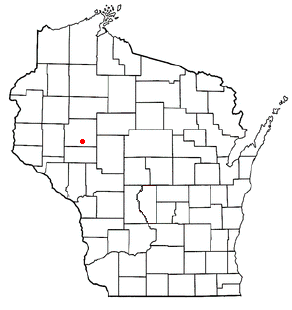
mapsize = 250px
map_caption = Location of Lafayette, Wisconsin
mapsize1 =
map_caption1 =subdivision_type = Country
subdivision_name =United States
subdivision_type1 = State
subdivision_name1 =Wisconsin
subdivision_type2 = County
subdivision_name2 = Chippewagovernment_footnotes =
government_type =
leader_title =
leader_name =
leader_title1 =
leader_name1 =
established_title =
established_date =unit_pref = Imperial
area_footnotes =area_magnitude =
area_total_km2 = 101.3
area_land_km2 = 89.4
area_water_km2 = 11.9
area_total_sq_mi = 39.1
area_land_sq_mi = 34.5
area_water_sq_mi = 4.6population_as_of = 2000
population_footnotes =
population_total = 5199
population_density_km2 = 58.1
population_density_sq_mi = 150.6timezone = Central (CST)
utc_offset = -6
timezone_DST = CDT
utc_offset_DST = -5
elevation_footnotes = GR|3
elevation_m = 297
elevation_ft = 974
latd = 44 |latm = 55 |lats = 30 |latNS = N
longd = 91 |longm = 17 |longs = 57 |longEW = Wpostal_code_type =
postal_code =
area_code =
blank_name = FIPS code
blank_info = 55-40900GR|2
blank1_name = GNIS feature ID
blank1_info = 1583502GR|3
website =
footnotes =Lafayette is a town in Chippewa County in the
U.S. state ofWisconsin . The population was 5,199 at the 2000 census. Thecensus-designated place known as Lake Wissota is located within the town. Lafayette is served by theSchool District of Cadott Community and theChippewa Falls Area School District .Geography
According to the
United States Census Bureau , the town has a total area of 39.1square mile s (101.3km² ), of which, 34.5 square miles (89.4 km²) of it is land and 4.6 square miles (11.9 km²) of it (11.74%) is water.Demographics
As of the
census GR|2 of 2000, there were 5,199 people, 1,980 households, and 1,520 families residing in the town. Thepopulation density was 150.6 people per square mile (58.2/km²). There were 2,112 housing units at an average density of 61.2/sq mi (23.6/km²). The racial makeup of the town was 98.56% White, 0.17% African American, 0.42% Native American, 0.27% Asian, 0.13% from other races, and 0.44% from two or more races. Hispanic or Latino of any race were 0.40% of the population.There were 1,980 households out of which 35.8% had children under the age of 18 living with them, 67.2% were married couples living together, 6.1% had a female householder with no husband present, and 23.2% were non-families. 17.0% of all households were made up of individuals and 5.4% had someone living alone who was 65 years of age or older. The average household size was 2.63 and the average family size was 2.97.
In the town the population was spread out with 26.5% under the age of 18, 6.1% from 18 to 24, 30.2% from 25 to 44, 25.7% from 45 to 64, and 11.4% who were 65 years of age or older. The median age was 39 years. For every 100 females there were 104.6 males. For every 100 females age 18 and over, there were 101.3 males.
The median income for a household in the town was $52,850, and the median income for a family was $58,776. Males had a median income of $36,442 versus $23,477 for females. The
per capita income for the town was $23,172. About 3.0% of families and 4.0% of the population were below thepoverty line , including 5.4% of those under age 18 and 5.1% of those age 65 or over.References
Wikimedia Foundation. 2010.