- McConnell Springs (park)
-
McConnell Springs
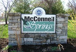
 McConnell Springs, entrance sign
Location: Lexington, Kentucky Coordinates: 38°3′19″N 84°31′40″W / 38.05528°N 84.52778°WCoordinates: 38°3′19″N 84°31′40″W / 38.05528°N 84.52778°W Governing body: Lexington-Fayette Urban County Government NRHP Reference#: 76000874 Added to NRHP: January 17, 1976[1] McConnell Springs is a twenty-six acre natural areas park located at the historic springs where the city of Lexington, Kentucky was named.[2]
McConnell Springs is historically and environmentally significant to this area. The central historic event which marks McConnell Springs place in history is the naming of Lexington. William McConnell and his party of kinsmen and companion surveyors, explorers and would-be settlers established a small camp in this area in June 1775. The group named their camp "Lexington" in honor of one of the first battles of the American Revolution in Lexington, Massachusetts. Four years later this name was adopted when founding their town. In the ensuing years the McConnell property changed hands several times with remnants of past use still visible throughout the park - including rock fences, a barn foundation, a small rock quarry, remains of an old dam and the foundation of an old creamery.
The most significant environmental feature is a complex system of sinking springs. McConnell Springs is the only known site in Fayette County that has a series of artesian springs that come to the surface, go underground, reappear, flow on the surface and go back underground only to surface again a couple miles away.
McConnell Springs has two miles of trails, with a half-mile paved loop which makes the park accessible to most visitors, as well as an education center.
References
- ^ "National Register Information System". National Register of Historic Places. National Park Service. 2008-04-06. http://nrhp.focus.nps.gov/natreg/docs/All_Data.html.
- ^ "McConnell Springs web site". McConnell Springs. Lexington-Fayette Urban County Government. 2008-04-06. http://www.mcconnellsprings.org/historynewsletter.html.
External links
U.S. National Register of Historic Places Topics Lists by states Alabama • Alaska • Arizona • Arkansas • California • Colorado • Connecticut • Delaware • Florida • Georgia • Hawaii • Idaho • Illinois • Indiana • Iowa • Kansas • Kentucky • Louisiana • Maine • Maryland • Massachusetts • Michigan • Minnesota • Mississippi • Missouri • Montana • Nebraska • Nevada • New Hampshire • New Jersey • New Mexico • New York • North Carolina • North Dakota • Ohio • Oklahoma • Oregon • Pennsylvania • Rhode Island • South Carolina • South Dakota • Tennessee • Texas • Utah • Vermont • Virginia • Washington • West Virginia • Wisconsin • WyomingLists by territories Lists by associated states Other  Category:National Register of Historic Places •
  Portal:National Register of Historic Places
:
Categories:- Parks in Lexington, Kentucky
- National Register of Historic Places in Lexington, Kentucky
- National Register of Historic Places in Kentucky
- Kentucky Registered Historic Place stubs
Wikimedia Foundation. 2010.

