- Gansbaai
-
Gansbaai — Town — Danger Point lighthouse near Gansbaai Location in the Western Cape
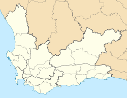
 Gansbaai
Coordinates: 34°34′58″S 19°21′8″E / 34.58278°S 19.35222°ECoordinates: 34°34′58″S 19°21′8″E / 34.58278°S 19.35222°E Country  South Africa
Province Western Cape District Overberg Municipality Overstrand Area[1] - Total 12.2 km2 (4.7 sq mi) Population (2001)[1] - Total 6,969 - Density 571.2/km2 (1,479.5/sq mi) Time zone SAST (UTC+2) Postal code 7220 Area code 028 Gansbaai (Afrikaans: "bay of geese," sometimes referred to as Gans Bay) is a fishing village and popular tourist destination in the Overberg District Municipality, Western Cape, South Africa. It is known for its dense population of Great White Sharks and as a whale-watching location.
The main tourist attraction in Gansbaai since approximately 1995 has been cage diving with Great White sharks. It is said[who?] that after Kruger National Park, the Great White sharks attract some of the highest number of tourist to South Africa for any singular activity.
Contents
History
Gansbaai at De Kelders has one of the oldest associations with man in the world. At the time when Neanderthal man was still the dominant species of genus Homo in Europe, a group of modern people (Homo sapiens sapiens) had already made Klipgat Cave their home. Remains have been excavated showing modern man living here more than 70,000 years ago.[citation needed] Klipgat Cave is located in the Walker Bay Nature Reserve, next to De Kelders, the residential shore area of Gansbaai. As one of only three places in South Africa where such old remains have been excavated, Klipgat Cave is one of the most important historical sites in the Western Cape. The reserve and the cave are open to the public.
The earliest evidence of the presence of sheep-herding Khoi people (after the hunter-gatherer-"San", the original indigenous population of the Western Cape) in the Western Cape has been found in Klipgat Cave as well. Until the arrival of the first white settlers at the end of the 18th century, the Khoi people thrived in this region. An expedition sent by Jan van Riebeeck to the area, described meeting people of the so-called Chainouqua-tribe near Baardskeerdersbos, a rural hamlet, 15 kilometres (9.3 mi) from Gansbaai. The river flowing through the Baardskeerdersbos Valley is still called "Boesmansrivier" (Afrikaans for Bushman's river). "Bushman" is a name commonly used the for San-people, but will in this case have reflected Khoi-people.
It was people of Khoi-descent that erected the first permanent settlement in the Gansbaai vicinity. In 1811 fishing-cottages were built at Stanfords Bay in De Kelders.
The first white settlers in the area were "trekboere" (nomadic farmers). They copied the Khoi herding techniques of using a grazing area until it was exhausted, then moving on to greener pastures. The area was big and fertile enough for such purposes. On many of the large farms around Gansbaai, the old and original homesteads and mudstone-houses tell of the days that the white farmers settled down.
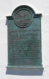 Plaque commemorating the sinking of the Birkenhead, affixed to the Danger Point lighthouse.
The troopship HMS Birkenhead was wrecked off Danger Point in 1852. A barely visible rock 2 kilometres (1.2 mi) from Danger Point (now aptly called "Birkenhead Rock") was fatal for the troopship carrying young Welsh and Scottish soldiers and their officers and family on their way to Eastern Cape to fight the Xhosa. The Birkenhead became famous because it was the first shipwreck where the "women and children first" protocol was applied. All women and children were saved; most of the men perished. Most of the horses swam ashore and were the ancestors of a feral herd that roamed the plains east of Gansbaai until late in the 20th century.
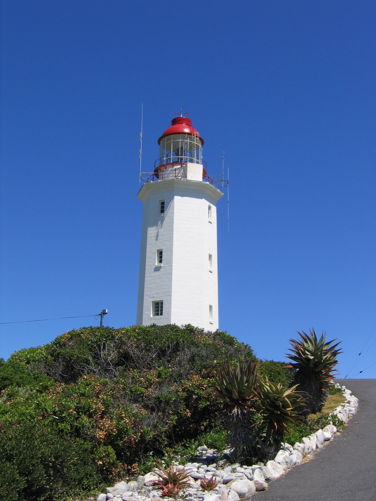
More than 140 ships have been wrecked and thousands of lives lost between Danger Point and Cape Infanta, to the east of Gansbaai. In 1895, the Danger Point Lighthouse was built, providing more security for the ships in these dangerous waters.
Gansbaai was founded in 1881 after 18-year-old fisherman Johannes Cornelis Wessels walked there across the dunes from Stanford and discovered excellent fishing in the area. He settled there, and soon after other families followed suit. Up until the late 20th century, however, it was little more than a primitive fishing village due to its isolation and lack of communication with the outside world.
Gansbaai's economy received an economic boost in 1939 when a small factory was built to process sharks' livers for Vitamin A and lubricant, which was in great demand during World War II. After the war, however, demand fell and the few short years of prosperity were over.
It wasn't until local school principal Johannes Barnard persuaded village fishermen to set up the first Fishery Cooperative in South Africa that the economy began to recover. Barnard helped the fishermen obtain capital from the Fisheries Development Corporation, deepen the harbour and establish a modern fish meal factory. The town became a municipality in 1963.
Today, Gansbaai's economy still revolves around its fishing industry, but an increasingly large part of it now comes from tourism. It is considered[who?] the Great White Shark capital of the world, drawing National Geographic Society film crews and researchers from around the globe to study the wildlife. It has also become a popular whale-watching spot for the Southern Right Whale.
The Southern Right Whale can be seen in large numbers, especially from the rocky shores of De Kelders on Walker Bay. This is also the site of an old whaling station. The lookout platform and the steps leading to it are still standing. Today whales are protected in South Afric and the descendants of the whalers are now the skippers on the boats that take tourists out for boat-based whale watching.
The hinterland is known for its vast mountainous landscapes covered with unspoilt vegetation of the Cape Floral Kingdom ('fynbos'). Despite being the smallest of the world's six floral kingdoms, the Cape Floral Kingdom, with 9000 species, is the richest.[citation needed]
Dyer Island, Geyser Rock and Shark Alley
The original name of Dyer Island was Ilha da Fera (Island of wild creatures), so named by Portuguese seafarers in the 15th century.
Dyer Island is the largest of a group of islands about 5 miles (8.0 km) offshore from Gansbaai and less than that from Danger Point peninsula. It is named after Samson Dyer, an emigrant from the USA to the Cape Colony in 1806, who lived on the island collecting guano, which he sold to mainlanders as fertilizer. The island is home to thousands of African Penguins.
Geyser Rock is a smaller island nearby, and is home to around 60,000 Cape Fur Seals.
The shallow channel between the two islands is popularly known as "Shark Alley".
Dyer Island is a nature reserve and cannot be accessed by the general public, but boat tours leave from Kleinbaai on Danger Point peninsula to watch whales, stop at a shark-diving-boat, to cross Shark-Alley and to go around Dyer Island.
Government
Gansbaai is located in the Overstrand Local Municipality, which falls within the Overberg District Municipality. The Overstrand council governs the southwestern coast of the Overberg, from Pringle Bay to Pearly Beach; its headquarters are in Hermanus but there is an office in Gansbaai.[2]
Demographics
In the 2001 census, the population of Gansbaai (including the adjacent township of Masakhane) was recorded as 6,969 people, living in an area of 12.2 square kilometres (4.7 sq mi), giving the town a population density of 572.9 inhabitants per square kilometre (1,484 /sq mi).[1] 35% of the inhabitants described themselves as "Coloured", 33% as "Black African", and 32% as "White". 65% spoke Afrikaans as their first language, 30% spoke Xhosa, 3% spoke English, and 2% spoke some other language.
See also
- List of shipwrecks in South Africa
- List of Islands of South Africa
References
- ^ a b c "Main Place 'Gansbaai'". Census 2001. http://census.adrianfrith.com/place/11207. Retrieved 1 April 2011. "Main Place 'Masakhane'". Census 2001. http://census.adrianfrith.com/place/11215. Retrieved 1 April 2011.
- ^ "Contact Us". Overstrand Municipality. http://new.overstrand.gov.za/index.php?option=com_content&task=blogsection&id=14&Itemid=242. Retrieved 7 January 2011.
External links

Cities and towns Arniston • Baardskeerdersbos • Barrydale • Betty's Bay • Birkenhead • Botrivier • Bredasdorp • Caledon • Dennehof • De Kelders • Elgin • Elim • Fisherhaven • Franskraalstrand • Gansbaai • Genadendal • Grabouw • Greyton • Hawston • Hermanus • Hotagterklip • Infanta • Kleinbaai • Kleinmond • L'Agulhas • Napier • Onrusrivier • Pearly Beach • Pringle Bay • Riviersonderend • Rooi-Els • Stanford • Struisbaai • Suiderstrand • Suurbraak • Swellendam • Van Dyksbaai • Vermont • Villiersdorp
Categories:- Populated places in the Overberg District Municipality


Wikimedia Foundation. 2010.