- De Kelders
-
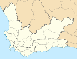
De Kelders — Town — Location in the Western Cape Coordinates: 34°34′S 19°21′E / 34.567°S 19.35°ECoordinates: 34°34′S 19°21′E / 34.567°S 19.35°E Country  South Africa
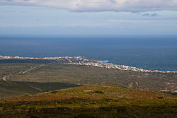
Province Western Cape District Overberg Municipality Overstrand Time zone South African Standard Time (UTC+2) Postal code 7220 Area code 028 De Kelders (Afrikaans: "the caves") is a coastal village in the Overberg District Municipality, Western Cape, South Africa.
Cities and towns Arniston • Baardskeerdersbos • Barrydale • Betty's Bay • Birkenhead • Botrivier • Bredasdorp • Caledon • Dennehof • De Kelders • Elgin • Elim • Fisherhaven • Franskraalstrand • Gansbaai • Genadendal • Grabouw • Greyton • Hawston • Hermanus • Hotagterklip • Infanta • Kleinbaai • Kleinmond • L'Agulhas • Napier • Onrusrivier • Pearly Beach • Pringle Bay • Riviersonderend • Rooi-Els • Stanford • Struisbaai • Suiderstrand • Suurbraak • Swellendam • Van Dyksbaai • Vermont • Villiersdorp
Categories:- Western Cape geography stubs
- Populated places in the Overberg District Municipality
Wikimedia Foundation. 2010.


