- Conneaut, Ohio
-
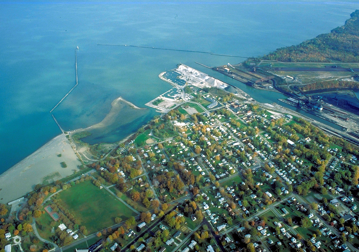
Conneaut, Ohio — City — Aerial view of the port at Conneaut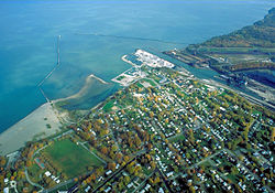 Location of Conneaut, Ohio
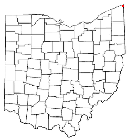
Coordinates: 41°57′N 80°34′W / 41.95°N 80.567°WCoordinates: 41°57′N 80°34′W / 41.95°N 80.567°W Country United States State Ohio County Ashtabula Settled 1799 Incorporated 1834 (village)
1902 (city)Government – City manager Area – Total 26.4 sq mi (68.5 km2) – Land 26.4 sq mi (68.3 km2) – Water 0.1 sq mi (0.1 km2) Elevation[1] 646 ft (197 m) Population (2000) – Total 12,335 – Density 473.4/sq mi (182.8/km2) Time zone Eastern (EST) (UTC-5) – Summer (DST) EDT (UTC-4) ZIP code 44030 Area code(s) 440 FIPS code 39-18350[2] GNIS feature ID 1077521[1] Website http://www.conneaut.net/ Conneaut (
 /ˈkɒni.ɔːt/)[3] is a city in Ashtabula County, Ohio, United States, along Lake Erie at the mouth of Conneaut Creek, which is the number one steelhead trout stream in the country. The population was 12,734 at the 2000 census.
Contents
History
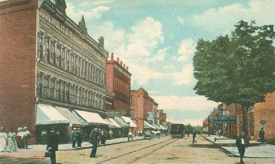
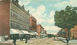 Main Street in 1909
The city of Conneaut is located on an old Native American trail, later used by early westbound pioneers. The word conneaut comes from the Seneca language, and has a disputed meaning.
A Mississauga village was located at or near Conneaut, c. 1747.[4]
Conneaut is located in the northeastern-most corner of Ohio, bordering the state of Pennsylvania to the east and has 27 square miles (70 km2) within its corporate city limits. The city has been operated under a council-manager government since 1992. The current city manager is Robert Schaumleffel, Jr. However, Robert Schaumleffel was fired in late 2010 for various reasons, including not consulting Council on some things he instigated. It is a mixture of urban areas and rural farmland. The city has over seven miles (11 km) of shoreline along Lake Erie, with beaches, boating facilities and a healthy summer tourist trade. Transportation services Conneaut via Interstate 90, which bisects the city, along with an international shipping port and three railroads. Major industries within the city include CSP of Ohio (formerly Venture Industries), General Aluminum (automotive parts), and CW Ohio (windows and pillars). The city's historic business district and its harbor business district are not as thriving as in the past.
 Industry related to the shipping of ores.
Conneaut was originally named "Salem", and the parts surrounding it were named "Lakeville" from 1944–1964, though these were eventually combined into what is now known as "Conneaut". People still refer to parts of Conneaut as Lakeville or Amboy.
Geography
Conneaut is located at 41°57′N 80°34′W / 41.95°N 80.567°W (41.9433, -80.5695)[5].
According to the United States Census Bureau, the city has a total area of 26.4 square miles (68 km2), of which, 26.4 square miles (68 km2) of it is land and 0.1 square miles (0.26 km2) of it (0.23%) is water. Conneaut is situated along Lake Erie at the mouth of Conneaut Creek.
Demographics
Historical populations Census Pop. %± 1840 2,642 — 1850 818 −69.0% 1860 1,952 138.6% 1870 1,163 −40.4% 1880 1,256 8.0% 1890 3,241 158.0% 1900 7,133 120.1% 1910 8,319 16.6% 1920 9,343 12.3% 1930 9,691 3.7% 1940 9,355 −3.5% 1950 10,230 9.4% 1960 10,567 3.3% 1970 14,552 37.7% 1980 13,839 −4.9% 1990 13,241 −4.3% 2000 12,485 −5.7% Est. 2008 12,355 −1.0% As of the census[2] of 2000, there were 12,485 people, 5,038 households, and 3,410 families residing in the city. The population density was 473.4 people per square mile (182.8/km²). There were 5,710 housing units at an average density of 216.5 per square mile (83.6/km²). The racial makeup of the city was 96.33% White, 1.12% African American, 0.18% Native American, 0.47% Asian, 0.05% Pacific Islander, 0.23% from other races, and 1.61% from two or more races. Hispanic or Latino of any race were 1.06% of the population. 19.7% were of German, 16.0% Italian, 13.7% English, 12.0% Irish, 6.2% American and 6.2% Finnish ancestry according to Census 2000.
 Conneaut lighthouse.
There were 5,038 households out of which 30.4% had children under the age of 18 living with them, 52.3% were married couples living together, 11.4% had a female householder with no husband present, and 32.3% were non-families. 27.9% of all households were made up of individuals and 13.5% had someone living alone who was 65 years of age or older. The average household size was 2.45 and the average family size was 2.98.
In the city the population was spread out with 25.2% under the age of 18, 7.7% from 18 to 24, 27.5% from 25 to 44, 22.4% from 45 to 64, and 17.2% who were 65 years of age or older. The median age was 38 years. For every 100 females there were 94.2 males. For every 100 females age 18 and over, there were 89.4 males.
The median income for a household in the city was $31,717, and the median income for a family was $37,955. Males had a median income of $31,964 versus $21,198 for females. The per capita income for the city was $14,703. About 10.7% of families and 13.0% of the population were below the poverty line, including 20.3% of those under age 18 and 9.1% of those age 65 or over.
Notable natives and residents
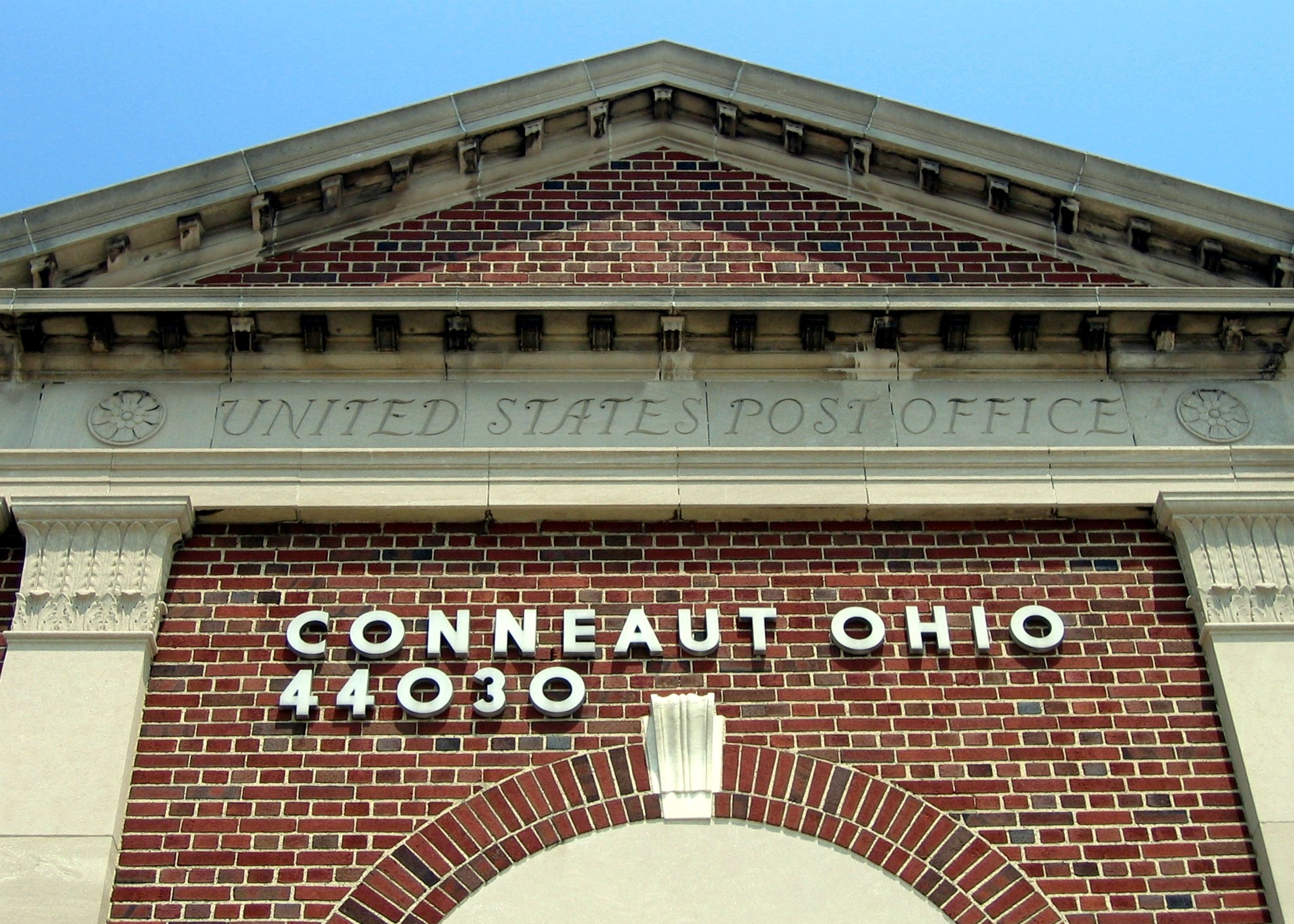
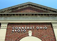 Conneaut Post Office
- Osee M. Hall, was a U.S. House Representative from Minnesota.
- Joseph Russell Jones, appointed by Ulysses S. Grant to Minister Resident to Belgium.
- Larry Kelley, American football player for Yale University, second winner of the Heisman Trophy
- Thomas R. Lyon, lumberman at Ludington, Michigan, and later Chicago, Illinois (1854–1909)
- John R. Pillion, Republican member of the United States House of Representatives from New York.
- George Morton Randall, United States Army general.
- Gordon I. Turner (1927–2006), Test Supervisor of Apollo 16[6]; retired from NASA in 1990.
- Trevor Vines, Professional motocross rider
Mildred Elizabeth Gillars "Axis Sally" Infamous for working for the radio propaganda department in Berlin during WWII.
References
Notes
- ^ a b "US Board on Geographic Names". United States Geological Survey. 2007-10-25. http://geonames.usgs.gov. Retrieved 2008-01-31.
- ^ a b "American FactFinder". United States Census Bureau. http://factfinder.census.gov. Retrieved 2008-01-31.
- ^ http://scrippsjschool.org/pronunciation/
- ^ Tanner, Helen Hornbeck; Adele Hast, Jacqueline Peterson, Robert J. Surtees, Miklos Pinther (1987). Atlas of Great Lakes Indian History. University of Oklahoma Press. p. 75. ISBN 0-8061-2056-8.
- ^ "US Gazetteer files: 2010, 2000, and 1990". United States Census Bureau. 2011-02-12. http://www.census.gov/geo/www/gazetteer/gazette.html. Retrieved 2011-04-23.
- ^ Apollo 16 Flight Journal: Day 1 Part One
Further reading
- Ashtabula County Genealogical Society. 1985. Ashtabula County history, then and now : a history of the people of the county. Dallas: Taylor Publishing.
- Biographical history of northeastern Ohio : embracing the counties of Ashtabula, Geauga and Lake. 1893. Chicago: Lewis Publishing.
- Borsvald, David. 2003. Railroading in Conneaut, Ohio. Images of Rail. Chicago: Arcadia Publishing. (ISBN 978-0738523460)
- Clark, Rev. Rufus. 1880. Early History of South Ridge. Published in the Conneaut Reporter starting c. 22 January 1880; Reprint, 1985, Ashtabula County Genealogical Society.
- Large, Moina M. 1924. History of Ashtabula County, Ohio. 2 vols. Indianapolis, IN: Historical Publishing Co.
- Owens, David B. 2010. Conneaut. Images of America. Charleston, SC: Arcadia Publishing. (ISBN 978-0738577319)
- Williams, William W. 1878. History of Ashtabula County, Ohio, with illustration and biographical sketches of its pioneers and most prominent men. Philadelphia: J.B. Lippincott. (Reprint, 1974, Ashtabula Geneaological Society; 1993, Higginson Book Company)
External links
- Conneaut's Official Government Website
- CityofConneaut.info
- Conneaut Public Library
- Conneaut Area Historical Society & Museum
- Everything Conneaut Ohio
- Andy Pochatko's History of Conneaut
- Sharon Wick's Conneaut, Ohio History & Genealogy
- Conneaut Tree Commission
Municipalities and communities of Ashtabula County, Ohio Cities 
Villages Townships Andover | Ashtabula | Austinburg | Cherry Valley | Colebrook | Denmark | Dorset | Geneva | Harpersfield | Hartsgrove | Jefferson | Kingsville | Lenox | Monroe | Morgan | New Lyme | Orwell | Pierpont | Plymouth | Richmond | Rome | Saybrook | Sheffield | Trumbull | Wayne | Williamsfield | Windsor
CDP Unincorporated
communitiesAustinburg | Dorset | Footville | Kingsville | Pierpont | Unionville | Williamsfield | Windsor
Categories:- Cities in Ohio
- Populated places in Ashtabula County, Ohio


Wikimedia Foundation. 2010.