- Morphou
-
Morphou Μόρφου (Greek) Güzelyurt/Omorfo (Turkish)  Morphou in Cyprus.
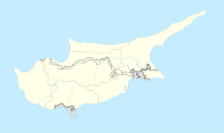
 Morphou
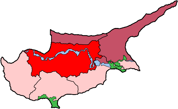
Coordinates: 35°12′0″N 32°59′0″E / 35.2°N 32.983333°E Country De jure  Cyprus
De facto Northern Cyprus
District De jure Nicosia District
De facto Güzelyurt DistrictPopulation - Total 12,000 (aprox) Time zone EET Morphou (Greek: Μόρφου (Morfou), Turkish: Omorfo/Güzelyurt) is a town in Cyprus. It is in the area controlled by the Turkish Republic of Northern Cyprus and the capital of the Güzelyurt District. Morphou was founded by Spartans who brought with them the worship of Aphrodite. In the Middle Ages, the city was referred to as Morphou but also Theomorphou.[1] The Morphou area grew more than half of Cyprus citrus fruits.
It contains one of the many churches in the country dedicated to St. Mamas, popularly believed to have lived as a hermit in a cave near Morphou. According to local legend, he was a hermit living in very poor circumstances and when the authorities tried to tax him, he evaded them. Soldiers were sent out and captured him but on the way back to town, he saw a lion attacking a lamb, escaped the soldiers, saved the lamb, jumped on the lion's back and in that way came to town. His bravery earned him exemption from tax, hence his traditional attribute.[2][3]
Morphou was an almost entirely Greek Cypriot community. According to the 1960 population census it was inhabited by 6480 Greeks Cypriots, 123 Turkish Cypriots and 32 Maronites. [4] Between 1907 and 1948, Morphou was one of the prominent stations of the Cyprus Government Railway.
Morphou was taken by the Turkish military during the Turkish Invasion in 1974. As a result, the whole of its Greek Cypriot population was forced to leave their homes and properties and flee to the areas under the control of the Republic of Cyprus.[5]
Contents
North-South crossing
Morphou is home to one of the islands crossing points, which was opened to civilian use in 2003. It is located at Zodeia to the southeast of the town.
The crossing is used by vehicles, and passport/Id checks are done at both sides when crossing. The road goes through the U.N buffer zone, before entering the opposite side of the border, which was set up to prevent any further attacks between the two communities.
Modern era
With a population of 12,000 people, the town is famous for its apples, vegetables, grapefruit and melons for which a large proportion of the citrus fruits are exported and the remainder are turned into fruit juice and canned for local consumption and export. Morphou is also famous for its annual Orange Festival, which is a major event lasting two weeks.
The church is an icon museum now.
Climate
Morphou has a borderline Mediterranean climate/semi-arid climate as the rest of the island where summers are hot and dry, and winters are cool and wet.
Climate data for Morphou Month Jan Feb Mar Apr May Jun Jul Aug Sep Oct Nov Dec Year Average high °C (°F) 16
(61)16
(61)17
(63)21
(70)26
(79)28
(82)31
(88)32
(90)30
(86)26
(79)22
(72)18
(64)23.6
(74.4)Average low °C (°F) 7
(45)7
(45)8
(46)11
(52)15
(59)19
(66)21
(70)22
(72)19
(66)15
(59)12
(54)9
(48)13.8
(56.8)Precipitation mm (inches) 73.6
(2.898)60.9
(2.398)60.9
(2.398)17.7
(0.697)10.2
(0.402)0.0
(0)0.0
(0)0.0
(0)5.1
(0.201)27.9
(1.098)38.1
(1.5)109.2
(4.299)403.6
(15.89)% humidity 72 70 69 73 70 70 69 69 70 69 72 73 70.5 Avg. rainy days 6 5 4 2 1 0 0 0 1 2 3 8 32 Source: Weatherbase [6] Gallery
-
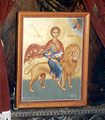
St Mamas, the lamb and the lion: altar painting in the church at Morphou
References
- ^ "Morphou". kypros.org. http://kypros.org/Occupied_Cyprus/morphou/morphou.html. Retrieved 2010-12-29.
- ^ "Saint Mamas". nostos.com. http://www.nostos.com/church/Mamas.htm. Retrieved 2010-12-29.
- ^ "St. Mamas Monastery". Northern Cyprus.cc. http://northerncyprus.cc/default.asp?iID=LIDFJ. Retrieved 2010-12-29.
- ^ "1960 Census". peace.org. http://www.peace-cyprus.org/VillagersMeeting/mixedvillagepop.pdf. Retrieved 2011-10-05.
- ^ "Morphou". kypros.org. http://kypros.org/Occupied_Cyprus/morphou/. Retrieved 2010-12-29.
- ^ http://www.weatherbase.com/weather/weatherall.php3?s=110541&refer=&units=us&cityname=Morphou-Cyprus
External links
Settlements Agia · Agia Eirini · Agia Marina · Agia Marina (Gürpınar) · Agia Varvara · Agioi Trimithias · Agios Dometios · Agios Epifanios · Agios Georgios · Agios Georgios Lefkas · Agios Ioannis (Pyrgos) · Agios Ioannis Malountas · Agios Nikolaos Lefkas · Agios Sozomenos · Agios Theodoros · Agios Vasileios · Aglantzia · Agrokipia · Agroladou · Akaki · Alampra · Alevga · Alithinou · Alona · Ampelikou· Analiontas · Anageia · Angolemi · Apliki · Arediou · Argaki · Askas · Astromeritis · Avlona · · Beikioi · Challeri · Chrysida · Chrysiliou · Dali · Deneia · Dyo Potamoi · Elia · Engomi · Epicho · Episkopeio · Ergates · Evrychou · Exometochi · Farmakas · Fikardou · Filani · Frodisia · Fterikoudi · Fyllia · Galata · Galini · Gerakies · Geri · Gerolakkos · Gourri · Kaimakli · Kakopetria · Kaliana · Kalo Chorio · Kalo Chorio (Çamlıköy) · Kalopanagiotis · Kalyvakia · Kampi · Kampia · Kampos · Kapouti · Kanli · Kannavia · Kapedes · Kapoura · Karavostasi · Kataliontas · Kato Deftera · Kato Flasou · Katokopia · Kato Koutrafas · Kato Lakatamia · Kato Moni · Kato Pyrgos · Kato Zodeia · Katydata · Kazivera · Kioneli · Klirou · Kokkina · Kokkinotrimithia · Korakou · Kotsiatis · Kourou Monastiri · Kyra · Kythrea · Lagoudera · Latsia · Lazanias · Lefka · Limnitis · Linou · Livadia · Louroujina · Loutros · Lympia · Lythrodontas · Malounta · Mammari · Mandres · Mansoura · Margi · Masari · Mathiatis · Meniko · Mia Milia · Mylikouri · Mitsero · Mora · Morphou · Mosfileri · Moutoullas · Neo Chorio · Nicosia · Nikitari · Nikitas · Nisou · Oikos · Orounta · Ortakioi · Pachyammos · Palaichori · Palaikythro · Palaiometocho · Pano Deftera · Pano Flasou · Pano Koutrafas · Pano Lakatamia · Pano Pyrgos · Pano Zodeia · Pedoulas · Pentageia · Pera · Pera Chorio · Peristerona · Peristeronari · Petra · Petra tou Digeni · Pigenia · Platanistasa · Politiko · Polystypos · Potami · Potamia · Potamos tou Kampou · Prastio · Psimolofou · Pyrogi · Saranti · Selladi tou Appi · Selemani · Sia · Sinaoros · Skouriotissa · Skylloura · Spilia · Strovolos · Syrianochori · Temvria · Trachoni · Trachonas · Tsakistra · Tseri · Tymvou · Variseia · Voni · Vyzakia · Xerovounos · Xyliatos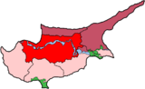
Municipalities of Cyprus Nicosia District 
Limassol District Ayios Athanasios • Kato Polemidhia • Limassol • Mesa Yitonia • YermasoyiaLarnaca District Famagusta District Paphos District Kyrenia District Categories:- Populated places in Northern Cyprus
-


Wikimedia Foundation. 2010.