- Limnitis
-
Limnitis Λιμνίτης (Greek) Yeşilırmak (Turkish) Location in Cyprus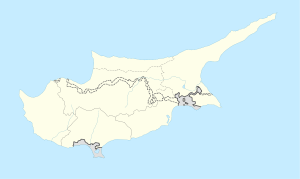
 Limnitis
Coordinates: 35°10′2″N 32°44′17″E / 35.16722°N 32.73806°ECoordinates: 35°10′2″N 32°44′17″E / 35.16722°N 32.73806°E Country  Cyprus
District Nicosia District Municipality Population [1] – Total 429 Time zone EET (UTC+2) – Summer (DST) EEST (UTC+3) Limnitis (Greek: Λιμνίτης, Turkish: Yeşilırmak) is a village in the Tilliria region in Nicosia District, North Western Cyprus. The ancient Vouni Palace was located nearby. It is a small village located on the shores of the Morphou Bay. The upper parts of the village are located 20 metres above sea level but settlement extends all the way down to the sea.
Contents
History
The village is located on the North Western slopes of the Troodos Mountains. The region shows clear signs of early settlement; the ruins of Vouni Palace are located nearby, and the ruins of the city of Soli are located a little further to the East.
Modern settlement in the area began in the early 19th century. Two families settled here; the Osman family settled in Xerovounos (Turkish: Kurutepe) and the Süleyman family settled in Selemani (Turkish: Süleymaniye).
Annan Plan
The Annan Peace Plan for Cyprus called for the transfer of this region to a new "Greek Cypriot Constituent State" in a new Cypriot (con)-federation, while allowing the original inhabitants to retain their homes. This plan was later rejected by a majority of the Greek Cypriot population, and the area remains under the de facto control of the Turkish occupational forces.
Population
The size of the original population of the village seems to be disputed. According to figures of the Cypriot Government, the 1960 population was 323 (315 Turks and 8 Greeks) and in 1973, the population was estimated at 396, all Turks. (Source:[1], click on "Sources".) Turkish sources say that the town had swelled to about 1,200 people by 1968. The number is now down to about 80 people. Turkish sources estimate that around 2,000 people originating in the town now live in United Kingdom and a further 1,500 live in Australia.
The population was recorded as 429 in the 2006 TRNC Population Census (Source: The Final Results of TRNC General Population and Housing Unit Census, I and II stage results, amended 10 September 2007, [2].
The People
The people are farmers. Growing fruit and vegetables and selling them at markets provide their main source of income. The village is known for its strawberries.
External links
References
Categories:- Populated places in Nicosia District
- Populated places in Northern Cyprus
- Mediterranean port cities and towns in Northern Cyprus

Wikimedia Foundation. 2010.