- Zodeia
-
Zodeia Ζώδεια (Greek) Bostancı (Turkish) 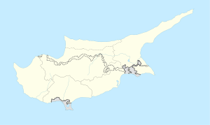
 Zodeia
Coordinates: 35°10′0″N 33°0′0″E / 35.166667°N 33°E  Cyprus
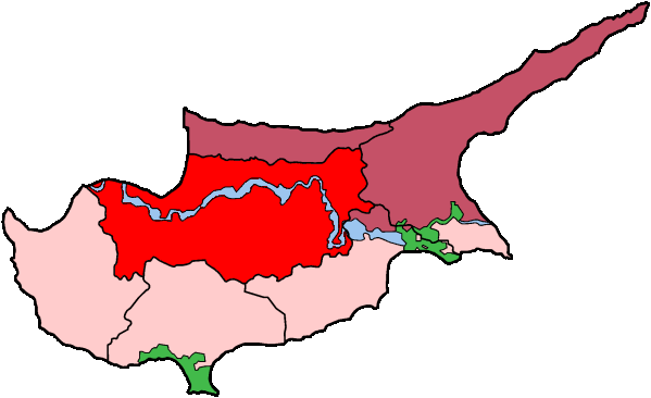
District Nicosia District Time zone EET (UTC+2) – Summer (DST) EEST (UTC+3) Zodeia (Greek: Ζώδεια, Turkish: Bostancı Latin spellings include Zodia and Zodhia) is a village on the island of Cyprus. It is located east of Morphou in Nicosia District. It is in the northern part of the island which has been occupied by Turkey since August 15, 1974. At the time of the invasion, the population of the village was around 8000.
Green Line crossing
Zodeia is the location of one of six crossings across the Green Line and the UN buffer zone between the Republic of Cyprus and the TRNC. The town on the Republic side of the border is Astromeritis. The crossing is only for vehicular traffic.
The crossing was opened on 31 August 2005.
External links
Coordinates: 35°10′N 33°00′E / 35.167°N 33°E
Settlements Agia · Agia Eirini · Agia Marina · Agia Marina (Gürpınar) · Agia Varvara · Agioi Trimithias · Agios Dometios · Agios Epifanios · Agios Georgios · Agios Georgios Lefkas · Agios Ioannis (Pyrgos) · Agios Ioannis Malountas · Agios Nikolaos Lefkas · Agios Sozomenos · Agios Theodoros · Agios Vasileios · Aglantzia · Agrokipia · Agroladou · Akaki · Alampra · Alevga · Alithinou · Alona · Ampelikou· Analiontas · Anageia · Angolemi · Apliki · Arediou · Argaki · Askas · Astromeritis · Avlona · · Beikioi · Challeri · Chrysida · Chrysiliou · Dali · Deneia · Dyo Potamoi · Elia · Engomi · Epicho · Episkopeio · Ergates · Evrychou · Exometochi · Farmakas · Fikardou · Filani · Frodisia · Fterikoudi · Fyllia · Galata · Galini · Gerakies · Geri · Gerolakkos · Gourri · Kaimakli · Kakopetria · Kaliana · Kalo Chorio · Kalo Chorio (Çamlıköy) · Kalopanagiotis · Kalyvakia · Kampi · Kampia · Kampos · Kapouti · Kanli · Kannavia · Kapedes · Kapoura · Karavostasi · Kataliontas · Kato Deftera · Kato Flasou · Katokopia · Kato Koutrafas · Kato Lakatamia · Kato Moni · Kato Pyrgos · Kato Zodeia · Katydata · Kazivera · Kioneli · Klirou · Kokkina · Kokkinotrimithia · Korakou · Kotsiatis · Kourou Monastiri · Kyra · Kythrea · Lagoudera · Latsia · Lazanias · Lefka · Limnitis · Linou · Livadia · Louroujina · Loutros · Lympia · Lythrodontas · Malounta · Mammari · Mandres · Mansoura · Margi · Masari · Mathiatis · Meniko · Mia Milia · Mylikouri · Mitsero · Mora · Morphou · Mosfileri · Moutoullas · Neo Chorio · Nicosia · Nikitari · Nikitas · Nisou · Oikos · Orounta · Ortakioi · Pachyammos · Palaichori · Palaikythro · Palaiometocho · Pano Deftera · Pano Flasou · Pano Koutrafas · Pano Lakatamia · Pano Pyrgos · Pano Zodeia · Pedoulas · Pentageia · Pera · Pera Chorio · Peristerona · Peristeronari · Petra · Petra tou Digeni · Pigenia · Platanistasa · Politiko · Polystypos · Potami · Potamia · Potamos tou Kampou · Prastio · Psimolofou · Pyrogi · Saranti · Selladi tou Appi · Selemani · Sia · Sinaoros · Skouriotissa · Skylloura · Spilia · Strovolos · Syrianochori · Temvria · Trachoni · Trachonas · Tsakistra · Tseri · Tymvou · Variseia · Voni · Vyzakia · Xerovounos · Xyliatos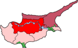 Categories:
- Populated places in Northern Cyprus
- Border crossings of Cyprus
- Greek Cypriot villages depopulated during the 1974 Turkish invasion of Cyprus
- Cyprus geography stubs

Wikimedia Foundation. 2010.