- Mathiatis
-
Mathiatis Μαθιάτης (Greek) Matyat (Turkish) Location in Cyprus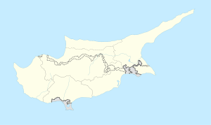
 Mathiatis
Coordinates: 34°57′46″N 33°20′10″E / 34.96278°N 33.33611°ECoordinates: 34°57′46″N 33°20′10″E / 34.96278°N 33.33611°E Country  Cyprus
District Nicosia District Municipality Population (2001)[1] - Total 581 Time zone EET (UTC+2) - Summer (DST) EEST (UTC+3) Mathiatis (Greek: Μαθιάτης, Turkish: Matiyat) is village located in the Nicosia District of Cyprus. Before 1960 the village had a mixed Greek and Turkish Cypriot population. [2]
References
Settlements Agia · Agia Eirini · Agia Marina · Agia Marina (Gürpınar) · Agia Varvara · Agioi Trimithias · Agios Dometios · Agios Epifanios · Agios Georgios · Agios Georgios Lefkas · Agios Ioannis (Pyrgos) · Agios Ioannis Malountas · Agios Nikolaos Lefkas · Agios Sozomenos · Agios Theodoros · Agios Vasileios · Aglantzia · Agrokipia · Agroladou · Akaki · Alampra · Alevga · Alithinou · Alona · Ampelikou· Analiontas · Anageia · Angolemi · Apliki · Arediou · Argaki · Askas · Astromeritis · Avlona · · Beikioi · Challeri · Chrysida · Chrysiliou · Dali · Deneia · Dyo Potamoi · Elia · Engomi · Epicho · Episkopeio · Ergates · Evrychou · Exometochi · Farmakas · Fikardou · Filani · Frodisia · Fterikoudi · Fyllia · Galata · Galini · Gerakies · Geri · Gerolakkos · Gourri · Kaimakli · Kakopetria · Kaliana · Kalo Chorio · Kalo Chorio (Çamlıköy) · Kalopanagiotis · Kalyvakia · Kampi · Kampia · Kampos · Kapouti · Kanli · Kannavia · Kapedes · Kapoura · Karavostasi · Kataliontas · Kato Deftera · Kato Flasou · Katokopia · Kato Koutrafas · Kato Lakatamia · Kato Moni · Kato Pyrgos · Kato Zodeia · Katydata · Kazivera · Kioneli · Klirou · Kokkina · Kokkinotrimithia · Korakou · Kotsiatis · Kourou Monastiri · Kyra · Kythrea · Lagoudera · Latsia · Lazanias · Lefka · Limnitis · Linou · Livadia · Louroujina · Loutros · Lympia · Lythrodontas · Malounta · Mammari · Mandres · Mansoura · Margi · Masari · Mathiatis · Meniko · Mia Milia · Mylikouri · Mitsero · Mora · Morphou · Mosfileri · Moutoullas · Neo Chorio · Nicosia · Nikitari · Nikitas · Nisou · Oikos · Orounta · Ortakioi · Pachyammos · Palaichori · Palaikythro · Palaiometocho · Pano Deftera · Pano Flasou · Pano Koutrafas · Pano Lakatamia · Pano Pyrgos · Pano Zodeia · Pedoulas · Pentageia · Pera · Pera Chorio · Peristerona · Peristeronari · Petra · Petra tou Digeni · Pigenia · Platanistasa · Politiko · Polystypos · Potami · Potamia · Potamos tou Kampou · Prastio · Psimolofou · Pyrogi · Saranti · Selladi tou Appi · Selemani · Sia · Sinaoros · Skouriotissa · Skylloura · Spilia · Strovolos · Syrianochori · Temvria · Trachoni · Trachonas · Tsakistra · Tseri · Tymvou · Variseia · Voni · Vyzakia · Xerovounos · Xyliatos Categories:
- Cyprus geography stubs
- Populated places in Nicosia District

Wikimedia Foundation. 2010.