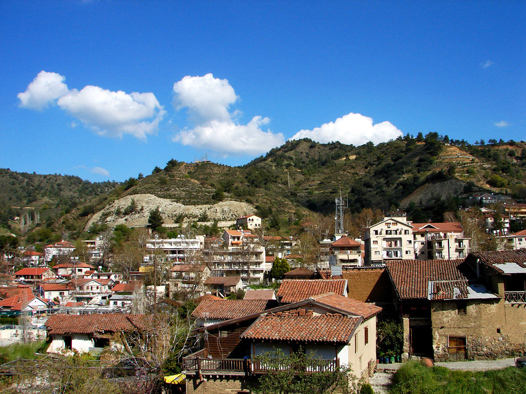
Kakopetria

Kakopetria

Infobox Settlement


subdivision_type=Country
subdivision_name=Cyprus
subdivision_type1=District
leader_title=Mayor

timezone=EET
utc_offset=+2
timezone_DST=EEST
utc_offset_DST=+3

postal_code_type=Postal code

official_name = Kakopetria
native_name = Κακοπετριά


img_coa_

shield_size = 210px
subdivision_name1 = Nicosia District
population_total = 1198
population_as_of = 2001 ["Statistical Service of the Republic of Cyprus", 2001 Population Census, MS Excel document [http://www.mof.gov.cy/mof/cystat/statistics.nsf/All/A5E0A9096615A568C2257122003FB72E/$file/POPULATION%20BY%20MUNICIPALITY_COMMUNITY-EN.xls?OpenElement] ]

elevation_m = 667
latd = 34
latm = 59
latNS = N
longd = 32
longm = 54
longEW = E
postal_code = 2800
leader_name = Dimitrakis Evgeniou (Δημητράκης Ευγενίου)
website = http://www.kakopetria.org.cy/

Kakopetria is a village in Cyprus located 55 kilometers southwest of the capital, Nicosia, on the north facing foothills of the Troodos Mountains. It stands at an altitude of 667 metres and it is the highest village in the Solea Valley. The community has about 1,200 permanent inhabitants and more people in the summer months when locals flock to the mountains to avoid the hot weather of the plains. It is surrounded by thick forestland and is built on the banks of the Kargotis and Garillis Rivers. The two rivers join within village itself and form the river Klarios, which crosses the Solea Valley and empties into Morfou Bay.

References


Wikimedia Foundation. 2010.

Игры ⚽ Нужен реферат?

Look at other dictionaries:

  • Kakopetria — Original name in latin Kakopetria Name in other language Kakopetria, Kakopetriya State code CY Continent/City Asia/Nicosia longitude 34.99167 latitude 32.90417 altitude 641 Population 1255 Date 2012 01 17 …   Cities with a population over 1000 database

  • Églises peintes de Troodos — Églises peintes de la région de Troodos * Patri …   Wikipédia en Français

  • Troodos-Gebirge — p1p5 Troodos Gebirge Das Troodos Gebirge mit dem Olymp Höchster Gipfel Olympos (1 …   Deutsch Wikipedia

  • Iglesias pintadas de la región de Troodos — Nombre descrito en la Lista del Patrimonio de la Humanida …   Wikipedia Español

  • Troodos — Iglesias pintadas de la región de Troodos Nombre descrito en la Lista del Patrimonio de la Humanida …   Wikipedia Español

  • Nicosia — Λευκωσία (Greek) Lefkoşa (Turkish) …   Wikipedia

  • Morphou — Μόρφου (Greek) Güzelyurt/Omorfo (Turkish) …   Wikipedia

  • List of cities, towns and villages in Cyprus — Map of Cyprus Nicosia, Capital of …   Wikipedia

  • Troodos Mountains — Infobox World Heritage Site WHS = Painted Churches in the Troodos Region State Party = CYP Type = Cultural Criteria = ii, iii, iv ID = 351 Region = Europe and North America Year = 1985 Session = 9th Extension = 2001 Link =… …   Wikipedia

  • Nicosia District — For the district of Northern Cyprus, see Lefkoşa District. Map of Cyprus showing Nicosia district (bright red) …   Wikipedia

Share the article and excerpts

Direct link
Do a right-click on the link above
and select “Copy Link”