- Mays Landing, New Jersey
-
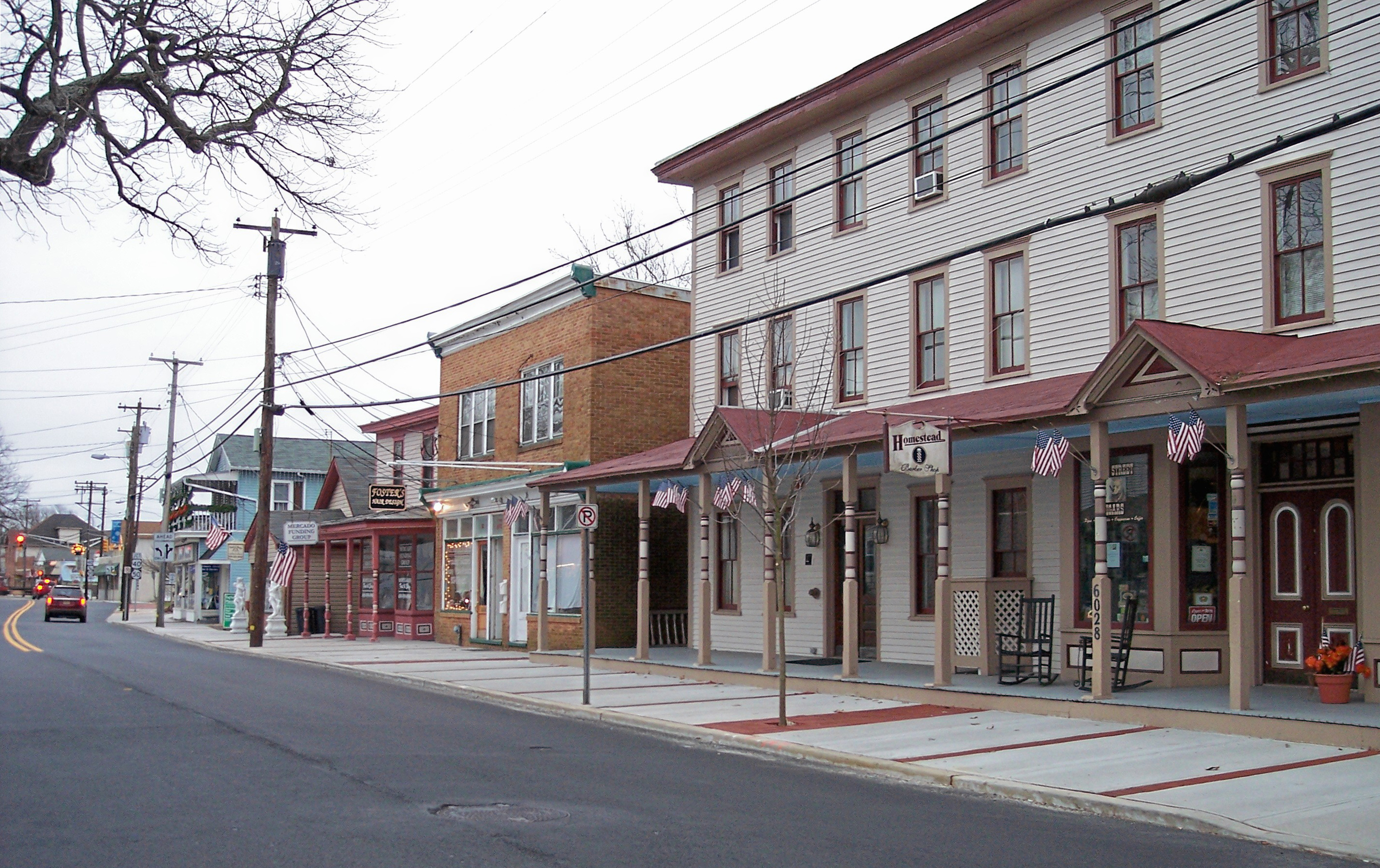
Mays Landing, New Jersey — CDP — Main Street in Mays Landing in 2006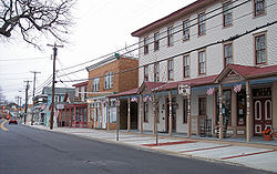 Map of Mays Landing CDP in Atlantic County
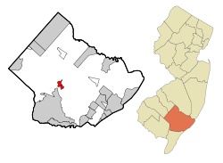 Census Bureau map of Mays Landing, New Jersey
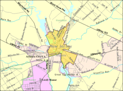
Coordinates: 39°27′22″N 74°43′37″W / 39.45611°N 74.72694°WCoordinates: 39°27′22″N 74°43′37″W / 39.45611°N 74.72694°W Country United States State New Jersey County Atlantic Area - Total 1.9 sq mi (5.0 km2) - Land 1.7 sq mi (4.4 km2) - Water 0.2 sq mi (0.6 km2) Elevation 16 ft (5 m) Population (2000) - Total 2,321 - Density 1,362.8/sq mi (526.2/km2) Time zone Eastern (EST) (UTC-5) - Summer (DST) EDT (UTC-4) ZIP code 08330 Area code(s) 609 FIPS code 34-44820[1] GNIS feature ID 0878206[2] Mays Landing is a census-designated place located within Hamilton Township, in Atlantic County, New Jersey. As of the United States 2000 Census, the CDP population was 2,321. It is the county seat of Atlantic County[3]. The community was named for Captain George May, who sailed the Great Egg Harbor River in 1740, and purchased land in the area in 1756.[4]
Contents
Geography
According to the United States Census Bureau, the CDP has a total area of 5.0 km2 (1.9 mi²). 4.4 km2 (1.7 mi2) of it is land and 0.5 km2 (0.2 mi2) of it (10.94%) is water.
Demographics
Historical populations Census Pop. %± 1990 2,090 — 2000 2,321 11.1% source: [5] As of the census[1] of 2000, there were 2,321 people, 892 households, and 599 families residing in the CDP. The population density was 527.1/km2 (1,362.8/mi2). There were 952 housing units at an average density of 216.2/km2 (559.0/mi2). The racial makeup of the CDP was 91.25% White, 5.00% African American, 0.09% Native American, 0.73% Asian, 0.22% Pacific Islander, 0.78% from other races, and 1.94% from two or more races. Hispanic or Latino of any race were 3.96% of the population. The town known as Mizpah is also part of Mays Landing with a zip code of 08330 and 08342. Mizpah is separate from Toward, Weymouth, and Buena. McKee City is an unincorporated area within Mays Landing.
There were 892 households out of which 33.9% had children under the age of 18 living with them, 49.2% were married couples living together, 14.5% had a female householder with no husband present, and 32.8% were non-families. 27.4% of all households were made up of individuals and 10.3% had someone living alone who was 65 years of age or older. The average household size was 2.55 and the average family size was 3.12.
In the CDP the population was spread out with 25.4% under the age of 18, 7.2% from 18 to 24, 30.9% from 25 to 44, 23.1% from 45 to 64, and 13.4% who were 65 years of age or older. The median age was 37 years. For every 100 females there were 93.1 males. For every 100 females age 18 and over, there were 88.3 males.
The median income for a household in the CDP was $52,628, and the median income for a family was $60,000. Males had a median income of $41,432 versus $30,154 for females. The per capita income for the CDP was $23,477. About 4.9% of families and 6.8% of the population were below the poverty line, including 14.1% of those under age 18 and 3.0% of those age 65 or over.
Education
Saint Vincent de Paul Regional School is a Catholic elementary school, operated under the jurisdiction of the Diocese of Camden. There is also the William Davies Middle School, George L. Hess Educational complex, and the Shanner School, all of which are in the same district. Mays Landing is also the home of Oakcrest High School and Atlantic County Institute of Technology. Rutgers, The State University of New Jersey has a partnership with Atlantic Cape Community College in Mays Landing.
Notable residents
Notable current and former residents of Mays Landing include:
- Suzette Charles (1963-), singer and entertainer, who became Miss America 1984.[6]
- Darren Drozdov, former wrestler for WWE and NFL player for the Denver Broncos.[7]
- Sharon Kay Penman, novelist of historical fiction and medieval mystery.
- William Moore (1810-1878), served in the United States House of Representatives, where he represented New Jersey's 1st congressional district from 1867 to 1871.[8]
- Graciela Rivera, first Puerto Rican to sing a lead role at the Metropolitan Opera in New York.
- Cory Bird, played for the Indianapolis Colts
See also
References
- ^ a b "American FactFinder". United States Census Bureau. http://factfinder.census.gov. Retrieved 2008-01-31.
- ^ "US Board on Geographic Names". United States Geological Survey. 2007-10-25. http://geonames.usgs.gov. Retrieved 2008-01-31.
- ^ "Find a County". National Association of Counties. http://www.naco.org/Counties/Pages/FindACounty.aspx. Retrieved 2011-06-07.
- ^ Mays Landing History. Accessed August 10, 2007. "1740 - Captain George May, an agent for the London Company, sailed up the Great Egg Harbor River and found an area rich in oak and pine which was perfect for shipbuilding. 1756 - Captain May bought land near Babcock Creek and later established a trading post and shipyard."
- ^ "Population Finder: Mays Landing CDP, New Jersey". U.S. Census Bureau. http://factfinder.census.gov/servlet/SAFFPopulation?_event=Search&geo_id=16000US3444100&_geoContext=01000US%7C04000US34%7C16000US3444100&_street=&_county=Mays+Landing&_cityTown=Mays+Landing&_state=04000US34&_zip=&_lang=en&_sse=on&ActiveGeoDiv=geoSelect&_useEV=&pctxt=fph&pgsl=160&_submenuId=population_0&ds_name=null&_ci_nbr=null&qr_name=null®=null%3Anull&_keyword=&_industry=. Retrieved 2007-03-19.
- ^ Chira, Susan. "TO FIRST BLACK MISS AMERICA, VICTORY IS A MEANS TO AN END", The New York Times, September 19, 1983. Accessed December 4, 2007. "Her home is in Mays Landing, 15 miles (24 km) west of Atlantic City, the site of the contest."
- ^ "Wrestler 'The Droz' hurt in match", Associated Press Archive, October 6, 1999. Accessed June 22, 2007. "Professional wrestler Darren Drozdov was undergoing surgery today, after fracturing his neck during a match at Nassau Coliseum. Drozdov, aka "The Droz," was wrestling D'Lo Brown Tuesday night when the accident occurred. Drozdov, 30, of Mays Landing, N.J., was taken by ambulance to the Nassau County Medical Center in serious condition."
- ^ William Moore, Biographical Directory of the United States Congress. Accessed August 24, 2007.
External links
Municipalities and communities of Atlantic County, New Jersey County seat: Mays Landing Cities 
Boroughs Town Townships Buena Vista | Egg Harbor | Galloway | Hamilton | Mullica | Weymouth
CDPs Collings Lakes | Elwood-Magnolia | Mays Landing | Pomona
Communities Dorothy | Elwood | Landisville | McKee City | Mizpah | Richland | Smithville | Sweetwater
National Register of Historic Places in Atlantic County, New Jersey Historic districts Bay Front Historic District | Bethlehem Loading Company Mays Landing Plant Archeological Historic District | Estellville Glassworks Historic District | Linwood Historic District | Marven Gardens Historic District | Mays Landing Historic District | Port Republic Historic District | John Stafford Historic District

Other properties Absecon Light | Atlantic City Convention Hall | Capt. Francis Babcock House | Barclay Court | Belcoville Post Office | William L. Black House | Amanda Blake Store | Church of the Ascension | Church of the Redeemer | John Doughty House | Egg Harbor Commercial Bank | Great Egg Coast Guard Station | Head of the River Church | Holmhurst Hotel | Jacobus Evangelical Lutheran Church | Capt. John Jeffries Burial Marker | Linwood Borough School No. 1 | Lucy the Elephant | Madison Hotel | Mays Landing Presbyterian Church | Morton Hotel | Neutral Water Health Resort Sanitarium | Dr. Jonathan Pitney House | Pleasant Mills | Samuel Richards Hotel | Jeremiah II or Edward Risley House | Santa Rita Apartments | Segal Building | Shelburne Hotel | Smithville Apothecary | Somers Mansion | St. Nicholas of Tolentine Church | Ventnor City Hall | Weymouth | Weymouth Road Bridge | World War I Memorial
See also: National Register of Historic Places listings in Atlantic County, New Jersey and List of National Historic Landmarks in New Jersey Categories:- Populated places in Atlantic County, New Jersey
- Census-designated places in New Jersey
- County seats in New Jersey


Wikimedia Foundation. 2010.