- Brigantine, New Jersey
Infobox Settlement
official_name = Brigantine, New Jersey
settlement_type = City
nickname =
motto =
imagesize =
image_caption =
image_
imagesize =
image_caption =
image_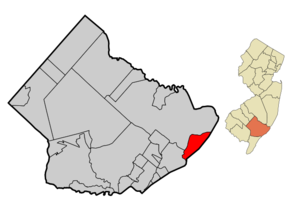
mapsize = 250x200px
map_caption = Map of Brigantine in Atlantic County
mapsize1 = 250x200px
map_caption1 = Census Bureau map of Brigantine, New Jerseysubdivision_type = Country
subdivision_name =United States
subdivision_type1 = State
subdivision_name1 =New Jersey
subdivision_type2 = County
subdivision_name2 = Atlantic
government_footnotes =
government_type =Faulkner Act (Council-Manager)
leader_title =Mayor
leader_name = Philip J. Guenther
leader_title1 = Manager
leader_name1 = James Barber
established_title = Incorporated
established_date =June 14 ,1890 unit_pref = Imperial
area_footnotes =area_magnitude =
area_total_km2 = 25.3
area_land_km2 = 16.7
area_water_km2 = 8.7
area_total_sq_mi = 9.8
area_land_sq_mi = 6.4
area_water_sq_mi = 3.4population_as_of = 2007
population_footnotes =
population_total = 12739
population_density_km2 = 756.4
population_density_sq_mi = 1959.0timezone = Eastern (EST)
utc_offset = -5
timezone_DST = EDT
utc_offset_DST = -4
elevation_footnotes = [Gnis|885171|City of Brigantine,Geographic Names Information System , accessedJanuary 4 ,2008 .]elevation_m = 0
elevation_ft = 0
latd = 39 |latm = 24 |lats = 49 |latNS = N
longd = 74 |longm = 22 |longs = 46 |longEW = Wpostal_code_type =
ZIP code
postal_code = 08203
area_code = 609
blank_name = FIPS code
blank_info = 34-07810GR|2
blank1_name = GNIS feature ID
blank1_info = 0885171GR|3
website = http://www.brigantinebeachnj.com
footnotes =Brigantine is a city in Atlantic County,
New Jersey ,United States . As of theUnited States 2000 Census , the city population was 12,594.What is now the City of Brigantine has passed through a series of names and incorporations since it was first created. The area was originally incorporated as Brigantine Beach Borough by an Act of the
New Jersey Legislature onJune 14 ,1890 from portions of Galloway Township, based on the results of a referendum held onJune 3 ,1890 . OnApril 23 ,1897 , the area was reincorporated as the City of Brigantine City. This name lasted untilApril 9 ,1914 , when it was renamed the City of East Atlantic City. OnMarch 16 ,1924 , Brigantine was incorporated as a city, replacing East Atlantic City and incorporating further portions of Galloway Township."The Story of New Jersey's Civil Boundaries: 1606-1968", John P. Snyder, Bureau of Geology and Topography; Trenton, New Jersey; 1969. p. 67.]"
New Jersey Monthly " magazine ranked Brigantine as its 36th best place to live in its 2008 rankings of the "Best Places To Live" in New Jersey. [ [http://njmonthly.com/articles/best_of/placestolive/best-places-to-live---the-complete-top-towns-list-.html "Best Places To Live - The Complete Top Towns List 1-100"] , "New Jersey Monthly ",February 21 ,2008 . AccessedFebruary 24 ,2008 .]Geography
Brigantine is located at coor dms|39|24|8|N|74|22|45|W|city (39.402150, -74.379074)GR|1.
According to the
United States Census Bureau , the city has a total area of 9.8square mile s (25.4km² ), of which, 6.4 square miles (16.7 km²) of it is land and 3.4 square miles (8.7 km²) of it (34.32%) is water. Brigantine is located onBrigantine Beach Island . The only road to and from Brigantine isNew Jersey Route 87 , locally known as Brigantine Boulevard.Demographics
USCensusPop
1930= 357
1940= 403
1950= 1267
1960= 4201
1970= 6741
1980= 8318
1990= 11354
2000= 12594
estimate=12739
estyear=2007
estref= [http://factfinder.census.gov/servlet/SAFFPopulation?_event=Search&geo_id=16000US3402080&_geoContext=01000US%7C04000US34%7C16000US3402080&_street=&_county=brigantine&_cityTown=brigantine&_state=&_zip=&_lang=en&_sse=on&ActiveGeoDiv=geoSelect&_useEV=&pctxt=fph&pgsl=160&_submenuId=population_0&ds_name=null&_ci_nbr=null&qr_name=null®=null%3Anull&_keyword=&_industry= Census data for Brigantine] ,United States Census Bureau . AccessedSeptember 2 ,2008 .]
footnote=Population 1930 - 1990. [ [http://www.wnjpin.net/OneStopCareerCenter/LaborMarketInformation/lmi01/poptrd6.htm Jersey Resident Population by Municipality: 1930 - 1990] , Workforce New Jersey Public Information Network. AccessedMarch 1 ,2007 .] As of thecensus GR|2 of 2000, there were 12,594 people, 5,473 households, and 3,338 families residing in the city. Thepopulation density was 1,959.0 people per square mile (756.2/km²). There were 9,304 housing units at an average density of 1,447.2/sq mi (558.7/km²). The racial makeup of the city was 83.15% White, 3.94% African American, 0.18% Native American, 5.72% Asian, 0.05% Pacific Islander, 4.67% from other races, and 2.29% from two or more races. Hispanic or Latino of any race were 9.41% of the population.There were 5,473 households out of which 24.0% had children under the age of 18 living with them, 44.9% were married couples living together, 11.7% had a female householder with no husband present, and 39.0% were non-families. 30.7% of all households were made up of individuals and 9.9% had someone living alone who was 65 years of age or older. The average household size was 2.30 and the average family size was 2.89.
In the city the population was spread out with 20.8% under the age of 18, 5.8% from 18 to 24, 30.9% from 25 to 44, 25.9% from 45 to 64, and 16.6% who were 65 years of age or older. The median age was 41 years. For every 100 females there were 95.1 males. For every 100 females age 18 and over, there were 92.4 males.
The median income for a household in the city was $44,639, and the median income for a family was $51,679. Males had a median income of $40,523 versus $29,779 for females. The
per capita income for the city was $23,950. About 7.6% of families and 9.4% of the population were below thepoverty line , including 15.9% of those under age 18 and 7.2% of those age 65 or over.Government
Local government
Based on a vote of the electorate in 1989, the form of government in the City of Brigantine has been established as the Council-Manager plan under the Faulkner Act. The City of Brigantine is governed by a City Council consisting of a Mayor (elected at large), two at-large Council members and four ward Council members – each serving four-year terms. The Mayor presides over the meetings of City Council. The functions of the Council are, among others, to adopt the municipal budget and to enact ordinances to promote and ensure the security, health, government and protection of the City and its residents. ["2005 New Jersey Legislative District Data Book",
Rutgers University Edward J. Bloustein School of Planning and Public Policy , April 2005, p. 13.]The
Mayor of Brigantine City is [http://www.brigantinebeachnj.com/mayor.html Philip J. Guenther] . Members of the City Council are: [http://www.brigantinebeachnj.com/government.html Mayor and City Council] , City of Brigantine. AccessedMay 1 ,2008 .]
*Councilwoman-at-Large - [http://www.brigantinebeachnj.com/schilling.html Sue Schilling]
*Councilman-at-Large - [http://www.brigantinebeachnj.com/murray.html John Murray]
*Councilman Ward 1 - [http://www.brigantinebeachnj.com/solari.html Robert Solari]
*Councilman Ward 2 - Steve Bonanni
*Councilman Ward 3 - [http://www.brigantinebeachnj.com/storino.html Sam Storino]
*Councilman Ward 4 - [http://www.brigantinebeachnj.com/aversa.html Ralph Aversa]Federal, state and county representation
Brigantine is in the Second Congressional District and is part of New Jersey's 2nd Legislative District. [ [http://www.lwvnj.org/pubs/CG06.pdf 2006 New Jersey Citizen's Guide to Government] , New Jersey
League of Women Voters , p. 55. AccessedAugust 30 ,2006 ]Education
The
Brigantine Public Schools serves students in kindergarten through eighth grade. The district is governed by the Brigantine Board of Education and operates as a Type 1 school district. The School Board consists of seven members who are appointed to three-year terms by the Mayor, the Council and the City Manager on a staggered basis. [ [http://www.brigantinebeachnj.com/comm_schools.html School Facilities] , City of Brigantine. AccessedMay 1 ,2008 .]Schools in the district (with 2005-06 enrollment data from the
National Center for Education Statistics [ [http://nces.ed.gov/ccd/schoolsearch/school_list.asp?Search=1&DistrictID=3402340 Data for the Brigantine Public Schools] ,National Center for Education Statistics . AccessedMay 1 ,2008 .] ) are [http://www.brigantine.atlnet.org/brigelementary.htm Brigantine Elementary School] for grades K-4 (512 students) and [http://www.brigantine.atlnet.org/BNMS.htm Brigantine North Middle School] for grades 5-8 (461 students).Students in public school for grades 9-12, along with those from Longport, Margate City and Ventnor City, attend
Atlantic City High School in neighboring Atlantic City, as part of asending/receiving relationship with theAtlantic City School District . [ [http://education.state.nj.us/rc/rc06/narrative/01/0110/01-0110-010.html Atlantic City High School 2006 Report Card] ,New Jersey Department of Education . AccessedJune 14 ,2007 . "Atlantic City High School is a unique, comprehensive state-of-the-art facility that serves a diverse student population from Atlantic City, Brigantine, Longport, Margate and Ventnor."]Points of interest
*
Brigantine Lighthouse
*Marine Mammal Stranding Center, where injured animals are treated and releasedNotable residents
*
Carol Plum-Ucci (born 1957),young adult novelist andessayist . [Good, Daniel. [http://www.pressofatlanticcity.com/113/story/204508.html "A mature subject for local author's new teen novel"] , "The Press of Atlantic City ",July 13 ,2008 . AccessedSeptember 2 ,2008 . "The work station in her Absecon home resembles a child's bedroom....Plum-Ucci, a Brigantine native, situates her stories in the towns and beaches from her childhood."]References
External links
* [http://www.brigantinebeachnj.com/ Brigantine City website]
* [http://www.brigantine.atlnet.org Brigantine Public Schools]
*NJReportCard|01|0570|0|Brigantine Public Schools
* [http://nces.ed.gov/ccd/schoolsearch/school_list.asp?Search=1&DistrictID=3402340 Data for the Brigantine Public Schools] ,National Center for Education Statistics
* [http://www.thebeachcombernews.com The Brigantine Beachcomber Newspaper]
Wikimedia Foundation. 2010.