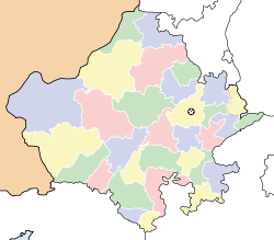
- Nagaur
-
This article is about the municipality in Rajasthan, India. For its namesake district, see Nagaur district.
Nagaur — city — Coordinates 27°12′N 73°44′E / 27.2°N 73.73°ECoordinates: 27°12′N 73°44′E / 27.2°N 73.73°E Country India State Rajasthan District(s) Nagaur Population 88,313 (2001[update]) Time zone IST (UTC+05:30) Area
• 302 metres (991 ft)
Nagaur is a city in the state of Rajasthan in India. It is the administrative headquarters of Nagaur District. The Nagaur city lies about midway between Jodhpur and Bikaner. It was founded by the Naga Kshatriyas.
Contents
History
Nagaur is referred to in the Mahabharata. The kingdom of Ahichhatrapur which Arjuna is said to have conquered and subsequently offered to his Guru Dronacharya, was perhaps some of the area of the Nagaur district. It was the capital of Jangaldesh. The foundation of city dates back to 4th century BC. Nagas originally ruled over this place and about 7th century onwards the Chauhans became the overlords of Nagaur and it was included in Sapadalaksha.
Nagaur city was at the centre of Muslim invasion from Central Asia. The Nagaur fort is of historical importance.[1]
After independence, Nagaur had the honour of being selected as the place in the country from where the Democratic Decentralisation process was launched by the late Shri Jawaharlal Nehru, the first Prime Minister of India on the 2 October 1959.
Nagaur has importance in cattle fair, Every year in month of February, it organises huge bullock/camel fair "Ramdev Pasumela". Nagaur district has got plenty of LimeStone, Salt and other type of Stones.
Climate
Nagaur has a dry climate with a hot summer. Sand storms are common in summer. The district's climate is marked by extreme dryness, large variations of temperature & highly irregular rainfall patterns. The maximum temperature recorded in district is 117F with 32F as the lowest recorded temperature. The average temperature of the district is 74 F. The winter season extends from mid November until the beginning of March. The rainy season is relatively short, extending from July through mid September. There are ten climatological stations within the district, being within the cities of Nagaur, Khinvsar, Didwana, Merta, Parbatsar, Makarana, Nawa, Jayal, Degana & Ladnun. The average rainfall in the district is 36.16cm & 51.5% relative humidity.
Language spoken
Marwari, Hindi, English, Urdu rajasthani
Geography
Nagaur is located at 27°12′N 73°44′E / 27.2°N 73.73°E.[2] It has an average elevation of 302 metres (990 feet).
Demographics
As of 2001[update] India census,[3] Nagaur had a population of 88,313. Males constitute 52% of the population and females 48%. Nagaur has an average literacy rate of 56%, lower than the national average of 59.5%: male literacy is 66%, and female literacy is 45%. In Nagaur, 17% of the population is under 6 years of age.
Place of Interest
- Guru Jambheshwar Temple, Nagaur
- Bishnoi Dhramsala, Nagaur
- Nagaur Fort, Nagaur
- Satlwas merta city beautiful place and village of Latiyal jats
See also
References
- ^ http://nagaur.nic.in/
- ^ Falling Rain Genomics, Inc - Nagaur
- ^ "Census of India 2001: Data from the 2001 Census, including cities, villages and towns (Provisional)". Census Commission of India. Archived from the original on 2004-06-16. http://web.archive.org/web/20040616075334/http://www.censusindia.net/results/town.php?stad=A&state5=999. Retrieved 2008-11-01.
External links
Nagaur Basni Belima · Didwana · Goredi Chancha · Kuchaman City · Kuchera · Ladnun · Makrana · Merta City · Mundwa · Nagaur · Nawa · Parbatsar
Cities and towns
in other districtsAjmer · Alwar · Banswara · Baran · Barmer · Bharatpur · Bhilwara · Bikaner · Bundi · Chittorgarh · Churu · Dausa · Dholpur · Dungarpur · Hanumangarh · Jaipur · Jaisalmer · Jalore · Jhalawar · Jhunjhunu · Jodhpur · Karauli · Kota · Pali · Pratapgarh · Rajsamand · Sawai Madhopur · Sikar · Sirohi · Sri Ganganagar · Tonk · Udaipur
State of Rajasthan (India) Major cities 
Divisions Districts Ajmer · Alwar · Banswara · Baran · Barmer · Bharatpur · Bhilwara · Bikaner · Bundi · Chittorgarh · Churu · Dausa · Dholpur · Dungarpur · Hanumangarh · Jaipur · Jaisalmer · Jalore · Jhalawar · Jhunjhunu · Jodhpur · Karauli · Kota · Nagaur · Pali · Pratapgarh · Rajsamand · Sawai Madhopur · Sikar · Sirohi · Sri Ganganagar · Tonk · UdaipurCategories:- Cities and towns in Nagaur district
Wikimedia Foundation. 2010.


