- Dartmouth, Massachusetts
-
Dartmouth, Massachusetts — Town — Dartmouth Town Hall
SealLocation in Bristol County in Massachusetts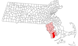
Coordinates: 41°36′52″N 70°58′11″W / 41.61444°N 70.96972°WCoordinates: 41°36′52″N 70°58′11″W / 41.61444°N 70.96972°W Country United States State Massachusetts County Bristol Settled 1650 Incorporated 1664 Government – Type Representative town meeting Area – Total 97.8 sq mi (253.4 km2) – Land 61.6 sq mi (159.5 km2) – Water 36.3 sq mi (93.9 km2) Elevation 125 ft (38 m) Population (2000) – Total 30,666 – Density 498.1/sq mi (192.3/km2) Time zone Eastern (UTC-5) – Summer (DST) Eastern (UTC-4) ZIP code 02747/02748/02714 Area code(s) 508 / 774 FIPS code 25-16425 GNIS feature ID 0618279 Website http://www.town.dartmouth.ma.us/ Dartmouth is a town in Bristol County, Massachusetts, United States established in 1664. The population was 30,665 at the 2000 census. It is the location of the University of Massachusetts Dartmouth.
The villages of Hixville Village Historic District, Bliss Corner, Padanaram Village, Smith Mills and Russells Mills Village Historic District are located in the town.
Contents
History
Dartmouth was the first settled in 1652 and was officially incorporated in 1664. It was named for the town of Dartmouth, Devon, England, where the Puritans originally intended to leave from for America. The land was purchased with trading goods from the Wampanoag chiefs Massasoit and Wamsutta by elders of the Plymouth Colony; reportedly thirty yards of cloth, eight moose skins, fifteen axes, fifteen hoes, fifteen pairs of shoes, one iron pot, and ten shillings' worth of assorted goods .[1] It was sold to the Religious Society of Friends or Quakers, who wished to live outside the stringent religious laws of the Puritans in Plymouth. There are still Quaker meeting houses in town, including the Smith Neck Meeting House, the Allens Neck Meeting House, and the Apponegansett Meeting House, which is on the National Register of Historic Places. Its borders were originally named in the charter (and set by King Philip) as the lands of "Acushnea, Ponagansett, and Coaksett." This includes the land of the towns of Westport, Fairhaven, and Acushnet, and the city of New Bedford. In 1789, the towns of Westport and New Bedford, which included Fairhaven and Acushnet, separated and were incorporated as towns themselves.
In 1780, seven black residents of Dartmouth petitioned the town's legislature for the right to vote, claiming a lack of representation despite the fact that they paid taxes and fought in the Revolutionary War.[2]
Dartmouth's history was that of an agricultural community, but during the late 19th century its coastline became a resort area for the wealthy members of New Bedford society.
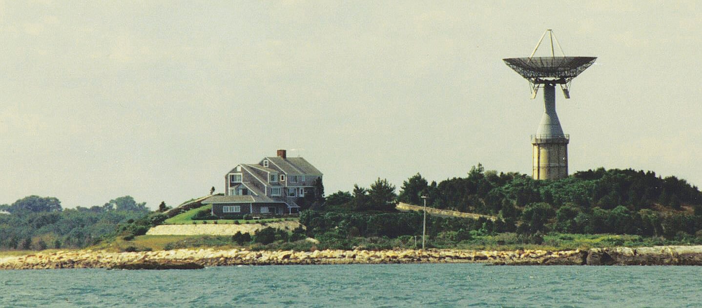
Round Hill was the site of early-to-mid 20th century research into the uses of radio and microwaves for aviation and communication by MIT researchers. It is also the site of the Green Mansion, the estate of "Colonel" Edward Howland Robinson Green, a colorful character in his own right, who was son of the even more colorful and wildly eccentric Hetty Green, said to be the richest woman in the world in her time, who is listed in the Guinness book of records as the "world's greatest miser". In 1936 the Colonel died and the estate fell into disrepair as litigation between his wife and his sister continued for eight years over his vast fortune. Finally, Mrs. Hetty Sylvia Wilks, the Colonel's sister, was ruled the sole beneficiary. In 1948, she bequeathed the entire estate to MIT, which used it for microwave and laser experiments. The giant antenna, which was a landmark to sailors on Buzzards Bay, was erected on top of a 50 thousand-gallon water tank. (after all efforts were made to preserve the structure, it was demolished on November 19, 2007.) Another antenna was erected next to the mansion and used in the development of the Ballistic Early Warning System. MIT continued to use Round Hill through 1964. It was then sold to the Society of Jesus of New England. It was used as a retreat house. The upper floors were divided into 64 individual rooms. The main floor was fitted with a Chapel, a library and meeting rooms. In 1970, the Jesuits sold the land and buildings to Gratia R. Montgomery. In 1981, Mrs. Montgomery sold most of the land to a group of developers who have worked to preserve the history, grandeur and natural environment. The property now is a gated community featuring a nine hole golf course.
The town's retail area has grown steadily since the 1960s, centering around the village of Smith Mills, but many of those stores have closed down now. Business is now branching northward towards Faunce Corners, now the home of the Dartmouth Mall.
The Lloyd Center for Environmental Studies, located in South Dartmouth, is a non-profit organization that provides educational programs on aquatic environments in southeastern New England. It is across the mouth of Slocums River from Demarest Lloyd State Park, a popular state beach known for its shallow waters.
The town was also once the home of Lincoln Park, a former amusement park which dated from the late 19th century as a park-stop along the trolley line from Fall River to New Bedford just east of the junction of Lake Noquochoke and the Westport River. The park closed in 1986 due to sagging attendance and lack of funds. Much of the park was burned to the ground in several incidents of arson, and today there are plans to turn the former park's lands into a housing development with accompanying stores.[citation needed]
Geography
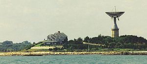 The former MIT antenna atop Round Hill
According to the United States Census Bureau, the town has a total area of 97.8 square miles (253 km2). 61.6 square miles (160 km2) of it is land and 36.2 square miles (94 km2) of it (37.06%) is water. Geographically, it is the 3rd largest town in Massachusetts.
The town is accessible by Interstate 195 and US Route 6, both of which run parallel through the town on an east-west axis. Route 140 is located just over the New Bedford Line and is accessible by US Route 6, and Interstate 195. Route 177 also lies to the edge of town (in Dartmouth) on the border with Westport, accessible by Route 6 near Lake Noquochoke and the Westport River's source. Route 177 runs south into Rhode Island. Routes 177, 140 and 195 are based upon old Indian routes and trails. Dartmouth includes Southeastern Massachusetts Bioreserve that extends from Fall River into many protected forests of North Dartmouth in the Collins Corner, Faunce Corner and Hixville Sections of town.
There are many rivers that flow North/South in Dartmouth such as the Copicut River, Shingle Island River, Paskamanset River, Slocums River, Destruction Brook, and Little River. Dartmouth is divided into two primary sections: North Dartmouth (USPS ZIP code 02747) and South Dartmouth (USPS ZIP code 02748). The use of "North" and "South" is no longer official, only colloquial.
The town is bordered by Westport to the west, New Bedford to the east, Fall River to the north and Buzzard's Bay to the south.
Demographics
Historical populations Year Pop. ±% 1850 3,868 — 1860 3,883 +0.4% 1870 3,367 −13.3% 1880 3,430 +1.9% 1890 3,122 −9.0% 1900 3,669 +17.5% 1910 4,378 +19.3% 1920 6,493 +48.3% 1930 8,778 +35.2% 1940 9,011 +2.7% 1950 11,115 +23.3% 1960 14,607 +31.4% 1970 18,800 +28.7% 1980 23,966 +27.5% 1990 27,244 +13.7% 2000 30,666 +12.6% 2001* 30,401 −0.9% 2002* 31,067 +2.2% 2003* 32,396 +4.3% 2004* 32,642 +0.8% 2005* 33,551 +2.8% 2006* 33,621 +0.2% 2007* 34,005 +1.1% 2008* 34,403 +1.2% 2009* 34,421 +0.1% 2010 34,032 −1.1% * = population estimate.
Source: United States Census records and Population Estimates Program data.[3][4][5][6][7][8][9][10][11][12] The village of Padanaram, with its bridge in the foreground
As of the census[13] of 2000, there were 30,666 people, 10,555 households, and 7,821 families residing in the town. The population density was 498.1 inhabitants per square mile (192.3/km²). There were 11,283 housing units at an average density of 183.3 per square mile (70.8/km²). The racial makeup of the town was 90.77% Caucasian, 1.06% African American, 0.20% Native American, 1.18% Asian, 0.03% Pacific Islander, 5.12% from other races, and 1.64% from two or more races. Hispanic or Latino of any race were 1.50% of the population.
There were 10,555 households out of which 31.9% had children under the age of 18 living with them, 61.3% were married couples living together, 9.6% had a female householder with no husband present, and 25.9% were non-families. 22.3% of all households were made up of individuals and 12.5% had someone living alone who was 65 years of age or older. The average household size was 2.60 and the average family size was 3.06.
In the town the population was spread out with 20.4% under the age of 18, 14.1% from 18 to 24, 25.8% from 25 to 44, 24.2% from 45 to 64, and 15.5% who were 65 years of age or older. The median age was 38 years. For every 100 females there were 97.7 males. For every 100 females age 18 and over, there were 96.0 males.
The median income for a household in the town was $50,742, and the median income for a family was $60,401. Males had a median income of $39,788 versus $28,033 for females. The per capita income for the town was $24,326. About 2.8% of families and 4.5% of the population were below the poverty line, including 3.6% of those under age 18 and 8.3% of those age 65 or over.
Government
Dartmouth is located in the Ninth Bristol state representative district, which includes all of Dartmouth as well as parts of Freetown, Lakeville and New Bedford. The town is represented in the state senate in the Second Bristol and Plymouth district, which includes the city of New Bedford and the towns of Acushnet, Dartmouth, Fairhaven and Mattapoisett. Dartmouth is the home of the Third Barracks of Troop D of the Massachusetts State Police, which recently relocated from Route 6 to just north of the retail center of town along Faunce Corner Road. On the national level, the town is part of Massachusetts Congressional District 4, which is represented by Barney Frank. The state's junior (Class I) Senator, up for re-election in 2012, is Scott Brown and the state's senior (Class II) Senator, up for re-election in 2014, is John F. Kerry.
Dartmouth is governed by a representative town meeting form of government, led by a board of selectmen. The Town Hall is located in the former Poole School, which also served as Dartmouth High School for several years. The town is patrolled by a central police department, located in the former Town Hall near the village of Padanaram. There are five fire stations in the town divided among three fire districts, all of which are paid-call departments. There are two post offices (North Dartmouth, under the 02747 zip code, and South Dartmouth, under the 02748 zip code).
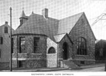 Southworth Library, South Dartmouth, 1899
Library
Dartmouth established public library services in 1895.[14][15] Today there are two libraries, the Southworth (Main) Library in South Dartmouth, and the North Dartmouth Library. In fiscal year 2008, the town of Dartmouth spent 1.5% ($865,864) of its budget on its public libraries—some $25 per person.[16]
Education
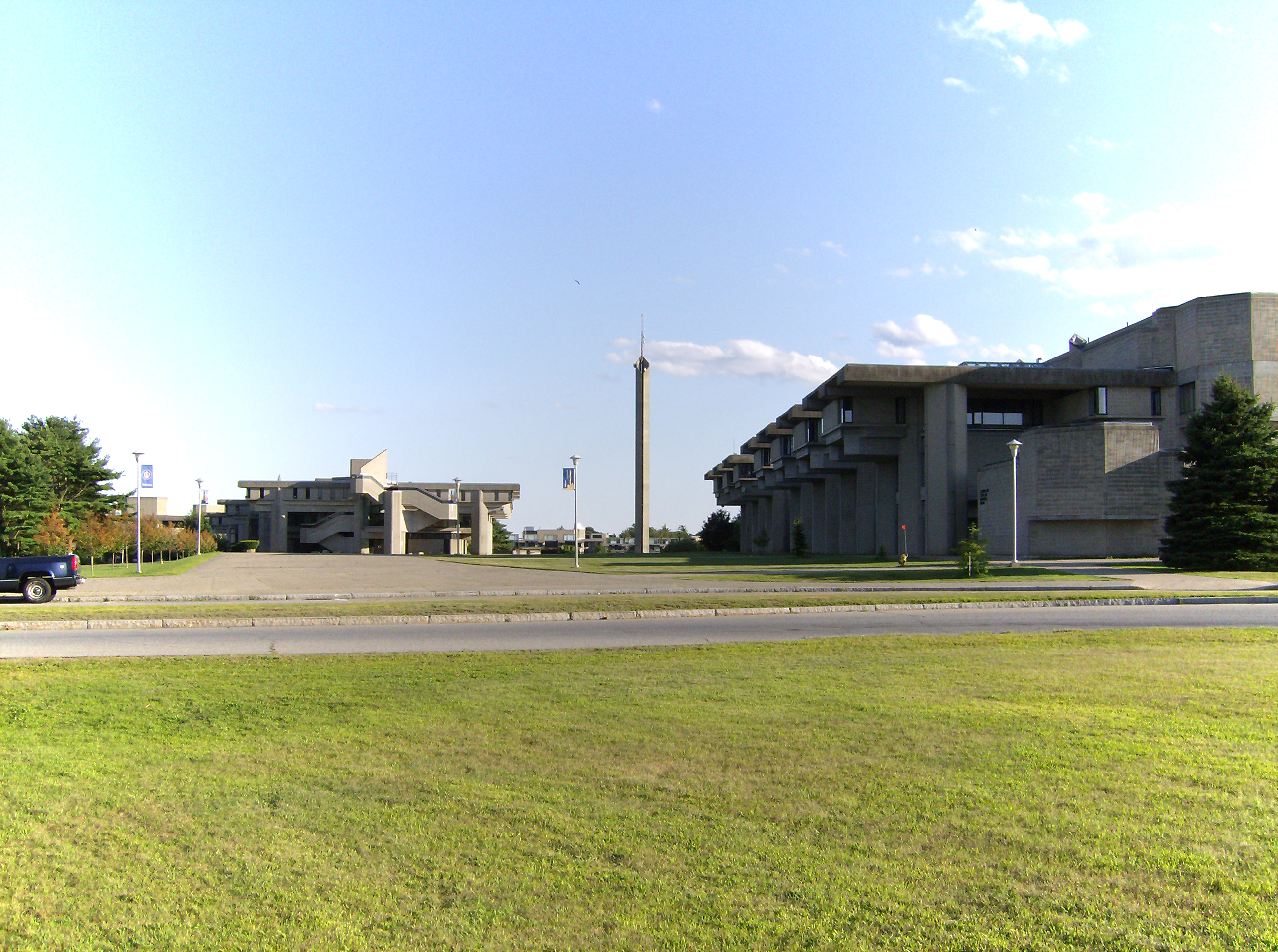
 The campus of UMass-Dartmouth
Dartmouth is governed by a single school department (dartmouthps.schoolfusion.us) whose headquarters are in the former Bush Street School in Padanaram. The school department has been experiencing many changes in the past decade, with the opening of a new high school, the moving of the former Middle School to the High School, and two venerable elementary schools - Job S. Gidley (the town's longest serving school) and Andrew B. Cushman - closing in 2007. The town currently has three elementary schools, Joseph P. DeMello, George H. Potter, and James M. Quinn. Potter and DeMello both were opened in 1955 and are mirror images of each other, with Quinn, currently one of the largest elementary schools by population in Massachusetts, opening in 2002 in the former middle school building. All three elementary schools serve students from kindergarten through fifth grade, with Quinn also serving pre-kindergarten students. The town has one middle school (located in the 1955-vintage High School building) next to the Town Hall, and one high school, the new Dartmouth High School, which opened in 2002 in the southern part of town. Its colors are Dartmouth green and white, and its fight song is "Glory to Dartmouth;" unlike the college, however, the school still uses the "Indians" nickname, with a stylized brave's head in profile as the logo.
DHS's most prominent group is the Dartmouth High School Marching Band, the current national champions in the USSBA marching band circuit and WGI indoor percussion circuit. They have won numerous state and regional titles in marching band field show and indoor percussion show competitions dating back to the 1970s, first under the direction of Gilbert A. Madrigale, and currently under the direction of William R. Kingsland. The assistant band director, Thomas Aungst, was the former percussion caption head for The Cadets Drum and Bugle Corps until 2008, and the music department has also had ties to the Boston Crusaders in the past. The band has appeared in the Tournament of Roses Parade (1996), the National Cherry Blossom Festival parade, the Shenandoah Apple Blossom Festival parade and field show competition (which it won for three consecutive years, 1990–92), as well as several other festivals and Disney Magic Music Days at Walt Disney World. The Indoor Percussion ensemble has also captured four WGI (Winter Guard International) championships and has placed in the top three since 1998. The Dartmouth High School Orchestra has also come to local prominence in recent years under the direction of Heather Church-Yarmac, traveling to and performing in the Azores, Ireland, and most recently Canada. Dartmouth High school also has a large drama department, they have put on shows such as "A Christmas Carol" and "Grease" in 2009. The school also has competitive MIAA Division I athletics, having won several state titles in different sports and given rise to former major league pitcher Brian Rose and former North Carolina Tar Heel basketball player Jess Gaspar along with UCONN Football star Jordan Todman and Georgia's Arthur Lynch.
In addition to DHS, students may also attend Greater New Bedford Regional Vocational-Technical High School or Bristol County Agricultural High School. The town is also home to Bishop Stang High School, named for the first Bishop of the Diocese of Fall River, William Stang, and Friends Academy, a private K-8 school affiliated with the Religious Society of Friends.
Since the 1960s, Dartmouth has been home to the University of Massachusetts Dartmouth campus, located on Old Westport Road, just southwest of the Smith Mills section of town. The campus was the result of the unification of the Bradford Durfee College of Technology in Fall River and the New Bedford Institute of Textiles and Technology in New Bedford in 1962 to form the Southeastern Massachusetts Technological Institute. The campus itself was begun in 1964 and its unique Brutalist design was created by Paul Rudolph, then the head of Yale's School of Architecture. From 1969 until its inclusion into the University of Massachusetts system in 1991, the school was known as Southeastern Massachusetts University, reflecting the school's expansion into liberal arts. The campus has expanded over the years to its current size, with several sub-centers located in Fall River and New Bedford.
Notable residents
- Ezekiel Cornell, (1732–1800) member of Continental Congress 1780-1782
- Philip Sheridan (March 6, 1831 – August 5, 1888) - career U.S. Army officer and a Union general in the American Civil War.
- Brian Rose - (born February 13, 1976) former Major League baseball player
- Tea Leoni - (born February 25, 1966) - American film actress (summer resident) (Because she is married to actor David Duchovny, he also can be seen frequenting Dartmouth.)
- Arthur Golden - Author, Memoirs of a Geisha (summer resident)
- Mark Kruger - Season 5 competitor on NBC's The Biggest Loser (4th place)
References
- ^ Philbrick, Nathanial. Mayflower. Penguin, 2006. p.171 ISBN 9780143111979
- ^ Zinn, Howard. A People's History of the United States. Perennial, 2003. p.89 ISBN 0060528370
- ^ "TOTAL POPULATION (P1), 2010 Census Summary File 1, All County Subdivisions within Massachusetts". United States Census Bureau. http://factfinder2.census.gov/bkmk/table/1.0/en/DEC/10_SF1/P1/0400000US25.06000. Retrieved September 13, 2011.
- ^ "Massachusetts by Place and County Subdivision - GCT-T1. Population Estimates". United States Census Bureau. http://factfinder.census.gov/servlet/GCTTable?_bm=y&-geo_id=04000US25&-_box_head_nbr=GCT-T1&-ds_name=PEP_2009_EST&-_lang=en&-format=ST-9&-_sse=on. Retrieved July 12, 2011.
- ^ "1990 Census of Population, General Population Characteristics: Massachusetts". US Census Bureau. December 1990. Table 76: General Characteristics of Persons, Households, and Families: 1990. 1990 CP-1-23. http://www.census.gov/prod/cen1990/cp1/cp-1-23.pdf. Retrieved July 12, 2011.
- ^ "1980 Census of the Population, Number of Inhabitants: Massachusetts". US Census Bureau. December 1981. Table 4. Populations of County Subdivisions: 1960 to 1980. PC80-1-A23. http://www2.census.gov/prod2/decennial/documents/1980a_maABC-01.pdf. Retrieved July 12, 2011.
- ^ "1950 Census of Population". Bureau of the Census. 1952. Section 6, Pages 21-10 and 21-11, Massachusetts Table 6. Population of Counties by Minor Civil Divisions: 1930 to 1950. http://www2.census.gov/prod2/decennial/documents/23761117v1ch06.pdf. Retrieved July 12, 2011.
- ^ "1920 Census of Population". Bureau of the Census. Number of Inhabitants, by Counties and Minor Civil Divisions. Pages 21-5 through 21-7. Massachusetts Table 2. Population of Counties by Minor Civil Divisions: 1920, 1910, and 1920. http://www2.census.gov/prod2/decennial/documents/41084506no553ch2.pdf. Retrieved July 12, 2011.
- ^ "1890 Census of the Population". Department of the Interior, Census Office. Pages 179 through 182. Massachusetts Table 5. Population of States and Territories by Minor Civil Divisions: 1880 and 1890. http://www2.census.gov/prod2/decennial/documents/41084506no553ch2.pdf. Retrieved July 12, 2011.
- ^ "1870 Census of the Population". Department of the Interior, Census Office. 1872. Pages 217 through 220. Table IX. Population of Minor Civil Divisions, &c. Massachusetts. http://www2.census.gov/prod2/decennial/documents/1870e-05.pdf. Retrieved July 12, 2011.
- ^ "1860 Census". Department of the Interior, Census Office. 1864. Pages 220 through 226. State of Massachusetts Table No. 3. Populations of Cities, Towns, &c.. http://www2.census.gov/prod2/decennial/documents/1860a-08.pdf. Retrieved July 12, 2011.
- ^ "1850 Census". Department of the Interior, Census Office. 1854. Pages 338 through 393. Populations of Cities, Towns, &c.. http://www2.census.gov/prod2/decennial/documents/1850c-11.pdf. Retrieved July 12, 2011.
- ^ "American FactFinder". United States Census Bureau. http://factfinder.census.gov. Retrieved 2008-01-31.
- ^ Report of the Free Public Library Commission of Massachusetts. v.9 (1899).
- ^ http://www.dartmouthpubliclibraries.org Dartmouth Public Libraries Retrieved 2010-11-11
- ^ July 1, 2007 through June 30, 2008; cf. The FY2008 Municipal Pie: What’s Your Share? Commonwealth of Massachusetts, Board of Library Commissioners. Boston: 2009. Available: Municipal Pie Reports. Retrieved 2010-08-04
External links
- Town of Dartmouth
- PDF document: Dartmouth Community Profile
- Town of Dartmouth: A Brief History
- Dartmouth Public Schools
- Dartmouth High School
- Bishop Stang High School
- University of Massachusetts - Dartmouth
- Dartmouth Harbormaster Office
Municipalities and communities of Bristol County, Massachusetts Cities 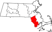
Towns CDPs Other
villagesCategories:- Dartmouth, Massachusetts
- Towns in Bristol County, Massachusetts
- Populated coastal places in Massachusetts
- Populated places established in the 1650s


Wikimedia Foundation. 2010.