- Medina Dam
-
Medina Dam
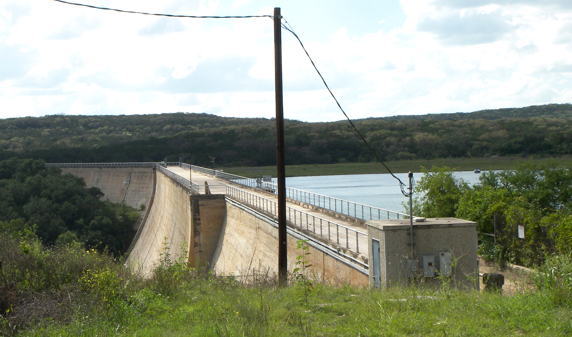
 Medina Dam in 2010

Location: Mico, Texas, USA Coordinates: 29°32′25″N 98°56′2″W / 29.54028°N 98.93389°WCoordinates: 29°32′25″N 98°56′2″W / 29.54028°N 98.93389°W Built: 1912 Governing body: Bexar-Medina-Atascosa Counties Water Improvement District No. 1 NRHP Reference#: 76002050[1] Added to NRHP: March 15, 1976 The Medina Dam is a hollow-masonry type dam built in 1911 and 1912 by the Medina Irrigation Company in what became Mico, Texas. Medina Lake extends north of it in northeastern Medina County, Texas. The dam and irrigation project was designed and financed by Dr. Frederick Stark Pearson, an American engineer, with extensive British financial backing. The construction took over 1500 men two years to build the dam while working 24 hours a day. They were mostly skilled Mexican workers with experience building other dams for Dr Pearson. They received two dollars for a day's work. Pearson's Medina Irrigation Company (MICO) built a camp to house the workers and their families; the company town was first called MICO after its acronym. The community is now known as Mico, Texas.
When the dam was completed in 1913, it was the largest hydraulic engineering project west of the Mississippi River and the fourth-largest dam in the US.[2] It is listed on the National Register of Historic Places for its significance as an infrastructure project and its contributions to economic development of the county.
The dam contains over 292,000 cubic yards (223,000 m³) of concrete, and the dam measures 164 feet high by 128 feet (39 m) wide at the base by 1,580 feet (482 m) long. It is 25 feet (8 m) wide at the top, which is 1084 feet (330 m) above sea level. The spillway is 1,072 feet (327 m) above sea level. The dam provides irrigation to over 34,000 acres (138 km²) to Blackland Prairie farmlands below the Balcones Escarpment around Castroville, Texas.
The reservoir behind the dam is called Medina Lake and serves as a major recreation area. It discharges into the Medina River, which also contains a diversion dam four miles downstream.
See also
- Medina Valley
- Bexar-Medina-Atascosa Water District
- Edwards Plateau
- Texas Hill Country
References
- ^ "National Register Information System". National Register of Historic Places. National Park Service. 2006-03-15. http://nrhp.focus.nps.gov/natreg/docs/All_Data.html.
- ^ Ruben E. Ochoa, "Medina County", Handbook of Texas Online, accessed 3 Aug 2010
Further reading
- Cyril Matthew Kuehne, S.M., Ripples from Medina Lake, San Antonio, TX: Naylor, 1966.
U.S. National Register of Historic Places Topics Lists by states Alabama • Alaska • Arizona • Arkansas • California • Colorado • Connecticut • Delaware • Florida • Georgia • Hawaii • Idaho • Illinois • Indiana • Iowa • Kansas • Kentucky • Louisiana • Maine • Maryland • Massachusetts • Michigan • Minnesota • Mississippi • Missouri • Montana • Nebraska • Nevada • New Hampshire • New Jersey • New Mexico • New York • North Carolina • North Dakota • Ohio • Oklahoma • Oregon • Pennsylvania • Rhode Island • South Carolina • South Dakota • Tennessee • Texas • Utah • Vermont • Virginia • Washington • West Virginia • Wisconsin • WyomingLists by territories Lists by associated states Other  Category:National Register of Historic Places •
  Portal:National Register of Historic PlacesCategories:
- Dams in Texas
- Buildings and structures in Medina County, Texas
- National Register of Historic Places in Texas
- Dams on the National Register of Historic Places

Wikimedia Foundation. 2010.