- Hackensack RiverWalk
-
Hackensack RiverWalk a is partially constructed greenway along the Newark Bay and Hackensack River on the west side of the Bergen Neck peninsula in Hudson County, New Jersey.[1][2] The eight mile walkway, following (where possible) the contour of the water's edge, will run between the southern tip at Bergen Point, where it may connect to the Hudson River Waterfront Walkway, and Eastern Brackish Marsh in the north. Existing parks and promenades have been incorporated and some new sections have been built, but there are remain large gaps. There is RiverWalk in the city of Hackensack,[3] sometimes called the Hackensack RiverWalk, but they are not part of the same project nor are they connected. A parallel walkway on the west banks of the river is known as the Meadow Path.[4]
Contents
Route
South 40°39′06″N 74°08′19″W / 40.6518°N 74.1385°W -40°47′24″N 74°02′49″W / 40.79°N 74.047°W North
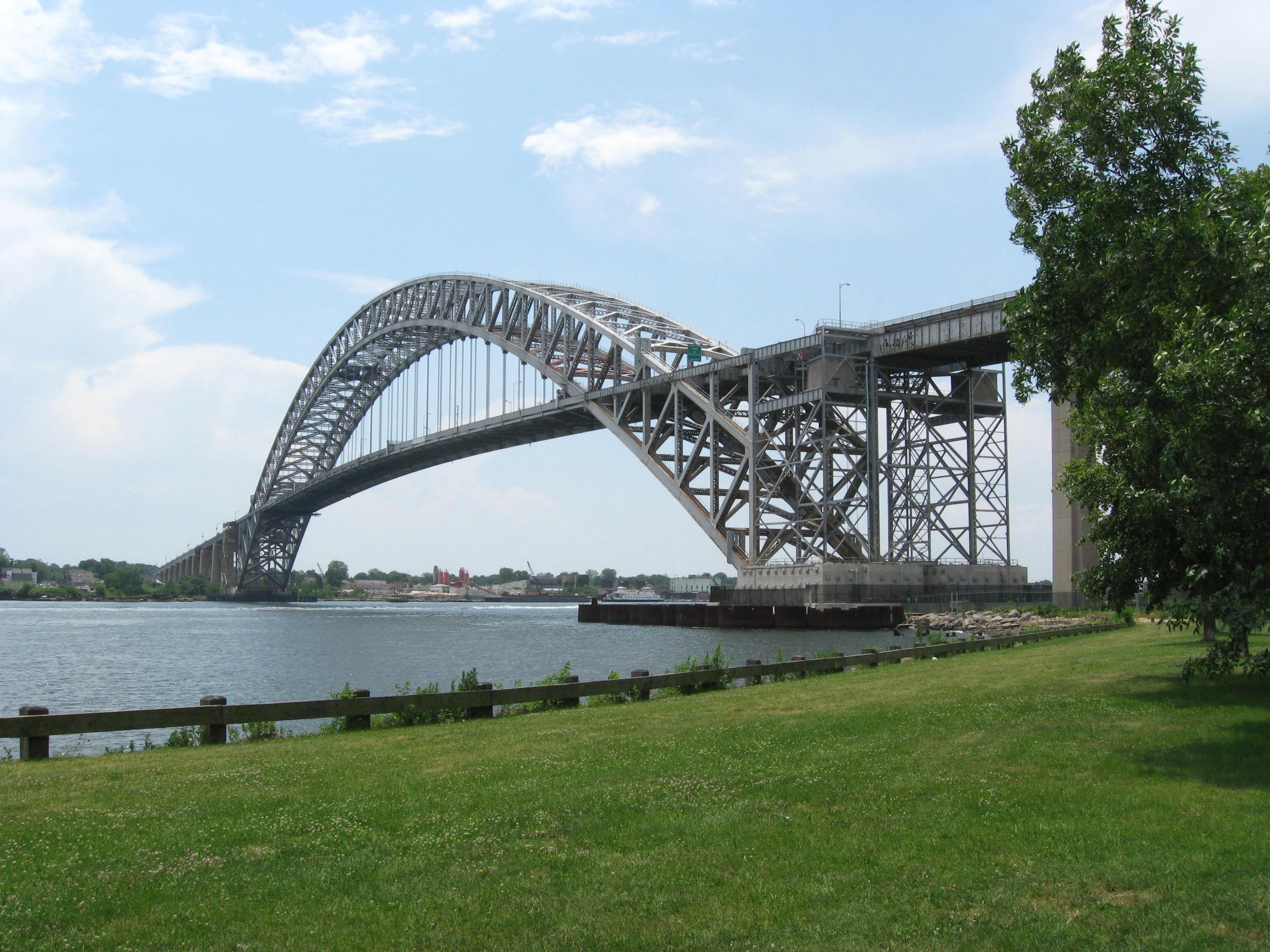
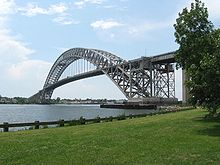 Bayone Bridge in Bayonne
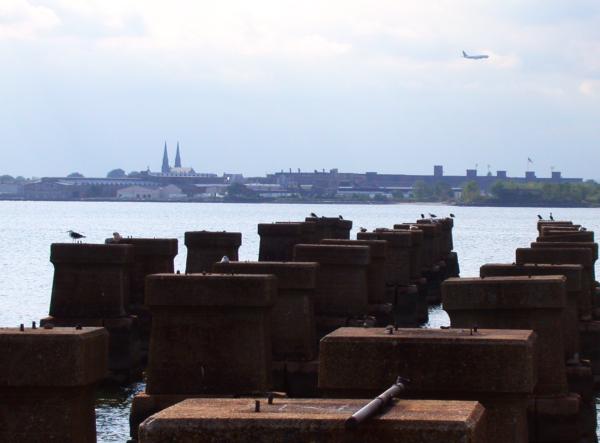
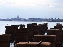 The CRRNJ Newark Bay Bridge, demolished in the 1980s, crossed to Elizabethport, seen in the distance.
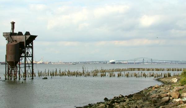
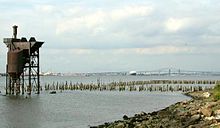 Newark Bay, as seen from Bayonne
The walkway will connect the following municipalities and pass through established residential neighborhoods, industrial areas, commercial districts, and nature preserves, some of which are part of the Hackensack Meadowlands.[5] It will pass under sixteen bridges (some no longer used) and cross over eight natural creeks.
The Bergen Point section of the city the Newark Bay waterfront is characterized by maritime, industrial, and retail uses. The center and northern part of the waterfront contains major parks which are not connected to each other, with residential streets from Kennedy Boulevard ending at the bay. Rutkowksi Park, a wetlands preservation area in the city's northwestern corner (south of the city line) is the city's newest public green space.
- Jersey City
- Route 440 south bound right-of-way runs along the bay. Farther inland, the filled-in bed of the former Morris Canal in Country Village may also be considered.
- The promenade at Droyer's Point jutting into the bay is completed.
- Bayfront is a planned community which will provide access to the shoreline.[6]
- Hackensack Riverfront area of the Jersey City Public Works and the Hudson Mall have space for a trail behind their facilities.
- Lincoln Park West contains wetlands preservation area that is part of the largest Hudson County Park[7]
- Marion Greenway Park has received funding.[8]
- The northern part the Marion Section contains extensive rail lines and the Hudson Generating Station occupies much waterfrontage.
- The Riverbend to Penhorn Creek is a small area containing New Jersey Meadowlands preservation area at the creek.
- Secaucus -
The Secaucus Greenway is a planned to connect the southern and northern porions of town.[9] Completion of this trail will allow public access along the river while providing a continuous pedestrian trail linking Secaucus retail, office, commercial and residential districts. This trail will connect the Laurel Hill Park and the boat launch at Laurel Hill, Secaucus Junction, Snipes Park, Secaucus High School, the Mill Ridge Ball Fields, Mill Creek Point Park, and Mill Creek Marsh. The portions of the Greenway that are completed include trails in the Hudson County#Parks Laurel Hill and a 1.5-mile pedestrian trail through the restored wetland at Mill Creek Marsh, and a .5 mile trail beginning at Mill Creek Point Park traveling south. The section between Penhorn Creek and the New Jersey Turnpike (south of the former Boonton Line is part of Riverbend Wetlands Preserve. The Anderson Creek Marsh at New Jersey Transit's Bergen County Line and Pascack Valley Line run along the waterfront for a half mile south of Harmon Cove, a private "gated community", where a path was created when the development was originally built, though the land at its small inlets is privately owned.
- North Bergen - A planned trail from Harmon Meadow Plaza through Eastern Brackish Marsh parallel to West Side Avenue will end at 71st Street Park.
Points of interest
 Rutkowski Park walkway
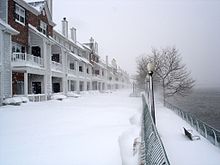 Society Hill at Droyer's Point
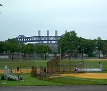 Lincoln Park and Pulaski Skyway
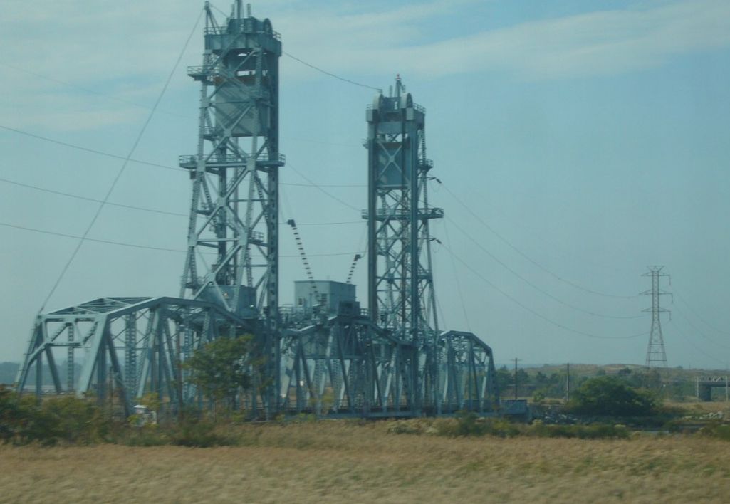
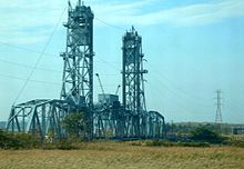 Upper Hack Lift from Secaucus
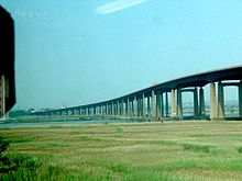 NJ Turnpike passes through Meadowlands
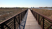 Mill Creek Point Board Walkway
- Bayonne Bridge
- Bergen Point
- Newark Bay
- Shooters Island, an off shore bird sanctuary in the Kill van Kull which the New York/New Jersey state line runs through
- Arthur Kill Vertical Lift Bridge, to the southwest crossing the Arthur Kill
- Central Railroad of New Jersey caissons
- Port Newark-Elizabeth Marine Terminal and Newark International Airport, across the bay
- Bayonne City Park
- Veterans Memorial Park
- Bayonne High School
- Hudson County Park, named for Stephen R. Gregg
- Rutkowski Park, a wetlands preservation area
- Newark Bay Bridge, part of New Jersey Turnpike Extension I-78
- Lehigh Valley Railroad Bridge
- Route 440
- Morris Canal section further inland
- New Jersey City University Athletic Complex [10]
- Droyer's Point
- Kearny Point, across the river's mouth
- Bayfront
- New York and Newark Railroad Bridge caissons
- Jersey City Public Works facility
- Hudson Mall & Fourhundred Forty Shopping Center
- U.S. Route 1/9 Truck, originally part of the transcontinental Lincoln Highway
- Lincoln Park West
- Hudson County Police Headquarters
- Pulaski Skyway, considered to be America's first super highway
- Marion Greenway
- PATH Lift Bridge)
- Harsimus Branch Lift, used for rail freight
- Wittpenn Bridge, for NJ Route 7
- Lower Hack Lift, bridge used by NJ Transit Hoboken and Newark Division trains
- Hudson Generating Station, formerly Public Service Railroad Powerhouse
- Croxton Yards
- Penhorn Creek
- Riverbend Wetlands Preserve
- Secaucus Transfer Station, main commuter hub, further inland
- Portal Bridge, part of the Northeast Corridor used by Amtrak and NJ Transit
- New Jersey Turnpike Eastern Spur Bridge
- Snake Hill, also known as Fraternity Rock, former site of insane asylum where the mineral Petersite was first discovered in 1981
- DB Draw, de-commissioned bridge on NJ Transit Boonton Line abandoned in 2002
- Saw Mill Creek Wildlife Preservation Area/Kearny Marsh across the river
- Laurel Hill Park
- DeKorte Park, across the river in Lyndhurst, home to the Meadowlands Environment Center
- Upper Hack Lift, for NJ Transit's Main Line and Metro-North's Port Jervis Line
- Anderson Marsh
- HX Draw for NJ Transit's Bergen County Line and Pascack Valley Line
- Harmon Cove
- Meadowlands Hospital
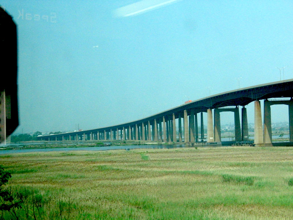
- Route 3 twin span bridge
- North End Trolley Park
- Meadowlands Sports Complex, across the water
- Snipes Park
- Mill Creek Marsh
- Harmon Meadow Plaza
- Paunpeck Creek
- Eastern Brackish Marsh
See also
- Hackensack Riverfront
- Hudson Parks
- Hudson River Waterfront Walkway
- List of crossings of the Hackensack River
Bridges of the Newark Bay Upstream
Newark and New York Railroad Bridge
(Hackensack River & Passaic River)
(demolished)
Lincoln Highway
(Hackensack River & Passaic River)

Lehigh Valley Railroad Draw Bridge
CRRNJ Newark Bay Bridge
(demolished)Downstream
Arthur Kill Vertical Lift Bridge
(Arthur Kill)
Bayonne Bridge
(Kill Van Kull)


References
- ^ Hackenack Riverwalk Plan proposal 2003
- ^ Hudson County Master Plan
- ^ http://www.nytimes.com/1998/05/03/realestate/if-you-re-thinking-living-hackensack-nj-after-long-decline-downtown-rebounds.html?sec=&spon=&pagewanted=2
- ^ http://www.nytimes.com/1995/07/16/nyregion/in-brief-help-for-a-nature-trail-through-the-meadowlands.html
- ^ NJMC
- ^ Bayfront
- ^ http://www.nytimes.com/1997/10/29/nyregion/new-jersey-daily-briefing-11-million-for-park-project.html?scp=9&sq=Lincoln%20Park%20Jersey%20City&st=cse
- ^ http://riverviewobserver.net/2009/05/jersey-citys-mayor-healy-and-city-council-introduce-marion-greenway-park/ Marion Greenway Park
- ^ Trolley Park
- ^ http://www.njcu.edu/i2e/tour/n.asp
External links
Categories:- Hackensack River
- Protected areas of Hudson County, New Jersey
- Hiking trails in New Jersey
- Geography of Hudson County, New Jersey
- New Jersey Meadowlands District
- Parks in Hudson County, New Jersey


Wikimedia Foundation. 2010.