- Droyer's Point
-
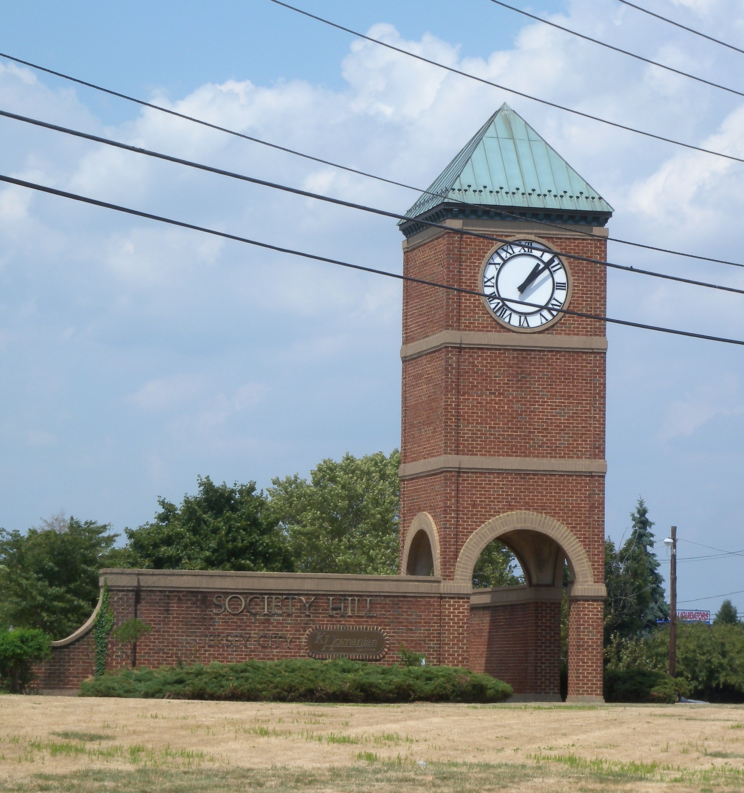
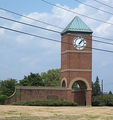 Clock tower marks Society Hill entrance
Droyer's Point is a section of Jersey City, New Jersey at Newark Bay.
Contents
Geography
In the southwestern part of the of the city, Droyer's Point is located on the Newark Bay. Its eastern perimeter is New Jersey Route 440. The point is entered from the highway's intersection with Danforth Avenue. To the north, Kellog Street creates its boundary with the brownfield and site of Bayfront,[1] a planned urban development project. The point itself is opposite Kearny Point, with which it marks the mouth of the Hackensack River.[2][3]
Description
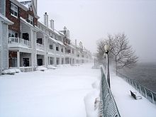 Winter on the Hackensack RiverWalk at Society Hill
Since the 1980s Droyer's Point has been developed as a residential and recreation area. At its southern end is the Athletic Complex of New Jersey City University - its other locations are further inland on the West Side.[4] Just to the north are the residential communities built by the Hovnanian Enterprises. Construction was delayed until there was remediation of chromium found at the site.[5] Known as Society Hill, built in the late 1980s[6][7] and Droyer's Point, built in the mid 2000s,[8] the complex includes condominium and rental townhomes and apartments and includes amenities such as pools, tennis courts, and a marina. Completed portions of the Hackensack RiverWalk, a public waterfront promendade which is accessible to the public through entrances outside the development, run along the shoreline.
History
Minkakwa and Morris Canal
Originally a tidal marsh, the area was the territory of the Hackensack and Raritan at the time of European contact in the 17th century. They called the area on Minkakwa, meaning a place of good crossing. This is likely so because it was the most convenient pass between two bays (the other being the Upper New York Bay) on either side of the Bergen Neck peninsula and near a natural break in Bergen Hill, the formation that rises to become the Hudson Palisades. Interpreted as place where the coves meet, in this case where they are closest to each, it describes a spot advantageous for portage. Just inland of Droyer's Point the construction of the Morris Canal in the 1830s took advantage of the geology to cut across Pamrapo. The canal then ran parallel to the bay before connecting to the river at a location further to the north.[9][10] A filled portion of the landmark can still be seen as a unmarked right of way in the nearby Country Village neighborhood.
Jersey City Airport
In the 1920s the land which was owned by the city became the object of development which included land reclamation and the construction of bulkhead, with the intention of expanding the city's port facilities south of the CRRNJ Newark and New York Railroad (which travelled from Downtown Newark across the river and Bergen Hill to Communipaw Terminal). While the planned distributuion facilities never materialized, the area did became the site of the short lived Jersey City Airport, which opened in 1927.[11] For a short time the airport was operated by Eddie August Schneider, a native of the city and one of early aviation's youthful celebrities.[12][13] The Jersey City Seaplane Base was later located nearby.[14]
Roosevelt Stadium
Main article: Roosevelt Stadium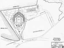 Map of Droyer's Point during stadium era
The Art Deco style Roosevelt Stadium was Works Progress Administration project secured by Jersey City Mayor Frank Hague, [12] as was The Jersey City Medical Center It was named for President Franklin D. Roosevelt, the author of that New Deal agency. Groundbreaking took place in 1935.[15] The baseball park's opening was scheduled for April 22, 1937 with the opening of the 1937 International League season. Mayor Hague declared a half-holiday for the city's schools and employees. New York Giants owner Horace Stoneham was expected at the opener along with Senator Harry Moore.[16] Rain washed out the planned events and the opening was postponed until April 23 with Mayor Hague throwing out the first pitch and Sen. Moore and owner Horace Stoneham on hand for the ballpark's dedication.[17] The stadium was also the home field of the Jersey City Giants, and was used for seven "home" games by the Brooklyn Dodgers during their last couple of seasons in Brooklyn, 1956 and 1957. On April 18, 1946, Roosevelt Stadium hosted the Jersey City Giants' season opener against the Montreal Royals, marking the professional debut of the Royals' Jackie Robinson. The stadium also hosted boxing bouts including fight with Max Baer, "Two Ton Tony" Galento, Marcel Cerdan and Tony Zale In 1950, Sugar Ray Robinson defended his welterweight title; in 1951, Jersey Joe Walcott beat heavyweight champion Ezzard Charles. During the 1970s the stadium was used sporadically as a music venue with performances by the Grateful Dead, Allman Brothers Band, Beach Boys, Eric Clapton, Tony Bennett, and Crosby, Stills, Nash and Young, among others In November 1982, the Jersey City City Council voted to demolish the stadium.[18] It was demolished in 1985.[19][20]
Transportation
The district is served by the A&C Bus Corporation with service to Journal Square via West Side Avenue. There is discussion to extend the Hudson Bergen Light Rail from the current West Side Avenue (HBLR station) terminus to a location near the waterfront, but there is no projected date for the project. The Danforth Avenue Station is located about a mile to the east.[21] Direct communter bus service to Manhattan is provided by privately operated NYC Commuter.[22]
See also
Neighborhoods in Jersey City, New Jersey Bergen-Lafayette 
Downtown Exchange Place · Hamilton Park · Harsimus · Holland Tunnel · Pavonia Newport · Paulus Hook · Van Vorst Park · The Village · WALDO/PowerhouseGreenville The Heights Journal Square Meadowlands Upper New York Bay West Side Bridges of the Newark Bay Upstream
Newark and New York Railroad Bridge
(Hackensack River & Passaic River)
(demolished)
Lincoln Highway
(Hackensack River & Passaic River)

Lehigh Valley Railroad Draw Bridge
CRRNJ Newark Bay Bridge
(demolished)Downstream
Arthur Kill Vertical Lift Bridge
(Arthur Kill)
Bayonne Bridge
(Kill Van Kull)


References
- ^ Jersey City
- ^ Hudson County New Jersey Street Map. Hagstrom Map Company, Inc. 2008. ISBN 0-88097-763-9.
- ^ Wikimapia:Droyer's Point
- ^ [1] NJCU Athletic Complex
- ^ NJDEP chrome update
- ^ NJCU: JC A to Z Droyer's Point
- ^ Society Hill website
- ^ Droyer's Point website
- ^ JC Online:Morris Canal
- ^ 1860 Map
- ^ JC A to Z Droyer's Point
- ^ a b "Jersey City to Get WPA Stadium Fund. Mayor Hague Reports Application for $800,000 Approved for Arena at Airport.". New York Times. September 26, 1935, Thursday. http://select.nytimes.com/gst/abstract.html?res=F10A11F83A5A107A93C4AB1782D85F418385F9. Retrieved 2007-08-21. "Mayor Frank Hague of Jersey City announced yesterday he had been informed that the Works Progress Administration had approved the city's application for an $800,000 grant to build a municipal sports stadium."
- ^ "Two In Plane Escape In Newark Bay Crash. Schneider, Ex-Transcontinental Record-Holder, And Student Pilot Rescued By Police.". New York Times. May 16, 1935. http://select.nytimes.com/gst/abstract.html?res=F50B16F73D5B177A93C4A8178ED85F418385F9. Retrieved 2007-08-21. "Two aviators escaped with only minor bruises and a thorough wetting last night when their three-seat, open-cockpit biplane developed motor trouble soon after taking off from the Jersey City Airport and fell into Newark Bay 200 feet off Droyer's Point, Jersey City. The men were rescued by police, who went to their aid in a collapsible rowboat kept at the field. ... The plane [had] taken off at 7 pm [piloted] by Edward Schneider, 23 years old, of 209 Sip Avenue, Jersey City, former holder of the junior transcontinental plane record and manager of the airport since January 1, 1935."
- ^ http://newjersey.quickcityinfo.com/Carlstadt/Airports/1166401/Jersey_City_Seaplane_Base
- ^ New York Times: Stadium groundbreaking
- ^ Kingsley Childs (1937-04-22). "International League to Begin Fifty-Fourth Season Today; Jersey City Ready for Gala Opening". New York Times. http://select.nytimes.com/mem/archive/pdf?res=F10915F6385E177A93C0AB178FD85F438385F9.
- ^ Arthur J. Daly (1937-04-23). "Jersey City Eager to See New Club; Opener, Put Back Because of Rain, Is Expected to Draw 30,000 Fans Today". New York Times: p. 26. http://select.nytimes.com/mem/archive/pdf?res=F20917F7385E177A93C1AB178FD85F438385F9.
- ^ Joseph Malinconico (1982-11-28). "ROOSEVELT STADIUM: GLORY FADING FAST". New York Times. http://www.nytimes.com/1982/11/28/nyregion/roosevelt-stadium-glory-fading-fast.html.
- ^ Jim Hague. "Bidding Giants Stadium a farewell" The Union City Reporter; January 10, 2010; Page 10
- ^ *Info about the stadium
- ^ "Hudson County 602 straight line diagram" (PDF). New Jersey Department of Transportation. http://www.state.nj.us/transportation/refdata/sldiag/09000602__-.pdf. Retrieved 2009-08-15.
- ^ NYC Commuter website
Categories:- Neighborhoods in Jersey City, New Jersey
- Geography of Hudson County, New Jersey
- Redeveloped ports and waterfronts
- Peninsulas of New Jersey


Wikimedia Foundation. 2010.