- Bergen Hill, Jersey City
-
- For lower Hudson Palisades, see: Bergen Hill.
Bergen Hill the name given to the emergence of the Hudson Palisades along the Bergen Neck peninsula in Hudson County, New Jersey and the inland neighborhood of the Jersey City where they rise from the coastal plain at the Upper New York Bay. The name is taken from the original 17th century New Netherland settlement of Bergen, which in Dutch means hills.
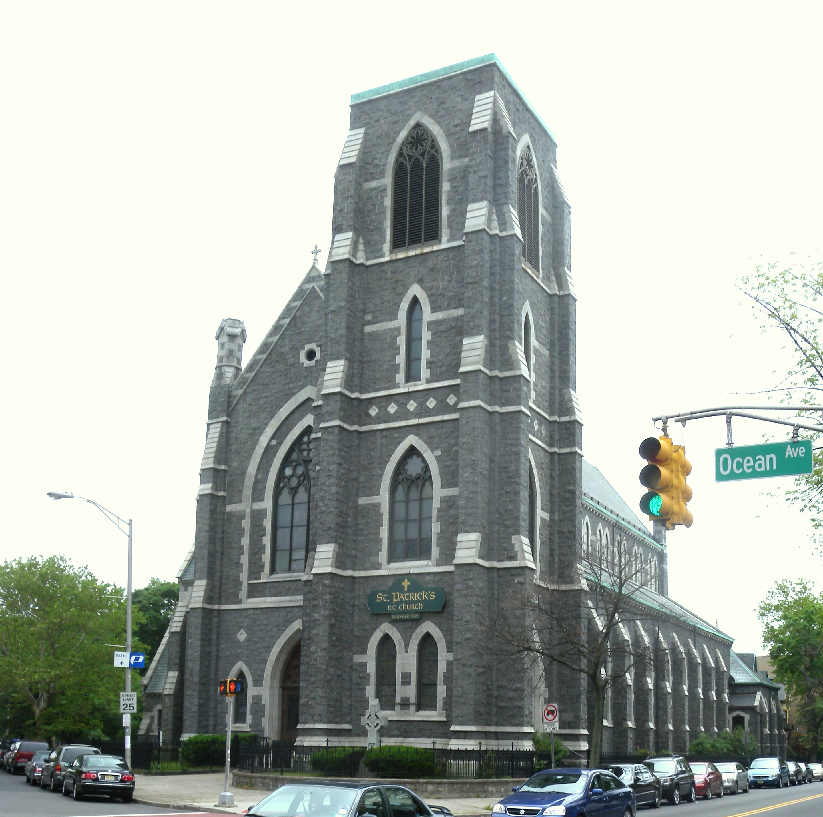
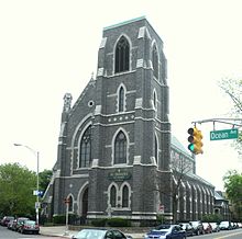 St Patrick's
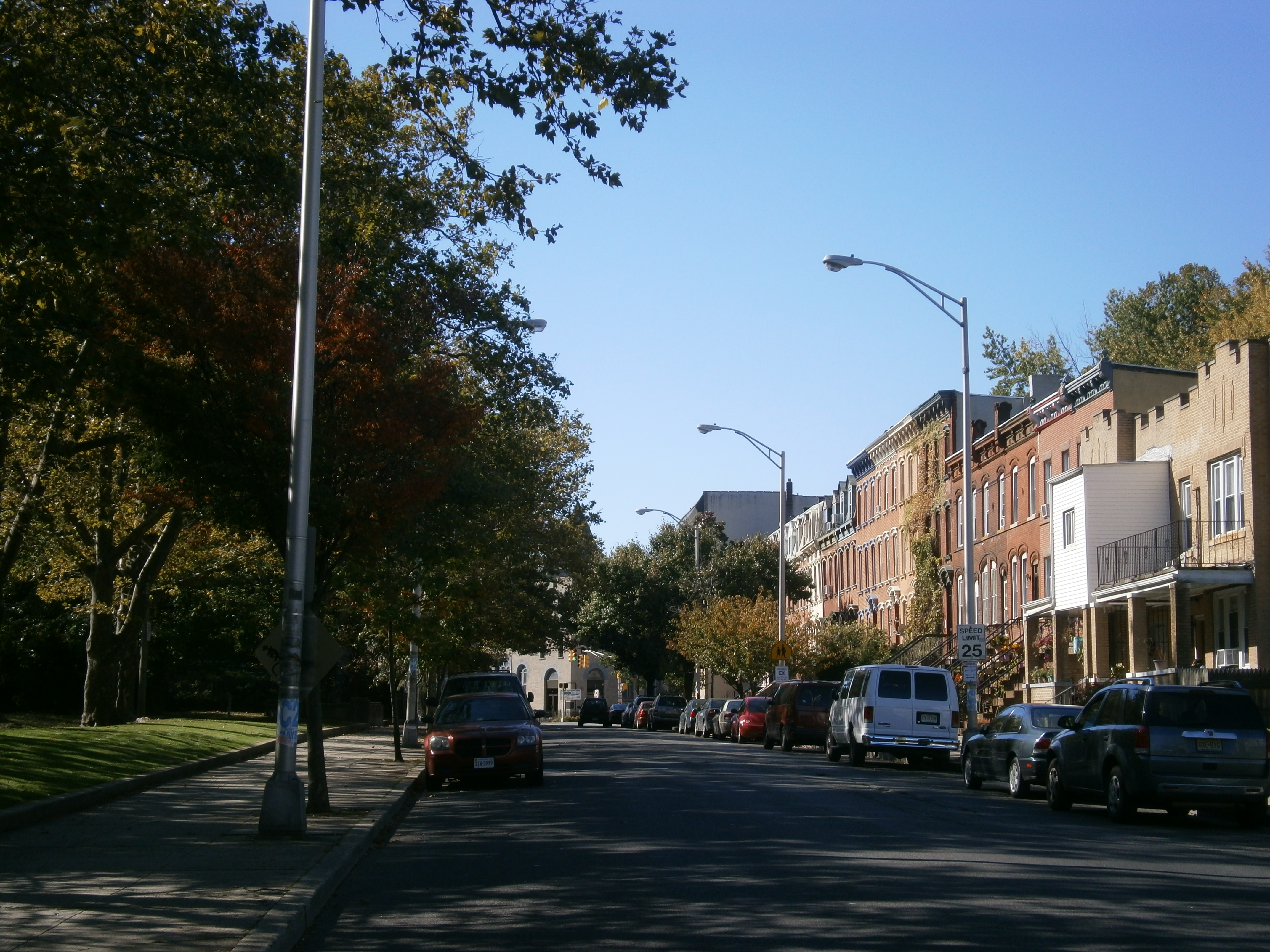
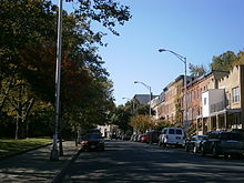 Ascending Grand Street
Locally, Bergen Hill has sometimes referred to colloquially as "The Hill"[1] and was part of Bergen City, one of the municipalities that elected to merge with Jersey City in the 1860s, and is part of the section of the city known as Bergen-Lafayette. The neighborhood radiates from Communipaw Junction, at the intersection at Communipaw Avenue, Summit Avenue, Grand Street where the toll house for the Bergen Point Plank Road was once situated. The avenues ascend the hill to the West Side, north to Five Corners, and south to Greenville. To the east is Communipaw-Lafayette and Liberty State Park.[2]
The Bergen Hill Historic District[3] received it New Jersey Register of Historic Places designation in 1980.[4][5] It includes Summit Avenue and side streets which feature a mix of late 19th/early 20th architecture that includes brick rowhouses, brownstones, Queen Anne style apartment buildings and private homes. At the foot of avenue is Library Hall, a renovated 1866 building, now residences.[6] It travels north to the landmark St John's Church[7] soon after coming in the neighborhood of the Beacon, site of the former Jersey City Medical Center which since 2005 is being renovated and restored for adaptive re-use. Lincoln High School is on Crescent Avenue which, as it its name suggests, arcs the neighborhood as is crosses Communipaw.
To the south Grand Street ascends along Arlington Park, at the top of which is located the St. Patrick's Parish and Buildings at Bramhall Avenue. (40°42′50″N 74°4′23″W). While not in the state historic district, this complex received its federal historic status in September 1980 and anchors the surrounding streets, some of which are lined with well-preserved or restored 19th-century rowhouses. MLK Drive, formerly Jackson Avenue, has long been a commercial street for the southern part of the neighborhood, and is site of Hudson Bergen Light Rail station of the same name.
The Claremont neighborhood lies south of Arlington Park, where before discontinuation of service the Central Railroad of New Jersey maintained station.
Transportation
Buses travelling southbound through The Junction are the R&T 4,[8] NJT 4,[9] NJT 81[10] through Greenville to Curries Woods, with the 81 continuing to Bayonne. On some trips on the NJT6 alternates it routes along the Lafayette Loop. Northbound the NJT6 travels to Journal Square, while the R&T4 and the NJT81 travel through Downtown Jersey City to Exchange Place. On the top of the hill, at MLK Drive and Monticelo Avenue the NJT 87[11] runs south along to Curries Woods and north to Journal Square, Jersey City Heights, and Hudson Place (Hoboken). The nearest stations of the Hudson Bergen Light Rail are located along the southern periphery of the neighborhood at Garfield Avenue and MLK Drive on the West Side Branch.
See also
- Ficken's Warehouse
References
Neighborhoods in Jersey City, New Jersey Bergen-Lafayette 
Downtown Exchange Place · Hamilton Park · Harsimus · Holland Tunnel · Pavonia Newport · Paulus Hook · Van Vorst Park · The Village · WALDO/PowerhouseGreenville The Heights Journal Square Meadowlands Upper New York Bay West Side Coordinates: 40°43′03″N 74°04′14″W / 40.717363°N 74.070515°W
Categories:- Neighborhoods in Jersey City, New Jersey
Wikimedia Foundation. 2010.