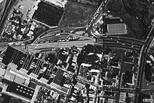
- Marion Section
-
 The American Can Company Building
The Marion Section is a district on the West Side of Jersey City, New Jersey.[1]
West of Journal Square and north of Holy Name Cemetery, the Marion's two distinct neighborhoods are separated by PATH rail lines It borders other districts of Riverbend, Croxton and the West Side, and is sometimes is considered to include the area along the Hackensack Riverfront, Tonnele Circle, and neighborhood overlapping India Square. Marion is mostly a low-rise residential district that is home to several new housing developments, light manufacturing, restaurants, LaPointe Park and the Marion Branch Public Library. Broadway, U.S. Route 1/9, Sip Avenue and West Side Avenue are the main streets running through the neighborhood.
 The warehouse district north of the PATH line
Many of the manufacturing and warehouse buildings along St Paul's Avenue have received a New Jersey State historical designation. The 1940 Marion Gardens housing Project creates the western residential border for the section.[2]
Jersey City's mayor, Jerramiah Healy has requested that Marion be given a stop on the PATH train at Broadway and West Side Avenue.[3] There are a growing number of condos and other housing units being built in the Marion neighborhood and city officials feel a stop on the PATH system will be necessary to unclog the city streets and lessen the commute for residents. Officials feel a station would help to bolster development in the neighborhood, which has fewer cultural attractions than many Jersey City neighborhoods and is without a school. Public School #23 operates on Romaine Ave.
The Marion Greenway Park has received funding and eventually will connect to the Hackensack RiverWalk.[4][5]
See also
- Hackensack Riverfront
- Hackensack RiverWalk
- Hudson Generating Station
- Holy Name Cemetery, Jersey City
- Tonnele Circle
- Marion Junction
- Pulaski Skyway
- Riverbend
References
- ^ Jersey City's Districts
- ^ http://www.jcha-gov.us/sites/MarionGardens.aspx Marion Gardens
- ^ Newe PATH Station in Jersey City Marion: PATH Trains Hudson Tubes Hudson & Manhattan RR
- ^ [1] Marion Greenway Park
- ^ http://www.jerseycityindependent.com/2011/01/12/first-phase-of-landfill-to-park-redevelopment-on-hackensack-riverfront-slated-to-be-complete-this-summer/
External links
- Marion Library
- Marion PATH Station?, Jersey Journal, May 15, 2006
- Marion Gardens
Neighborhoods in Jersey City, New Jersey Bergen-Lafayette 
Downtown Exchange Place · Hamilton Park · Harsimus · Holland Tunnel · Pavonia Newport · Paulus Hook · Van Vorst Park · The Village · WALDO/PowerhouseGreenville The Heights Journal Square Meadowlands Upper New York Bay West Side Coordinates: 40°44′07″N 74°04′27″W / 40.73538°N 74.07403°W
Categories:- Neighborhoods in Jersey City, New Jersey
Wikimedia Foundation. 2010.

