- Milo, Oklahoma
-
Milo — Unincorporated community — Location within the state of Oklahoma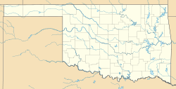
 Milo
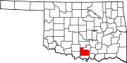
MiloCoordinates: 34°19′57″N 97°20′22″W / 34.3325°N 97.33944°WCoordinates: 34°19′57″N 97°20′22″W / 34.3325°N 97.33944°W Country United States State Oklahoma County Carter Time zone Central (CST) (UTC-6) - Summer (DST) CDT (UTC-5) ZIP codes 73401 FIPS code GNIS feature ID Milo is a rural community located in Carter County, Oklahoma, on State Highway 53 south of the Arbuckles. The post office opened October 28, 1899. The ZIP Code is 73401. Milo is said to have been named the initials of the four daughters of resident, J.W. Johnson.
Sources
- Shirk, George H. Oklahoma Place Names. Norman: University of Oklahoma Press, 1987. ISBN 0-8061-2028-2 .
Municipalities and communities of Carter County, Oklahoma County seat: Ardmore Cities Ardmore | Healdton | Lone Grove | Wilson
Towns Dickson | Gene Autry | Ratliff City | Springer | Tatums
Unincorporated
communitiesAlpers | Baum | Cheek | Berwyn | Brock | Caldwell Hill | Clemscot | Cobalt Junction | Countyline‡ | Dillard | Dripping Springs | Dundee | Durwood | Fox | Glenn | Graham | Hewitt | Milo | Newport | Oil City | Old Scott | Pooleville | Post Oak | Provence | Pruitt City | Reck | Rexroat | Tussy‡ | Wirt | Woodford | Zaneis
Ghost towns Pike City
Footnotes ‡This populated place also has portions in an adjacent county or counties
Categories:- Populated places in Carter County, Oklahoma
- Unincorporated communities in Oklahoma
- Oklahoma geography stubs


Wikimedia Foundation. 2010.