- Countyline, Oklahoma
-
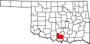
Countyline — Unincorporated community — Location within the state of Oklahoma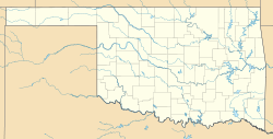
 Countyline
Coordinates: 34°26′55″N 97°33′46″W / 34.44861°N 97.56278°WCoordinates: 34°26′55″N 97°33′46″W / 34.44861°N 97.56278°W Country United States State Oklahoma County Carter and Stephens Time zone Central (CST) (UTC-6) – Summer (DST) CDT (UTC-5) ZIP codes 73425 FIPS code GNIS feature ID Countyline, or County Line, is a rural unincorporated community north of State Highway 7 on the Stephens-Carter county line in south central Oklahoma. The post office opened June 29, 1928. The ZIP Code is 73425.
Sources
- Shirk, George H. Oklahoma Place Names. Norman: University of Oklahoma Press, 1987. ISBN 0-8061-2028-2 .
Municipalities and communities of Carter County, Oklahoma Cities Ardmore | Healdton | Lone Grove | Wilson
Towns Dickson | Gene Autry | Ratliff City | Springer | Tatums
Unincorporated
communitiesAlpers | Baum | Cheek | Berwyn | Brock | Caldwell Hill | Clemscot | Cobalt Junction | Countyline‡ | Dillard | Dripping Springs | Dundee | Durwood | Fox | Glenn | Graham | Hewitt | Milo | Newport | Oil City | Old Scott | Pooleville | Post Oak | Provence | Pruitt City | Reck | Rexroat | Tussy‡ | Wirt | Woodford | Zaneis
Ghost towns Pike City
Footnotes ‡This populated place also has portions in an adjacent county or counties
Municipalities and communities of Stephens County, Oklahoma Cities 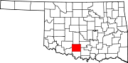
Towns Bray | Central High | Empire City | Loco | Velma
CDP Unincorporated
communitiesGhost town Arthur
Categories:- Populated places in Carter County, Oklahoma
- Populated places in Stephens County, Oklahoma
- Unincorporated communities in Oklahoma
- Oklahoma geography stubs


Wikimedia Foundation. 2010.