- Coria (Corbridge)
-
Coordinates: 54°58′42″N 2°01′59″W / 54.9784°N 2.03316°W
Coria (Corbridge) 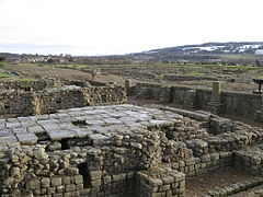
Corbridge Roman Site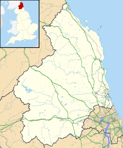
 Coria (Corbridge)
 Coria (Corbridge) shown within Northumberland
OS grid reference NY981647 List of places: UK • England • Northumberland 
This article is part of the series on:
Military of ancient Rome (portal)
753 BC – AD 476Structural history Roman army (unit types and ranks, legions, auxiliaries, generals) Roman navy (fleets, admirals) Campaign history Lists of wars and battles Decorations and punishments Technological history Military engineering (castra, siege engines, arches, roads) Political history Strategy and tactics Infantry tactics Frontiers and fortifications (limes, Hadrian's Wall) Coria was a fort and town, located 2.5 miles (4.0 km) south of Hadrian's Wall, in the Roman province of Britannia. Its full Latin name is uncertain. Today it is known as Corchester or Corbridge Roman Site, adjoining Corbridge in the English county of Northumberland. It is currently in the guardianship of English Heritage and is partially exposed as a visitor attraction, including a site museum.
Contents
Name
The place-name appears in contemporary records as both Corstopitum and Corie Lopocarium. These forms are generally recognised as corrupt. Suggested reconstructions include Coriosopitum, Corsopitum or Corsobetum. However, the Vindolanda tablets show that is was locally referred to by the simple form, Coria[1], the name for a local tribal centre. The suffix ought to represent the name of the local tribe, a member of the Brigantian confederation, but its correct form is, as yet, unknown[2].
Early occupation
There is evidence of Iron Age round houses on the site, but the first Romans in the area built the Red House Fort, half a mile (800 m) to the west, as a supply camp for Agricola's campaigns. [3]
Forts
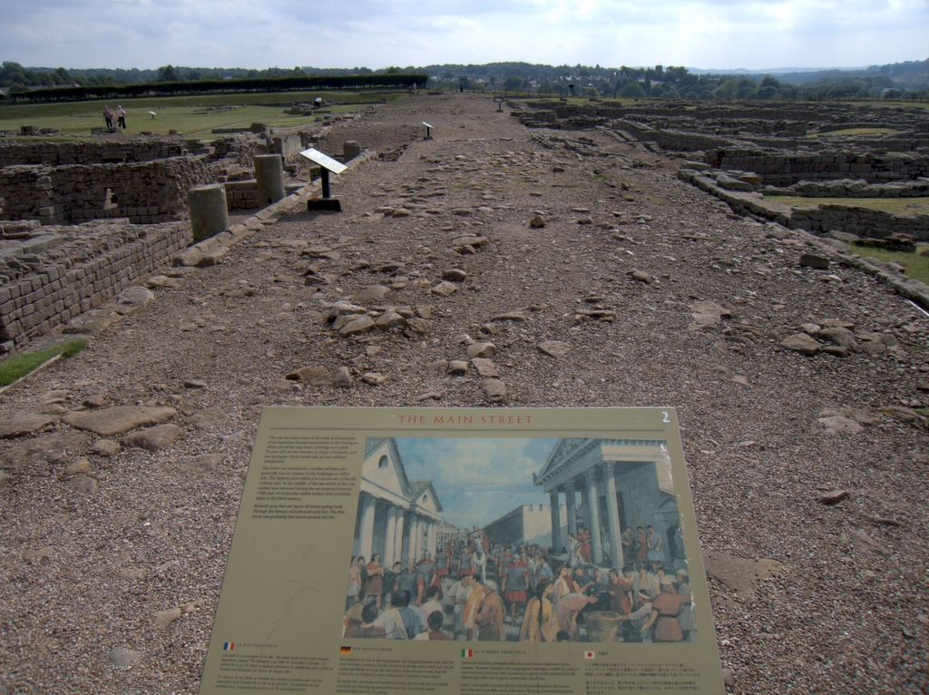
 The Stanegate, Corbridge Roman Site
Soon after Roman victories in modern Scotland, around AD 84, a new fort was built on the present site with turf ramparts and timber gates. Internally, barrack blocks surrounded a headquarters building, a commander’s residence, administrative staff accommodation, workshops and granaries. It was probably occupied by a 500-strong cavalry unit called the Ala Petriana, but was destroyed by fire in AD 105. A second timber fort was built guarding a major crossing of the River Tyne at a time when the Solway Firth-Tyne divide was the Roman frontier. Around AD 120, when Hadrian’s Wall was built, the fort was again rebuilt, probably to house infantry troops away from the Wall. About twenty years later, when the frontier was pushed further north and the Antonine Wall built, the first stone fort was erected under the Governor Quintus Lollius Urbicus[3].
Town development
After the Romans fell back to Hadrian's Wall in AD 163, the army seems to have been largely removed from Coria. Its ramparts were levelled and a major rebuilding programme of a very different nature was instigated. A series of probable temples were erected, followed by granaries, a fountain house and a large courtyard complex which may have been intended to become a civilian forum or a military storehouse and workshop establishment. It was never finished in its original plan[3].
Burnt timber buildings may relate to Cassius Dio's reference to enemy tribes crossing the frontier, but by the early 3rd century there was more construction. Two compounds opposite the supposed forum were built as part of a military supply depot within the town. It was connected with both the Second and the Sixth Legion and may have been part of the supply network for Septimus Severus' northern campaigns[3].
Information on the 3rd and 4th century town is lacking, but an elaborate house was certainly put up which may have housed an Imperial official of some kind. Coria was probably a major market centre for the mineral industries in the area – lead, iron and coal – as well as agriculture, as evidenced by the granaries. A pottery store has also been identified. When occupation came to an end is unclear. It is not even known if the site was still occupied when the Anglo-Saxons arrived to found adjoining Corbridge[3].
The Corbridge Hoard was found here.
In fiction
In Rosemary Sutcliff's 1965 novel The Mark of the Horse Lord the lead character is a gladiator in Corstopitum, before leaving to join the Dal Riata north of the Antonine Wall.
References
- ^ Breeze, David J (2006). J Collingwood Bruce’s Handbook to the Roman Wall. Newcastle-upon-Tyne: The Society of Antiquaries of Newcastle upon Tyne.
- ^ Rivet, A L F; Smith, Colin (1979). The Place-Names of Roman Britain. London: B T Batsford.
- ^ a b c d e Dore, J N (1989). Corbridge Roman Site. London: English Heritage.
External links
- English Heritage web page on Corbridge Roman Site
- Teachers' resource pack: English Heritage Handling Collection
- Archaeological research Hadrian's Wall 1976-2000: English Heritage
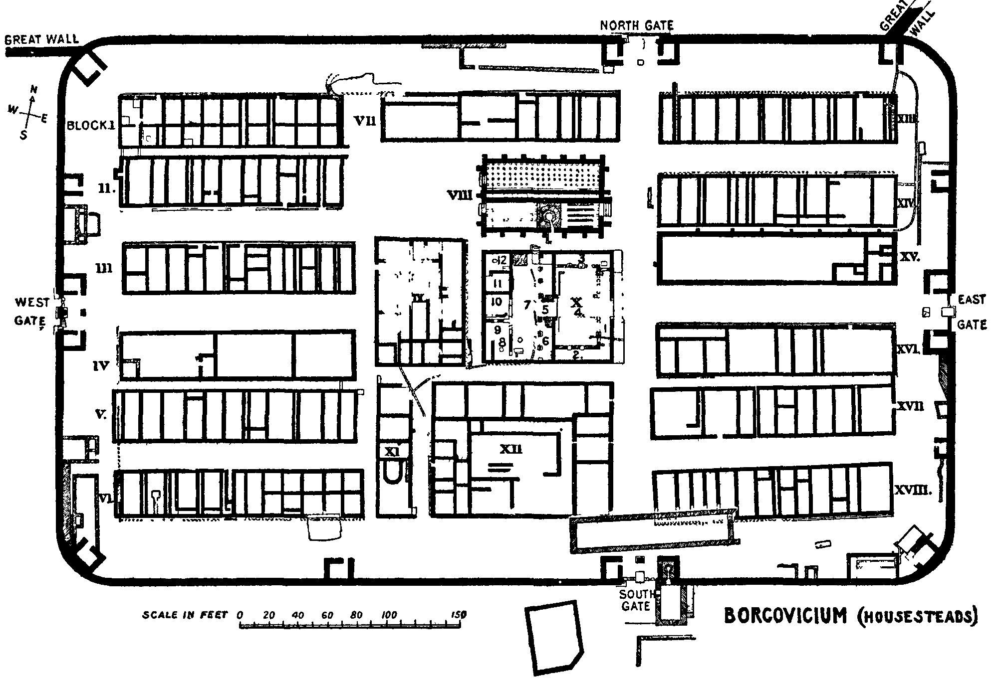
Wall Forts (East to West) Segedunum • Pons Aelius • Condercum • Vindobala • Onnum • Cilurnum • Procolita • Vercovicium • Aesica • Magnis • Banna • Camboglanna • Uxelodunum • Aballava • Coggabata • Maia
Outpost Forts Stanegate Forts Corstopitum • Newbrough • Vindolanda • Haltwhistle Burn • Magnis • Throp • Nether Denton • Castle Hill Boothby • Brampton Old Church • LuguvaliumSupply Forts Roman visitor sites in the UK Villas Bignor • Brading • Chedworth • Crofton • Dover Painted House • Littlecote • Lullingstone • Fishbourne • Newport • Piddington • Rockbourne • Wroxeter
Forts & Military Towns Roman Museums Canterbury Roman Museum • Carvoran Roman Army Museum • Corinium Museum • Jewry Wall Museum • Ribchester • Senhouse Roman Museum • Trimontium Trust (Melrose) • Verulamium MuseumOther sites Bath Roman Baths • Caerleon Roman Baths • Verulamium Roman Theatre • Welwyn Roman Baths • York Roman BathsCategories:- Roman towns and cities in England
- Roman forts in England
- Roman sites in Northumberland
- English Heritage sites in Northumberland
- History of Northumberland
- Former populated places in England
- Museums in Northumberland
- Museums of Ancient Rome in the United Kingdom
- Archaeology museums in England


Wikimedia Foundation. 2010.