- Merrow, Surrey
-
Coordinates: 51°14′47″N 0°31′40″W / 51.2463°N 0.5279°W
Merrow 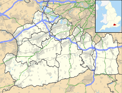
 Merrow
Merrow shown within SurreyPopulation 7,706 [1] OS grid reference TQ022508 District Guildford Shire county Surrey Region South East Country England Sovereign state United Kingdom Post town GUILDFORD Postcode district GU1, GU4 Dialling code 01483 Police Surrey Fire Surrey Ambulance South East Coast EU Parliament South East England UK Parliament Guildford List of places: UK • England • Surrey The village of Merrow, in Surrey, England, lies on the north-east corner of Guildford. It is about two miles from the town centre, right on the edge of the ridge of hills that forms the North Downs. Although now a relatively anonymous suburb, the village can trace its origins back many hundreds of years. According to the Institute for Name-Studies, Merrow means 'fat', literally, "probably referring to the high fertility of the land".[2]
Merrow is separated from Burpham (to the north-west) by the New Guildford Line, the railway line between Guildford and Effingham Junction.
Contents
History
The village grew up around a crossroads: where what is now the A25, the road between Guildford and Leatherhead, crossed the original road (Merrow Street) from Burpham to Dorking.
The oldest houses in the village can still be seen along these two roads, together with St John's Church and the Horse and Groom, a 17th century coaching inn next door. The old Dorking road squeezes between the church and the inn, creating a significant bottleneck for modern motor traffic.
To the north is Clandon Park, once the home of the Onslow family, and now a National Trust property. The Onslows provided some of the earliest Speakers of the House of Commons, such as Arthur Onslow who held this post through the reign of George II.
Merrow remained a relatively small settlement right up to the 1950s, when the Bushy Hill estate was built. This development of several hundred houses was originally all council-owned, but since the 1980s, many have passed into private ownership.
Further expansion occurred in the mid-1980s. In the green-field site bordered by Burpham, the Bushy Hill estate and Clandon Park, the Merrow Park development was built, completely surrounding the old houses on Merrow Street. Comprising several thousand houses, Merrow Park is often considered a suburb in its own right and has its own shops, school and doctor's surgery.
St John's Church
The parish church of St John the Evangelist was built in the mid 12th century and a few early features have survived later additions, such as a Norman arch and a 13th century chapel.
The churchyard is the burial place of the Onslow family.
There is a war memorial in the churchyard, dedicated to those who lost their lives in the First and Second World Wars. This was re-dedicated in 2002 following a restoration and research project part-funded by a Heritage Lottery Fund grant.
The church hall (The St. John's Centre) is a focal point for the community and was reopened in 2001 following a major refurbishing and enlargement project.
Schools
- Merrow C of E Infant School (ages 4 – 7)
- Bushy Hill Junior School (ages 7 – 11)
- Boxgrove Primary School (ages 4 – 11)
- St Thomas of Canterbury Catholic Primary School (ages 4 – 11)
- St Peter's Catholic Comprehensive School (ages 11 – 18)
St Peter's School also has a sixth form college.
Churches
- St. John the Evangelist parish church, Anglican (Church of England)
- Merrow Methodist Church
- St. Pius X Roman Catholic church
Sport and leisure
Merrow is situated right on the edge of the North Downs. Guildford Golf Club, the oldest Golf Course in Surrey, is located on the Downs. A short walk from Merrow is Newlands Corner, a popular beauty spot in the Surrey Hills Area of Outstanding Natural Beauty.
Merrow has a non-league football club (Merrow F.C.), a tennis club and a cricket club, as well as a fitness club (which was formerly known as "Dragons").
Merrow Dramatic Society is claimed to be the oldest amateur dramatic group in Guildford, having been in existence for over 80 years. Each year, the Society produces two plays, performed at the Electric Theatre in Guildford, and a traditional pantomime, put on at Merrow Village Hall (built 1909). They also take part in Drama Festivals (winning recently at both Guildford and Woking) and host their own variety evenings.
Merrow F.C.
The non-League football club, Merrow F.C., nicknamed "The Robins", was established in 1922. Their home ground is The Urnfield, Downside Road, in Merrow (51°14′14.72″N 0°32′11.69″W / 51.2374222°N 0.5365806°W). The club was among the founding members of the Surrey Premier League in 1982.
At the end of the 2007–08 season the club resigned from Division 1 of the Combined Counties League and joined the Surrey County Intermediate League (Western), playing in the Premier Division. In the 2009–10 season the club finished in 8th position.
Their average home attendance is 8, which leaves them ranked 737th in England.[3]
Transport
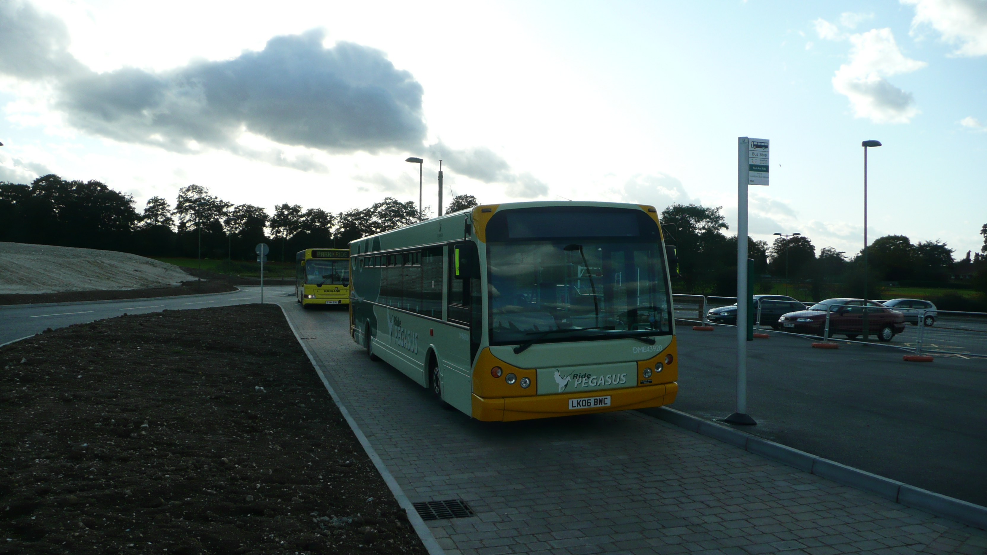
 Merrow park and ride.
Merrow is on several bus routes that start or finish in Guildford.
A park and ride facility was built to the north of the village, construction starting in Autumn 2006, which opened on 29 September 2008. This service, operated by Safeguard Coaches on behalf of Guildford Borough Council and Surrey County Council, was introduced to reduce the traffic levels between Merrow and the town centre.
There have been several proposals to build a railway station on the Guildford to Effingham Junction line, the most probable site being the Surrey County Council depot near Burpham. As yet the funding has not been forthcoming to develop this further, although a feasibility study was carried out.
Literature
Merrow Downs in prehistory is the setting for two of the Just So Stories by Rudyard Kipling: "How the First Letter was Written" and "How the Alphabet was Made".
Trivia
- Residents of Merrow are known as Merrovians.
See also
References
- ^ Census data
- ^ "Merrow, Surrey". A Key to English Placenames. Institute for Name-Studies, School of English Studies, University of Nottingham. http://www.nottingham.ac.uk/~aezins//kepn/detailpop.php?placeno=8317. Retrieved 26 April 2011.
- ^ http://www.tonykempster.co.uk/archive05-06/attcomp.htm Attendance Comparisons
External links
History
- Merrow Village History
- History of Merrow, from Census records and 'travellers' tales'
- War memorial restoration project
- Record of stained glass windows in St. John's Church
Churches
- St. John the Evangelist parish church
- Merrow Methodist Church
- St. Pius X, Roman Catholic church
Community
- Merrow Residents Association - includes news concerning developments in the Merrow area
- 1st Merrow Scout Group
- Merrow C of E Infant School
- Merrow Dramatic Society
Towns, villages and hamlets in the Guildford District of Surrey, England  Albury · Artington · Ash · Ash Vale · Burntcommon · Burpham · Chilworth · Compton · East Clandon · East Horsley · Effingham · Fairlands · Farley Green · Gomshall · Guildford · Jacobs Well · Merrow · Normandy · Ockham · Onslow Village · Peaslake · Pirbright · Puttenham · Ripley · Seale · Shalford · Send · Shere · St Martha · Stoughton · Tongham · Wanborough · West Clandon · West Horsley · Wisley · Wood Street Village · WorplesdonCategories:
- Guildford
- Villages in Surrey


Wikimedia Foundation. 2010.