- Omemee, North Dakota
-
Omemee, North Dakota Location of Omemee, North Dakota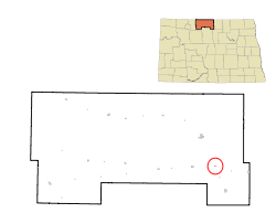
Coordinates: 48°42′23″N 100°21′18″W / 48.70639°N 100.355°WCoordinates: 48°42′23″N 100°21′18″W / 48.70639°N 100.355°W Country United States State North Dakota County Bottineau County Township Willow Vale Legislative district 6th Founded 1887 Incorporated 1902 Disincorporated ca. 1990 Elevation 1,512 ft (461 m) Time zone Central (CST) (UTC-6) – Summer (DST) CDT (UTC-5) Area code(s) 701 FIPS code 38-59420[1] GNIS feature ID 1030570[1] Omemee is a ghost town in Bottineau County in the U.S. State of North Dakota. It was a railroad hub in the early 1910s, located at the junction of two major railroads, the Soo Line Railroad and the Great Northern Railway. Incorporated as a city in 1902,[2] Omemee has been abandoned since the late 1980s.
Contents
History
 Map with Omemee at center
Omemee was founded in 1887 in Willow Vale Township. It is named after Omemee, Ontario, in Canada, which was the hometown of Omemee's first post master. Omemee itself is an alternate spelling of the Ojibwe word omimi, meaning "dove." The post office opened in 1890 and closed in 1967, with mail service transferring to nearby Willow City. The town was incorporated in 1902 and was moved slightly in 1903 to the junction of the Great Northern Railway and the Soo Line Railway in 1903.[3] Omemee disincorporated as a city prior to the 1990 Census.[4] It currently has no population.
A 1906 review by the North Dakota Department of Agriculture and Labor[5] indicated Omemee was the fourth largest town in Bottineau County. However, by the time it was founded, the cities of Bottineau and Willow City had grown to dominate trade in the region. Omemee, located between both towns was at a disadvangate, since many farmers had grown accustomed to doing business in those towns. Many predicted its status as a hub between two railroads would lead to substantial growth, making Omemee the railroad center of Bottineau County.
In 1906, the town already boasted numerous businesses, including general stores, banks, hotels, a restaurant, school, opera house,[5] and a newspaper, the Omemee Herald.[6] Omemee Brick Company operated a plant three miles north of town.[7] The town also claimed it had "one of the best brass bands in the state" at 22 members, and the only musical organization in the state with "a quartette of saxophones [sic.]".[5]
However, the lack of a townsite company to promote the town, the predicted population boom never came and the town declined in later years.[5]
In 1998, the Canadian Museum of Rail Travel in Cranbrook, British Columbia, British Columbia, bought and restored a 1906 sleeper car. Originally built by Barney and Smith Car Company, the railcar was previously owned by a former Soo Line Railroad employee, and was named Omemee in honor of the old rail station.[8] The car is now on permanent display at the museum.[9]
Geography
Omemee is located in the eastern part of Bottineau County. It lies in the Souris River basin, which is part of the ancient lake bed of Lake Souris, a large glacial lake in the area responsible for much of the surrounding geology. East of the town, undulations of the prairie rise often ten feet above the adjoining hollows. These swells form the moranic hills which were not entirely leveled down by the waves of the lake. The high and rugged hills of the same moraines beyond the lake shore show how much the action of the waves leveled the hills which were deposited in the waters of the lake.[10]
Demographics
The city had a high population of 650 in 1906,[3] but by the 1910 Census it had declined to 332.[11] The population fluctuated until the 1970 Census when the recorded population was just 5 people. However, the 1980 Census showed a population increase to 10 people.[12]
When Omemee disincorporated, the 1990 Census reported only 3 remaining residents. The area reverted to Willow Vale Township,[4] which recorded a 2000 Census population of 34.[13]
German settlers established an evangelical church in Omemee in the early 1900s.[14]
Land sale controversy
In the early 2000s, real estate developers begain selling lots in Omemee to buyers in the United States, Canada, Australia, and New Zealand. Advertisements described a typical lot as "a great retirement home site and a superb investment." However, county officials contradicted those claims saying the lots were "unfit for development". Many buyers purchased the lots site unseen through eBay or other online providers. Some buyers treated the purchases as investments, with no intent to ever build or move to North Dakota, while others felt they were misled once they saw the nature of the property they had purchased. Some property owners complained to the North Dakota Attorney General's office, which found no misrepresentations to prosecute.[15]
Notable natives
- Duncan Fraser (1890 – 1967), member of the North Dakota House of Representatives (1939 – 1948) and North Dakota State Senator (1949 – 1958)[16]
- Matt Johnson (1871 – 1935), editor of the Omemee Herald and member of the North Dakota House of Representatives (1909 – 1910)[6][17]
References
- ^ a b "US Board on Geographic Names". United States Geological Survey. 2007-10-25. http://geonames.usgs.gov. Retrieved 2008-01-31.
- ^ All incorporated communities in North Dakota are called "cities" regardless of their size.
- ^ a b Wick, Douglas A.. North Dakota Place Names. Hedemarken Collectibles. pp. 145. ISBN 0-9620968-0-6.
- ^ a b U.S. Census Bureau (1992). "Population and Housing Unit Counts, North Dakota" (PDF). 1990 Census of Population and Housing. Government Printing Office. http://www.census.gov/prod/cen1990/cph2/cph-2-36.pdf. Retrieved 2008-07-20.
- ^ a b c d "North Dakota magazine: the state's resources--agricultural, industrial, & commercial". North Dakota magazine (North Dakota Department of Agriculture) 1 (1): 51–52. 1906. OCLC 01715730. http://books.google.com/?id=Y-xYAAAAMAAJ&pg=PA51&dq=omemee,+north+dakota.
- ^ a b Lounsberry, Clement Augustus (1919). Early History of North Dakota: Essential Outlines of American History. Washington, D.C.: Liberty Press. pp. 492. OCLC 02465171. http://books.google.com/?id=Go0dAAAAYAAJ. Retrieved 2009-07-27.
- ^ Biennial report. Washington, D.C.: North Dakota Geological Survey. 1906. pp. 300. OCLC 02465171. http://books.google.com/?id=4T4QAAAAIAAJ. Retrieved 2009-07-27.
- ^ Associated Press (1998-05-17). "Cottage to Hit the Rails Again". Millwaukee Sentinal Journal. pp. 7. http://nl.newsbank.com/nl-search/we/Archives?p_product=MWSB&p_theme=mwsb&p_action=search&p_maxdocs=200&p_topdoc=1&p_text_direct-0=0EB82BA0463E69DC&p_field_direct-0=document_id&p_perpage=10&p_sort=YMD_date:D&s_trackval=GooglePM. Retrieved 2009-08-05., via Westlaw.
- ^ "Facilities and Tour Map". Canadian Museum of Rail Travel. March 2006. http://www.crowsnest.bc.ca/cmrt/7680-tours-no-parking.pdf. Retrieved 2009-08-05.
- ^ Willard, Daniel Everett (1907). The story of the prairies: or, The landscape geology of North Dakota (Fifth ed.). Rand, McNally and Company. pp. 321. OCLC 3626683. http://books.google.com/?id=V3tCAAAAIAAJ&pg=PA321. Retrieved 2009-07-27.
- ^ U.S. Census Bureau (1901). "Number of Inhabitants, North Dakota" (PDF). Twelfth Census of the United States: 1910. Government Printing Office. http://www2.census.gov/prod2/decennial/documents/33405927v1ch06.pdf. Retrieved 2008-07-20.
- ^ U.S. Census Bureau (1981). "Number of Inhabitants, North Dakota" (PDF). 1980 Census of Population and Housing. Government Printing Office. http://www2.census.gov/prod2/decennial/documents/1980a_ndABCD-01.pdf. Retrieved 2008-07-20.
- ^ U.S. Census Bureau. Census 2000. "Census Demographic Profiles, Willow Vale Township" (PDF). CenStats Databases. <http://censtats.census.gov/data/>. http://censtats.census.gov/data/ND/0603800986500.pdf. Retrieved 2009-01-31.
- ^ Sherman, William C. (1983). Pairie Mosaic: An Ethnic Atlas of Rural North Dakota. Fargo, North Dakota: North Dakota Institute for Regional Studies. pp. 66. ISBN 091104227X. OCLC 256228966.
- ^ "People From All Over Buying 'Ghost Town' Property". Associated Press. 2005-07-26. http://wcco.com/local/ghost.town.North.2.348691.html. Retrieved 2009-07-27.[dead link]
- ^ Dakota Lawmakers (F), North Dakota Legislative Council
- ^ Dakota Lawmakers (J), North Dakota Legislative Council
External links
Municipalities and communities of Bottineau County, North Dakota Cities 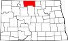
Townships Amity | Antler | Bentinck | Blaine | Brander | Cecil | Chatfield | Cordelia | Cut Bank | Dalen | Eidsvold | Elms | Elysian | Haram | Hastings | Hoffman | Homen | Kane | Lansford | Lewis | Lordsburg | Mount Rose | Newborg | Oak Creek | Oak Valley | Ostby | Peabody | Pickering | Renville | Richburg | Roland | Scandia | Scotia | Sergius | Sherman | Starbuck | Stone Creek | Tacoma | Wayne | Wellington | Wheaton | Whitby | Whitteron | Willow Vale
Unincorporated
communityBelmar | Carbury | Dunning | Eckman | Forfar | Hurd | Kuroki | Omemee | Roth | Russell | Truro | White
Categories:- Ghost towns in North Dakota
- Populated places in Bottineau County, North Dakota
- Former municipalities in North Dakota
- Populated places established in 1887


Wikimedia Foundation. 2010.