- New Ireland (island)
-
For the political strategy of the Provisional IRA and Sinn Féin meaning New Ireland in English, see Éire Nua.
New Ireland Native name: Niu Ailan 
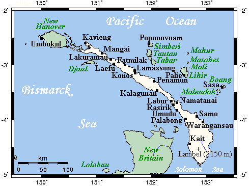
New Ireland's main towns and nearby islands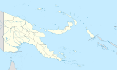
 New Ireland (island) (Papua New Guinea)
Geography Coordinates 3°20′S 152°00′E / 3.33°S 152°E Archipelago Bismarck Archipelago Area 7,404 km2 (2,858.7 sq mi) Length 360 km (224 mi) Width 10 km (6 mi) - 40 km (25 mi) Highest elevation 2,379 m (7,805 ft) Highest point Mount Taron Country Papua New GuineaProvince New Ireland Province Largest city Kavieng (pop. 10,600) Demographics Population 118,350[1] (as of 2002) New Ireland (Tok Pisin: Niu Ailan) is a large island in Papua New Guinea, approximately 7,404 km² in area[2]. It is the largest island of the New Ireland Province, lying northeast of the island of New Britain. Both islands are part of the Bismarck Archipelago, named after Otto von Bismarck, and they are separated by Saint George's Channel. The administrative centre of the island and of New Ireland province is the town of Kavieng located at the northern end of the island. While the island was part of German New Guinea, it was named Neumecklenburg ("New Mecklenburg").
Contents
Geography
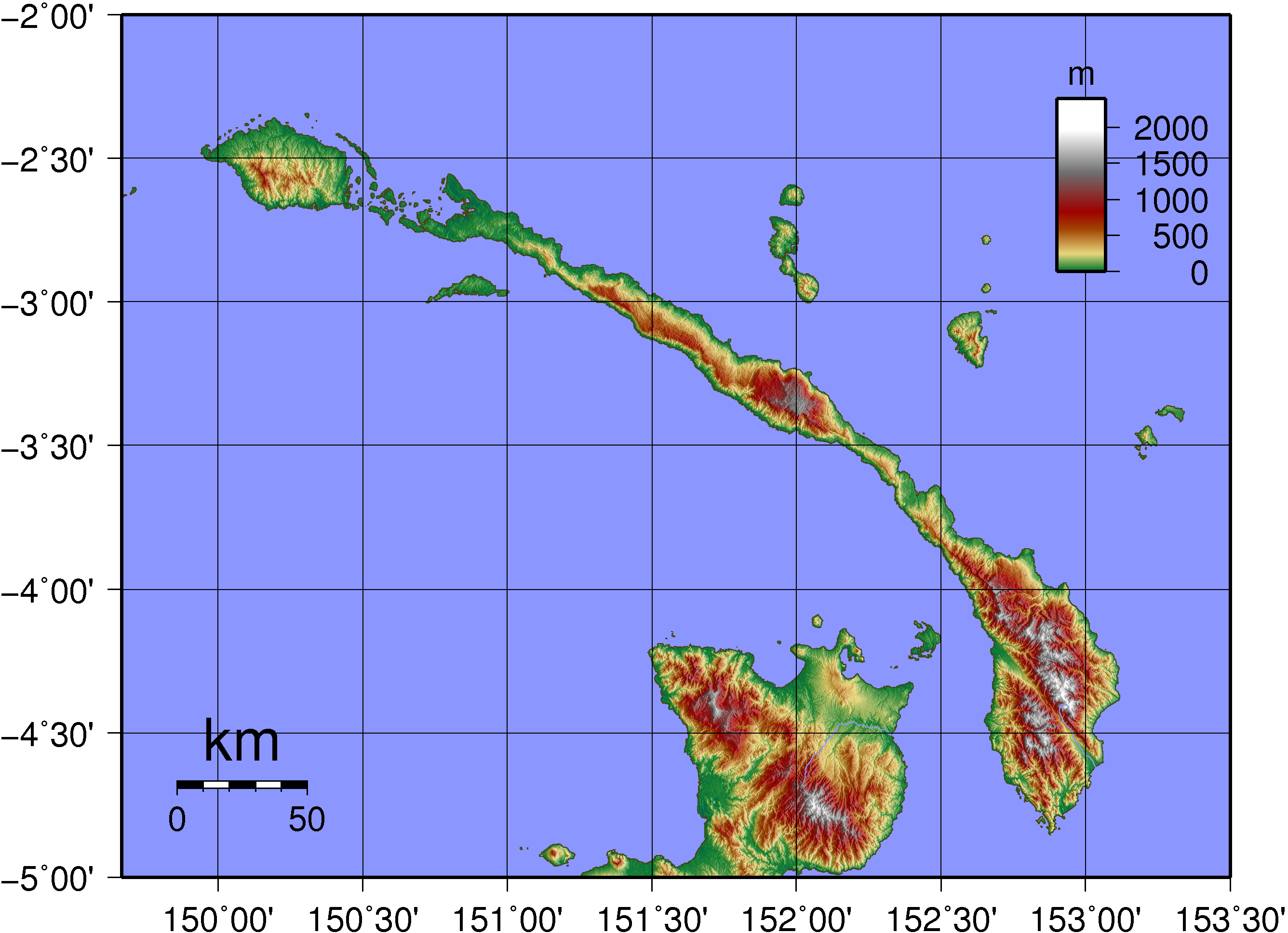
 Topographic map of New Ireland
The island is part of the Bismarck Archipelago and is often described as having the shape of a musket. For much of its 360 kilometers in length, the island's width varies between less than 10 km to 40 km, yet the central mountainous spine is very steep and rugged. The highest peak is Mount Taron in the Hans Meyer Range (2,379 meters). Other mountain ranges are Tirpitz, Schleinitz, Verron and Rossel.[3] The island lies between two and five degrees south of the equator. The original land cover was primarily dense rainforest.
New Ireland is surrounded by the Bismarck Sea in the southwest and by the Pacific Ocean in the northeast.
History
The first inhabitants of the Bismarck Archipelago arrived around 33,000 years ago after sailing from what is now Papua New Guinea. Later arrivals included the Lapita people approximately 3,000 years ago.
In 1616 the Dutch sailors Jacob Le Maire and Willem Schouten were the first Europeans to set foot on the island.
In the 1870s and 1880s, the Marquis de Rays, a French nobleman, attempted to establish a French colony on the island called New France.[4] He sent four ill-fated expeditions to the island, the most famous of which caused the death of 123 settlers.
From 1885 to 1914 New Ireland was a part of German New Guinea and bore the name Neumecklenburg. Germans managed several highly profitable copra plantations and built a road to transport the goods. This road is currently in service and is named the Boluminski Highway after the German administrator of German New Guinea, Franz Boluminski. After World War I New Ireland was ceded to Australia. In 1942, during World War II, the island was captured by Japanese forces and was under their control. The Japanese built a large naval base at Kavieng, but the entire island of New Ireland was bypassed by Allied troops and left to "wither on the vine" until the final Japanese surrender on 2 September 1945 in Tokyo Bay.
Culture
- Malagan - funerary arts that originate in Tabar Group, and have been imported to the northern region of New Ireland.[5]
- Tatanua - "The person who organises a tatanua performance must select the music and dancers, assemble a male chorus and acquire the masks. The masks are usually rented from one of the sculptors who makes them." [6]
- Kulap - chalk limestone funerary sculptures Male Figure (Kulap) at the Metropolitan Museum of Art
References
- ^ New Ireland Province
- ^ United Nations Environment Program, "Islands by land area: New Ireland," islands.unep.ch (1988).
- ^ NI mountains tell a tale
- ^ Ben Cahoon, "Papua New Guinea," World Statesmen.org (2000).
- ^ Gunn, Michael; Phillipe Feltier (2006). New Ireland: Art of the South Pacific. Milan: Continents Editions. ISBN 88-7439-369-5.
- ^ d'Alleva, Anne. Kara Hattersley-Smith. ed. Arts of the Pacific Islands. New York: Perspectives - Harry N. Abrams, Inc., Publishers. pp. 75. ISBN 0-8109-2722-5.
External links
- Entry at the Linköping University
- WWF Terrestrial Ecoregions - New Britain-New Ireland lowland rain forests (AA0111)
- Persée : Archaeological survey in southern New Ireland
- Wallaby extinctions at the Macropodid frontier
Coordinates: 3°20′S 152°00′E / 3.33°S 152°E
Categories:

Wikimedia Foundation. 2010.