- Dudyńce
-
Coordinates: 49°33′N 22°05′E / 49.55°N 22.083°E
Dudyńce
Dudyńce— Village — Country Poland Region Beskids Founded 1372 Area – Total 8.8 km2 (3.4 sq mi) Elevation 250 m (820 ft) Population – Total 200 Dudyńce, village in East Małopolska in the Beskid mountains, Bukowsko rural commune, parish in loco. Location of Dudynce, sometimes spelled Dwdinicze 1372-1378, Dudenycze - 1436, de Dudenyecz - 1448, Dudence - 1678. Dudyńce is located near the town of Sanok (now in southeastern Poland), located near the towns of Dukla and Palota (in northeastern Slovakia).
Dudyńce is about 10 miles from Sanok in southeast Poland. It is situated below the main watershed at the foot of the Słonne Mountain, and has an elevation of 250 metres. Situated in the Subcarpathian Voivodship (since 1999), previously in Krosno Voivodship (1975-1998) and Sanok district, (10 miles east of Sanok), parish Bukowsko.
Dudyńce was founded in 1372 by prince Władysław Opolczyk. From 966-1018, 1340-1772 (Ruthenian Voivodeship) and from 1918-1939 Dudyńce was part of Poland. While during 1772-1918 it belonged to Austrian empire, later Austrian-Hungarian empire when double monarchy was introduced in Austria.
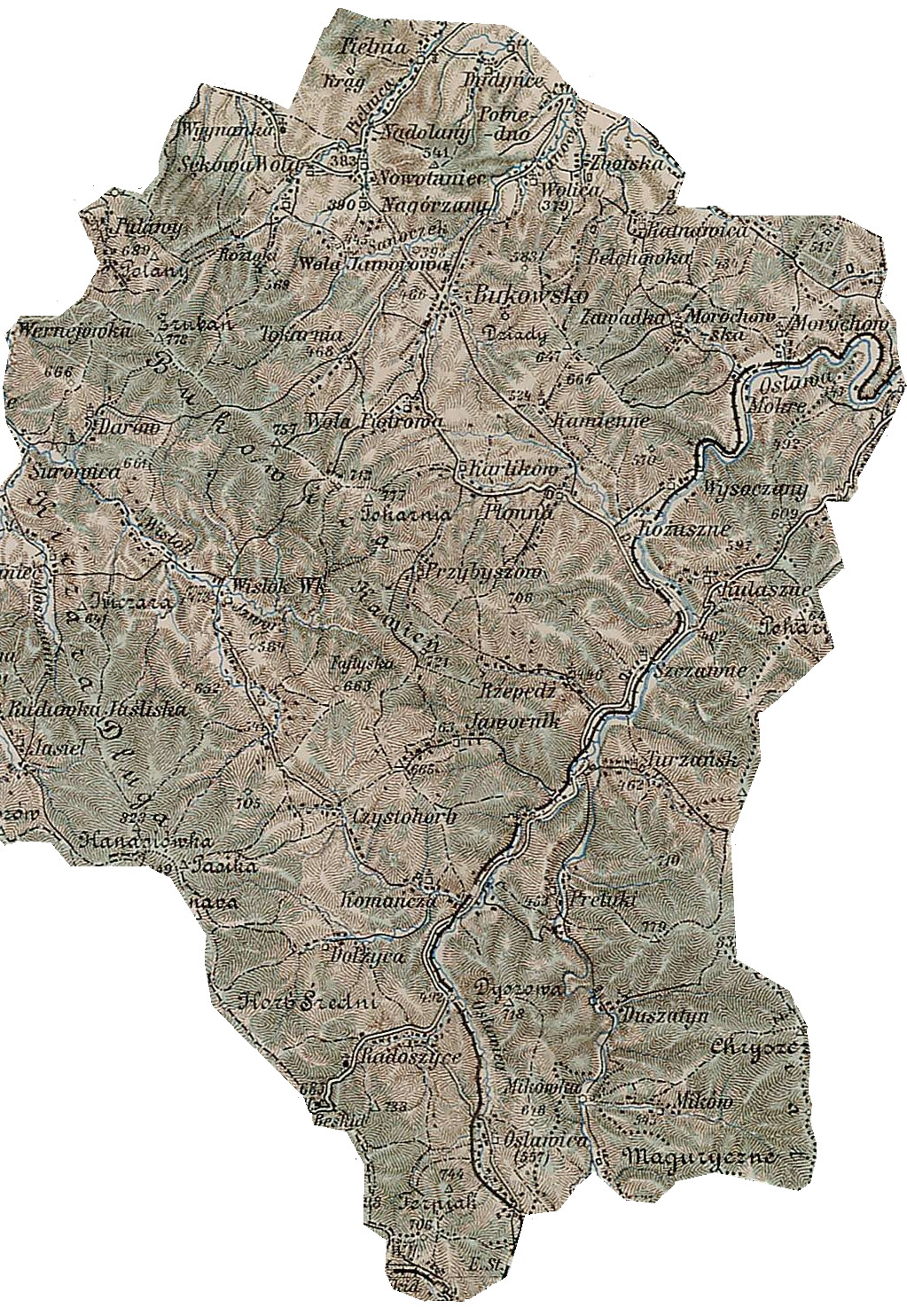
 Gerichts-Bezirk Bukowsko bis 1918, Bukowsko Rural Commune. A 1898 map shows the location of Dudyńce (click to enlarge)
On April, 1946 the village was attacked by a strong unit of UPA and some buildings were burnt. Only over a dozen years after the war the village started to rebuild. Some people left Dudynce on April 29, 1947 (Akcja Wisla) and moved to the Gdansk area of Poland. Some people went to Ukraine in 1946. Dudyńce has a church (R. Catholic) and outside the church there's a cemetery. The rural families are poor, agriculture is rarely profitable and low income makes it difficult for farms to invest in from improvements.
Population
- 1880 - 920
- 1936 - 1140
- 2001 - 200
Literature
- Prof. Adam Fastnacht. Slownik Historyczno-Geograficzny Ziemi Sanockiej w Średniowieczu (Historic-Geographic Dictionary of the Sanok District in the Middle Ages), Kraków, 2002, ISBN 83-88385-14-3.
- Jerzy Zuba "W Gminie Bukowsko". Roksana, 2004, ISBN 83-7343-150-0. Translated by 7Deborah Greenlee. Arlington, TX 76016.
Seat 
Other villages Bełchówka • Dudyńce • Kamienne • Karlików • Nadolany • Nagórzany • Nowotaniec • Płonna • Pobiedno • Przybyszów • Ratnawica • Tokarnia • Wola Piotrowa • Wola Sękowa • Wolica • ZboiskaCategories:- Sanok County geography stubs
- Villages in Sanok County

Wikimedia Foundation. 2010.