- Wola Piotrowa
Geobox|Settlement
name = Wola Piotrawa
category = Village
etymology = Its name comes from the west slavic dialect word "Wola" and Piotr, meaning exactly "little village ofPeter
official_name =
motto =
nickname =
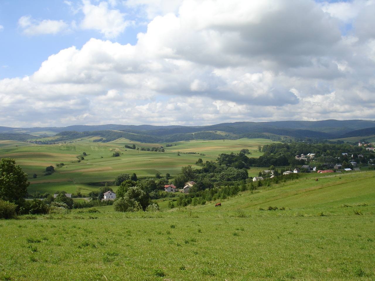
image_caption = ThePogórze Bukowskie is a hilly region (thus the name, Bukowsko hilly region) in Poland (Wola Piotrowa view.
symbol =
symbol_type =
country = Poland
country_
state =
region = Sanok County
district = Gmina Bukowsko
municipality =
landmark =
river = Pielnica, Sanoczek
location =
elevation = 270
prominence =
lat_d =49 | lat_m =31 | lat_s =10 | lat_NS =N
long_d =22 | long_m =02 | long_s =30 | long_EW =E
highest =
highest_location = | highest_region = | highest_state =
highest_elevation =
highest_lat_d = | highest_lat_m = | highest_lat_s = | highest_lat_NS =
highest_long_d = | highest_long_m = | highest_long_s = | highest_long_EW =
lowest =
lowest_location = | lowest_region = | lowest_state =
lowest_elevation =
lowest_lat_d = | lowest_lat_m = | lowest_lat_s = | lowest_lat_NS =
lowest_long_d = | lowest_long_m = | lowest_long_s = | lowest_long_EW =
length = | length_orientation =
width = | width_orientation =
area = 8.8
area_land =
area_water =
area_urban =
area_metro =
population =280 | population_date =31 December 2002
population_urban =
population_metro =
population_density = auto
population_density_urban =
population_density_metro =
established =1526
established_type = First mentioned
date =
government =
government_location = | government_region = | government_state =
government_elevation =
government_lat_d = | government_lat_m = | government_lat_s = | government_lat_NS =
government_long_d = | government_long_m = | government_long_s = | government_long_EW =
mayor =
leader =sołtys Jan Hołomek
timezone =CET | utc_offset =+1
timezone_DST =CEST | utc_offset_DST =+2
postal_code = 38 507
area_code =
area_code_type = Phone prefix
code = KUS, RSA
code_type =Car plate
whs_name =
whs_year =
whs_number =
whs_region =
whs_criteria =
iucn_category =
free = | free_type =
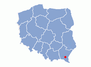
map_caption = Location of Wola Piotrowa inSanok County
map_background =
map_locator =
map1 =
map1_caption =
map1_background =
map1_locator =
commons = Pogórze Bukowskie
statistics =
website = http://www.bukowsko.pl
footnotes =Wola Piotrowa– village in East Małopolska in the Bukowsko Upland mountains,
Bukowsko rural commune, latin parish inBukowsko , protestans parish "in loco".Wola Piotrowa is about 17 miles from
Sanok in south-west Poland. It is situated below the main watershed at the foot of the Słonne Mountain, and has an elevation of 340 metres. Situated in theSubcarpathian Voivodship (since 1999), previously inKrosno Voivodship (1975-1998) andSanok district, (10 miles east of Sanok), located near the towns ofMedzilaborce andPalota (in northeastern Slovakia). Wola Piotrowa was founded in 1526 by Herburts family. From 966-1018, 1340- 1772 (Ruthenian Voivodeship ,Sanok Land ) and from 1918-1939 Wola was part ofPoland . While during 1772-1918 it belonged to Austrian empire, later Austrian-Hungarian empire when double monarchy was introduced in Austria. This part of Poland was controlled byAustria for almost 120years. At that time the area (including west and east ofSubcarpathian Voivodship ) was known as Galicia. In 1785 the village lands comprised 6 1 lan. There were 50 Greek Catholics, 267 Roman Catholics and 5 Jews. In 1899 the village lands comprised 3.43 km². The village was burned down in the spring 1946 by the UPA. The cemetery has a few headstones in it. The rural families are poor, agriculture is rarely profitable and low income makes it difficult for farms to invest in from improvements.Most popular surnames in the region
Tomko Selimka, Michael Chrobaczek, Peter Ścieranka, Hryć Ilciów, Iwan Stefura, Hryć Mega, Łukasz Sałak, Fedko Borys, Jan Chrząszcz, Michał Hawryło, Jacko Hawryło, Jacko Pisik, Iwan Białoruski, Michał Labant, Iwan Labant, Sawka Labant, Michał Ścieranka, Salka Ścieranka, Matwij Rusienczak, Stefan Pituch, Michał Romański, Iwan Ścieranka, Matwij Duduś, Matwij Labant, Danko Sadowski, Jacko Bawolak, Anton Kotecki, Andreas Stefura, Andreas Gymak, Iwan Ścieranka, Danko Pituch, Jan Chrząszcz, Iwan Mielnik, Roman Sałak, Iwan Labant, Leśko Sałak, Semko Wołczek, Andreas Czornenki, Iwan Czernenki, Leszko Ostafij, Tymko Król, Iwan Demian, Iwan Król, Lucja Gniewosz (51nr), Iwan Pituch, Tymko Walecki, Herschko Peltz. [Steueramtsbezirk Bukowsko, Steuergemeide Wola Piotrowa, der Hausbesitzer in 1852]
Twin cities
*
Topoľovka
*Maizières-lès-Metz
* Time zone;UTC+1 /SummerUTC+2 Literature
* Prof.
Adam Fastnacht . Slownik Historyczno-Geograficzny Ziemi Sanockiej w Średniowieczu (Historic-Geographic Dictionary of the Sanok District in the Middle Ages), Kraków, 2002, ISBN 83-88385-14-3.Linki zewnętrzne
* [http://www.wolapiotrowa.chsi.pl/ Wola Piotrowa]
* [http://republika.pl/zboiska/ Caritas in Zboiska]
* [http://zamki.res.pl/ Castle in Zboiska]References
::Inline:

Wikimedia Foundation. 2010.