- Wola Sękowa
Geobox|Settlement
name = Wola Sękowa
category = Village
etymology = Its name comes from the west slavic dialect word "Wola" and "Sienko", meaning "little village ofSimon
official_name =
motto =
nickname =
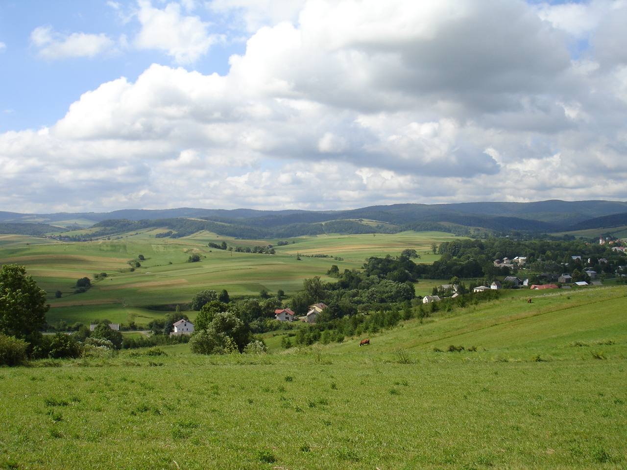
image_caption = ThePogórze Bukowskie is a hilly region (thus the name, Bukowsko hilly region) in Poland. Wola Sękowa center of village.
symbol =
symbol_type =
country = Poland
country_
state =
region = Sanok County
district = Gmina Bukowsko
municipality =
landmark =
river =
location =
elevation = 270
prominence =
lat_d =49 | lat_m =31 | lat_s =10 | lat_NS =N
long_d =22 | long_m =02 | long_s =30 | long_EW =E
highest =
highest_location = | highest_region = | highest_state =
highest_elevation =
highest_lat_d = | highest_lat_m = | highest_lat_s = | highest_lat_NS =
highest_long_d = | highest_long_m = | highest_long_s = | highest_long_EW =
lowest =
lowest_location = | lowest_region = | lowest_state =
lowest_elevation =
lowest_lat_d = | lowest_lat_m = | lowest_lat_s = | lowest_lat_NS =
lowest_long_d = | lowest_long_m = | lowest_long_s = | lowest_long_EW =
length = | length_orientation =
width = | width_orientation =
area = 8.8
area_land =
area_water =
area_urban =
area_metro =
population =220 | population_date =31 December 2002
population_urban =
population_metro =
population_density = auto
population_density_urban =
population_density_metro =
established =1493
established_type = First mentioned
date =
government =
government_location = | government_region = | government_state =
government_elevation =
government_lat_d = | government_lat_m = | government_lat_s = | government_lat_NS =
government_long_d = | government_long_m = | government_long_s = | government_long_EW =
mayor =
leader =
timezone =CET | utc_offset =+1
timezone_DST =CEST | utc_offset_DST =+2
postal_code = 38 507
area_code =
area_code_type = Phone prefix
code = KUS, RSA
code_type =Car plate
whs_name =
whs_year =
whs_number =
whs_region =
whs_criteria =
iucn_category =
free = | free_type =
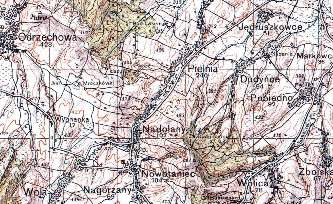
map_caption = Location of Wola (Wola Sękowa) inGmina Bukowsko
map_background =
map_locator =
map1 =
map1_caption =
map1_background =
map1_locator =
commons = Pogórze Bukowskie
statistics =
website = http://www.bukowsko.pl
footnotes =Wola Sękowa, village in East Małopolska in the Bukowsko Upland mountains,
Bukowsko rural commune, parish in Bukowsko.Zboiska is about 15 miles from
Sanok in south-west Poland. It is situated below the main watershed at the foot of the Słonne Mountain, and has an elevation of 340 metres. Situated in theSubcarpathian Voivodship (since 1999), previously inKrosno Voivodship (1975-1998) andSanok district, (10 miles east of Sanok), located near the towns ofMedzilaborce andPalota (in northeasternSlovakia ).Wola Sękowa was founded in 1493 by Bals de Lobetanz family. From 966-1018, 1340-1772 (
Ruthenian Voivodeship , Sanoker County) and during 1918-1939 Zboiska was part of Poland. While during 1772-1918 it belonged to Austrian empire, later Austrian-Hungarian empire when double monarchy was introduced in Austria. This part of Poland was controlled byAustria for almost 120years. At that time the area (including west and east ofSubcarpathian Voivodship ) was known as Galicia. In 1785 the village lands comprised 6 1 lan. In 1899 the village lands comprised 3.43 km². The church at Wola Sękowa is right on the road an easy to get to. Church was "Saint Michael" 1848. The cemetery has a few headstones in it. On April, 1946 the village was attacked by a strong unit of UPA and some buildings were burnt. Only over a dozen years after the war the village started to rebuild. The rural families are poor, agriculture is rarely profitable and low income makes it difficult for farms to invest in from improvements.Hiking trails
*
European walking route E8 Most popular surnames in the region
Surnames from 1787 Cadastral Records : Balwierczak, Bednarczyk, Białas, Biega, Biesiada, Błażyna, Bolanowski, Borkowski, Bubrowiak, Burnat, Cap, Chomik, Chrząszcz, Ciulik, Cymbrak, Czapla, Czucz, Dańko, Dębicki, Didur, Długosz, Drewnik, Dąbrowiak, Dudek, Dumnicki, Dżugan, Froń, Gebus, Germański, Gmytryk, Goliat, Gorka, Graff, Granatowski, Gula, Hlawaty, Hnat, Hnatik, Jakubaszek, Jakubowski, Jasiński, Jazoski, Kacuba, Kanonik, Kasprzyk, Katulka, Klepacki, Komar, Komarkiewicz (pedagogus), Kondyjoski, Konik, Kopacz, Korczak, Kowalczyk, Kozimor, Kozma, Krolicki, Krupianik, Leczowicz, Lenio, Luczyński, Majchrowicz, Majeski, Majka, Mazurkiewicz, Meciński, Mejza, Melnik, Meyza, Mindur, Moreńko, Morski, Musial, Muszański, Nameśniak, Naparla, Niewistka, Nycz, Orlowski, Palica, Pańkiewicz, Patrylak, Pelczar, Pflanzer, Piech, Piróg, Pisiewicz, Piskadlo, Pituch, Podgórski alias Klimek, Podowski, Poliwka, Próżny, Pstrak, Puchala (pedagogus), Rabicki, Radwański, Rajchel, Raychel, Reichel, Rodzinka, , Rozycki, nobilis, Rybczyński, Safka, Sawka, Serwoński, Siedlarski, Sikora, Siwik, Skarbowski, Skrobala, Skuczyński, Sobkoski, Solon, Sołtys, Sowa, Steliga, Sternik, Streng, Sywik, Szatkowski , Szczepański, Szczerba, Szwast, Szymański, Szypula, Terlecki, Wabicz, Walach, Wasylewicz, Watach, Wielgos or Wielgosz, Wiktor (hares bonorum Wola Sękowa, Wola Jaworowa, Nowotaniec), Wójcik, Wróbel, Zatwarnicki, Zawisza, Zdybek, Zychiewicz, Zygmunt, Żyłka, Żytka,
Time zone;
UTC+1 /SummerUTC+2 Literature
* Prof.
Adam Fastnacht . Slownik Historyczno-Geograficzny Ziemi Sanockiej w Średniowieczu (Historic-Geographic Dictionary of the Sanok District in the Middle Ages), Kraków, 2002, ISBN 83-88385-14-3.External links
* [http://www.republika.pl/uniwlud/ Wola Sekowa]
* [http://www.wolapiotrowa.chsi.pl/ Wola Piotrowa]
* [http://republika.pl/zboiska/ Caritas in Zboiska]
* [http://zamki.res.pl/ Castle in Zboiska]

Wikimedia Foundation. 2010.