- Zboiska, Sanok County
Infobox City
settlement_type = village
subdivision_type = Country
official_name = Zboiska| native_name = Zboiska| subdivision_name = Poland
image_
subdivision_type1 = Region
subdivision_name1 = Subcarpathian Voivodship
population_total = 220
area_total_km2 = 8.8
elevation_m = 250
established_date = 1361
established_title = Founded
code = 38507
latd =
latm =
latNS =
longd =
longm =
longEW =
website =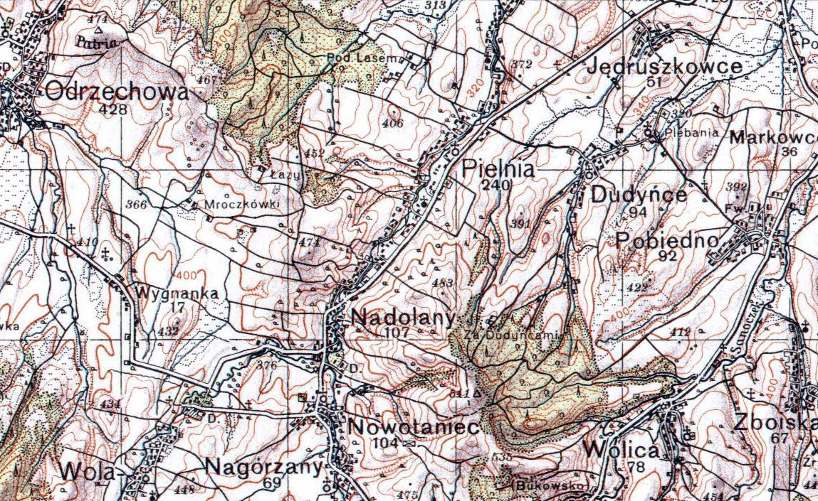
Zboiska – "Boyscza" 1361, "Boyska" 1398, "Boyschcze" 1402, "Bogiska" 1437, "Szboyska" 1539, Zboiska alias "Uhrynowce" 1676, village in East Małopolska in the Lesser Beskid mountains,
Bukowsko rural commune, parish inBukowsko .Zboiska is about 10 miles from
Sanok in south-west Polands. It is situated below the main watershed at the foot of the Słonne Mountain, and has an elevation of 340 metres. Situated in theSubcarpathian Voivodship (since 1999), previously inKrosno Voivodship (1975-1998) andSanok district, (10 miles east of Sanok).Zboiska was founded in 1361 by Bals de Lobetanz family. From 966-1018, 1340-1772 (
Ruthenian Voivodeship , Sanoker County) and during 1918-1939 Zboiska was part of Poland. While during 1772-1918 it belonged to Austrian empire, later Austrian-Hungarian empire when double monarchy was introduced in Austria. This part of Poland was controlled byAustria for almost 120years. At that time the area (including west and east ofSubcarpathian Voivodship ) was known as Galicia. In 1785 the village lands comprised 6 1 lan. There were 50 Greek Catholics, 267 Roman Catholics and 5 Jews. In 1899 the village lands comprised 3,43 km². There were 49 Greek Catholics, 431 Roman Catholics, and 10 Jews. The church at Zboiska is right on the road an easy to get to. Church was "Saint Michael" 1848 - Saints Peter & Paul". The cemetery has a few headstones in it. The rural families are poor, agriculture is rarely profitable and low income makes it difficult for farms to invest in from improvements.Most popular surnames in the region
Surnames from 1787 Cadastral Records : Bończak, Barna, Beck, Bogacz, Januk, Kozak, Klepczyk, Knieja, Kos, Krok, Macek, Lilienthal, Maciejowski, Mazur, Marosz, Modrzanski, Patała, Olejarczyk, Pendzior, Peszyński, Rakoczy, Starzecki, Petejko, Pielech, Szczurek, Tarnawczyk, Wdowiak.
There are many families with the surname "Bończak" who still live in the village. Some have emigrated to the United States and through out Europe. Several of the US families have managed to attain great wealth and are well known in the financial business circles. Also there are several members of Bończak families who have reached celebrity status in the motion picture industries in Europe and the United States.
Twin cities
*
Topoľovka
*Maizières-lès-Metz ,France External links
* [http://republika.pl/zboiska/ Caritas in Zboiskach]
* [http://zamki.res.pl/ Castle Zboiska]
Wikimedia Foundation. 2010.