- Wolica, Sanok County
Infobox City
settlement_type = Village
subdivision_type = Country
official_name = Wolica| native_name = Wolica| subdivision_name = Poland
image_
subdivision_type1 =Beskids
subdivision_name1 =Subcarpathian Voivodship
population_total = 200
area_total_km2 = 8.8
elevation_m = 250
established_date = 1361
established_title = Founded
code = 38500 (Bukowsko)
latd =
latm =
latNS =
longd =
longm =
longEW =
website =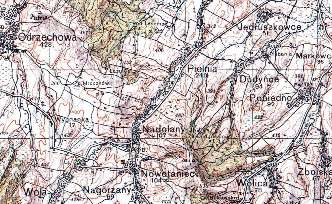
Wolica, village in East Małopolska in the Lesser Beskid mountains, located near the towns of
Medzilaborce andPalota (in northeastern Slovakia).Wolica is about 10 miles from
Sanok in south-west Poland. It is situated below the main watershed at the foot of the Słonne Mountain, and has an elevation of 340 metres. Situated in theSubcarpathian Voivodship (since 1999), previously inKrosno Voivodship (1975-1998) andSanok district, (10 miles east of Sanok),parish Bukowsko.Wolica was founded in 1361 by Bals family. From 966-1018, 1340-1772 (
Ruthenian Voivodeship ) and from 1918-1939 Wolica was part of Poland. While during 1772-1918 it belonged to Austrian empire, later Austrian-Hungarian empire when double monarchy was introduced in Austria. The village was burned down in the spring 1946 by the UPA. Some people left Wolica on April 29, 1947 (Akcja Wisla) and moved to the Gdansk area of Poland. Some people went toUkraine in 1946.Wolica has a church (R. Catholic) and outside the church there's a cemetery. The rural families are poor, agriculture is rarely profitable and low income makes it difficult for farms to invest in from improvements.Population
* 1880 - 903
* 1936 - 150
* 2001 - 200
Wikimedia Foundation. 2010.