- Cerro Arenales
-
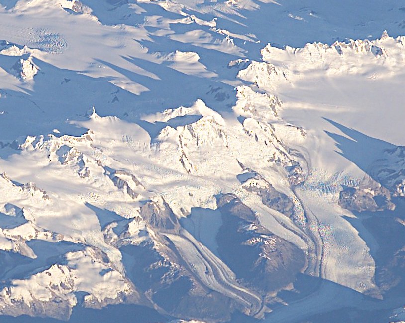
Cerro Arenales 
The pyramidal Cerro Arenales can be seen in the center of this NASA image.Elevation 3,437 m (11,276 ft) [1] Location Location Chile Range Andes Coordinates 47°12′S 73°29′W / 47.2°S 73.483°W[1] Geology Type Stratovolcano Volcanic arc/belt South Volcanic Zone Last eruption 1979[1] Climbing First ascent 1958 by Tanaka and party Cerro Arenales is a heavily ice-covered stratovolcano located in the Aisén Region of Chile, within Laguna San Rafael National Park. It towers over the southern part of the Northern Patagonian Ice Field.
The first ascent of Cerro Arenales was made in 1958 by a Japanese-Chilean expedition, headed by Professor Tanaka. In December 1963 an expedition led by Eric Shipton, crossed the NPIF heading southeast from Laguna San Rafael to Río de la Colonia and accomplished on the way the second ascent. [2]
See also
References
- ^ a b c "Cerro Arenales". Global Volcanism Program, Smithsonian Institution. http://www.volcano.si.edu/world/volcano.cfm?vnum=1508-059. Retrieved 2006-10-21.
- ^ USGS. "P 1386-I -- Chile and Argentina - Wet Andes". http://pubs.usgs.gov/pp/p1386i/chile-arg/wet/index.html. Retrieved 2007-02-19.
Andean volcanoes Northern Volcanic Zone (6° N–3° S) Nevado del Ruiz · Nevado del Huila · Galeras · Cayambe · Reventador · Pichincha · Antisana · Illiniza · Cotopaxi · Quilotoa · Tungurahua · SangayCentral Volcanic Zone (15°–27° S) Ampato · Coropuna · Sabancaya · Chachani · El Misti · Ubinas · Huaynaputina · Parinacota · Irruputuncu · Azufre · Sairecabur · Pacana · Licancabur · Lascar · Llullaillaco · Galán · San Francisco · Ojos del SaladoSouthern Volcanic Zone (33°–46° S) Tupungato · Tupungatito · Maipo · Calabozos · Descabezado Grande · Cerro Azul · Nevado de Longaví · Nevados de Chillán · Antuco · Copahue · Callaqui · Lonquimay · Llaima · Sollipulli · Villarrica · Quetrupillán · Lanín · Mocho-Choshuenco · Carrán-Los Venados · Puyehue-Cordón Caulle · Osorno · Calbuco · Hornopirén · Michinmahuida · Chaitén · Corcovado · Cay · Macá · HudsonAustral Volcanic Zone (49°–55° S) Note: volcanoes are ordered by latitude from north to south Categories:- Volcanoes of Aisén Region
- Active volcanoes
- Stratovolcanoes of Chile
- Mountains of Chile
- Aisén Region geography stubs
Wikimedia Foundation. 2010.