- Chieveley
-
Coordinates: 51°27′40″N 1°19′08″W / 51.461°N 1.319°W
Chieveley 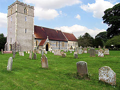
St Mary's Church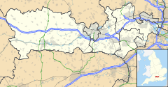
 Chieveley
Chieveley shown within BerkshirePopulation 1,481 (2001) OS grid reference SU474738 Parish Chieveley Unitary authority West Berkshire Ceremonial county Berkshire Region South East Country England Sovereign state United Kingdom Post town Newbury Postcode district RG20 Dialling code 01635 Police Thames Valley Fire Royal Berkshire Ambulance South Central EU Parliament South East England UK Parliament Newbury Website MyChieveley.co.uk List of places: UK • England • Berkshire Chieveley is a village and civil parish about 4 miles (6.4 km) north of Newbury in Berkshire, close to the M4 motorway and A34 road.
Contents
Character
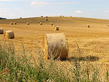 Harvested Land on Grange Farm
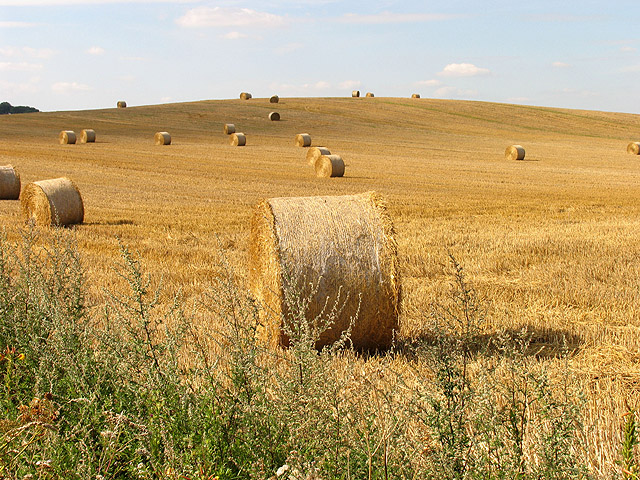
Chieveley is a village of 1,481 people (2001 census) and 508 households. A map of 1877 stated the area at the time to be roughly 5,328.189 acres (21.56242 km2). Chieveley Service Station serves Junction 13 of the M4 motorway.
The landscape is of gently rolling chalk hills. The land is predominantly arable with some dairy, sheep and pigs. There is a healthy quantity of woodland and abundant wildlife. There is a network of green lanes and footpaths that afford good walking.
The civil parish consists of the villages of Chieveley and Curridge and the hamlets of Downend, Oare and Snelsmore Common. The original parish also included Leckhampstead and Winterbourne. The structure has been much affected by roads. The M4 passes east-west through the middle of the parish and has done much to cut Curridge and Oare from Chieveley. This was opened in 1971. The A34 running north-south quarters the parish. Its path has moved several times, the most recent development being a change to Junction 13 that opened in Autumn 2004.
The landscape is dominated by farming. There are currently three working farms in the parish. Other industries include a garden centre, land-fill site, hotels, baker and many small businesses.
History
There is ancient civilisation nearby that indicates early settlement. The parish boasts a fine Iron Age hill fort in Snelsmore, called Bussock Camp. This is in private grounds but is visible in May when they are opened to the public to view the fine display of bluebells.
The name Chieveley is said to be derived from 'Field of Chives'. The WI's 'Berkshire Book' assures the reader that chives were noted in the area as far back as 951. This is the same year that King Edred gave the village to his bailiff, Wulf.
The Domesday Book of 1086 says this of Chieveley (source: The National Archives):
- In Rowbury Hundred
- The abbey itself holds Chieveley. It has always held it. TRE (in the reign of King Edward) it was assessed at 27 hides; now at 7½ hides. There is land for 20 ploughs. In demesne are 3 ploughs; and 28 villains and 10 bordars with 18 ploughs. There are 3 slaves, and 4 acres (16,000 m2) of meadow, [and] woodland for 60 pigs. Of this land William holds of the abbot 5 hides, and Godfrey 1½ hides, and there is 1 plough, with 3 villains and 2 bordars having 1 plough, and 3 acres (12,000 m2) of meadow. The whole, TRE and afterwards, was worth 12l; now the abbot's portion [is worth] 10l; [that] of his men 50s.
This text is a structured shorthand tax assessment.
In August 1207, King John seems to have had a good few days' hunting in West Berkshire. He is reported in Curridge on the 3rd and Chieveley on the 5th.
The first vicar of Chieveley was Elias, appointed in 1154. It is likely that there was a Saxon church before it was replaced by the Normans and later the Victorians. Chieveley parish registers start on 10 April 1560. There are still several families in the area who were recorded in those annals.
Chieveley once had its own maypole, on the site now occupied by Maypole Cottage (on the corner of the High Street and Church Lane).
Famous people
- Robert Goff, Baron Goff of Chieveley, Lord of Appeal in Ordinary
- the mother of Lord Chief Justice Holt came from Chieveley.
References
- Much of the text for this page was originally taken, with permission, from MyChieveley.co.uk.
External links
 Media related to Chieveley at Wikimedia CommonsCategories:
- Villages in Berkshire
- West Berkshire
- Civil parishes in Berkshire
- M4 corridor
- Places in Berkshire listed in the Domesday Book


Wikimedia Foundation. 2010.