- Mount Hotham Airport
-
Mount Hotham Airport 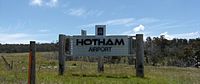
IATA: MHU – ICAO: YHOT Location of airport in Victoria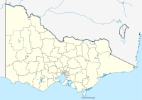
 MHU
MHUSummary Airport type Public Operator Mount Hotham Skiing Company Location Bright, Victoria Elevation AMSL 4,260 ft / 1,298 m Coordinates 37°02′51″S 147°20′03″E / 37.0475°S 147.33417°E Runways Direction Length Surface ft m 11/29 4,762 1,451 Asphalt Mount Hotham Airport (IATA: MHU, ICAO: YHOT) is a small Australian regional airport, which serves the Victorian ski resort of Mount Hotham. The airport opened in 2000, and it is Australia's highest-altitude airport.
Contents
Airlines and destinations
Airlines Destinations Qantas operated by QantasLink Seasonal: Sydney Incidents and accidents
On July 8, 2005, a Piper PA-31-350 Navajo Chieftain charter plane crashed into terrain while attempting to make a landing at the airport, killing the pilot and two passengers. Fragments of the aircraft were said to have dropped on the ground at the nearby alpine community of Cobungra.[1]
References
- ^ "Aviation Safety Investigation Report 200503265 - Collision with terrain, Piper PA-31-350 VH-OAO at Mt Hotham". Australian Transport Safety Bureau, Department of Transport and Regional Services, Government of Australia. https://www.atsb.gov.au/publications/investigation_reports/2005/AAIR/aair200503265.aspx. Retrieved 2007-06-09.
External links
- Airport information for YHOT at World Aero Data. Data current as of October 2006.
Categories:- Airports in Victoria (Australia)
- Australian airport stubs


Wikimedia Foundation. 2010.