- Merimbula Airport
-
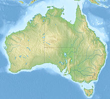
Merimbula Airport IATA: MIM – ICAO: YMER Summary Airport type Public Operator Airport Agencies Pty. Ltd. Serves Merimbula, New South Wales, Australia Elevation AMSL 7 ft / 2 m Coordinates 36°54.5′S 149°54.1′E / 36.9083°S 149.9017°ECoordinates: 36°54.5′S 149°54.1′E / 36.9083°S 149.9017°E Website Map Location of airport in Australia Runways Direction Length Surface m ft 03/21 1,602 5,256 Asphalt Sources: Australian AIP,[1] DAFIF[2][3] Merimbula Airport (IATA: MIM, ICAO: YMER) is an airport serving Merimbula, New South Wales, Australia.[1][4] It is located 1 nautical mile (2 km) south of Merimbula and operated by Airport Agencies Pty. Ltd.[1]
Contents
Facilities
The airport resides at an elevation of 7 feet (2 m) above mean sea level. It has one runway designated 03/21 with an asphalt surface measuring 1,602 by 30 metres (5,256 × 98 ft).[2]
Airlines and destinations
- Regional Express (Melbourne, Moruya, Sydney) [5]
- Merimbula Air Services offers charter flights from the airport.[6]
- Air Sapphire offers scenic, whale watching and charter flights from the airport.[7]
Statistics
Merimbula Airport was ranked 59th in Australia for the number of revenue passengers served in financial year 2009-2010.[8]
Annual passenger and aircraft statistics for Merimbula Airport[8] Year Revenue passengers Aircraft movements 2001-02 20,1942,2812002-03 22,0572,6332003-04 34,7942,6642004-05 49,2342,7542005-06 57,7323,0042006-07 64,8812,9562007-08 63,9042,9122008-09 54,7182,8112009-10 52,2102,791See also
References
- ^ a b c YMER – MERIMBULA (PDF). AIP En Route Supplement from Airservices Australia, effective 25 August 2011
- ^ a b Airport information for YMER from DAFIF (effective October 2006)
- ^ Airport information for MIM at Great Circle Mapper. Source: DAFIF (effective Oct. 2006).
- ^ Merimbula Airport website
- ^ Regional Express
- ^ Merimbula Air Services
- ^ Air Sapphire
- ^ a b "Airport Traffic Data 1985-86 to 2009-10". Bureau of Infrastructure, Transport and Regional Economics (BITRE). June 2010. http://www.bitre.gov.au/info.aspx?ResourceId=191&NodeId=96. Retrieved 29 July 2011.
External links
Albury • Armidale • Ballina • Bankstown • Bathurst • Belmont • Bourke • Broken Hill • Camden • Cessnock • Cobar • Coffs Harbour • Cooma • Coonabarabran • Coonamble • Corowa • Deniliquin • Dubbo • Evans Head • Goulburn • Grafton • Griffith • Hay • Illawarra • Inverell • Lightning Ridge • Lismore • Lord Howe Island • Merimbula • Moree • Moruya • Mudgee • Narrabri • Narrandera • Newcastle • Nyngan • Orange • Palm Beach • Parkes • Port Macquarie • Tamworth • Taree • Temora • Wagga Wagga • Walgett • West Wyalong • Warnervale • YoungThis lists all airports classed as regional in New South Wales including those without scheduled passenger services. Categories:- Airports in New South Wales
- South Coast, New South Wales
- Australian airport stubs
Wikimedia Foundation. 2010.

