- Orange Airport
-
Orange Airport IATA: OAG – ICAO: YORG Summary Airport type Public Operator Orange City Council Serves Orange, New South Wales, Australia Location Huntley / Spring Hill Elevation AMSL 3,115 ft / 949 m Coordinates 33°22.9′S 149°08.0′E / 33.3817°S 149.133°ECoordinates: 33°22.9′S 149°08.0′E / 33.3817°S 149.133°E Map Location of airport in Australia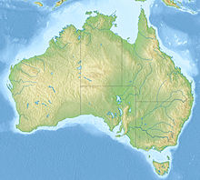
 YORG
YORGRunways Direction Length Surface m ft 11/29 1,676 5,499 Asphalt 04/22 783 2,569 Grassed red clay Sources: Australian AIP,[1] DAFIF[2][3] Orange Airport (IATA: OAG, ICAO: YORG) is located in the Central Tablelands region of New South Wales servicing the city of Orange[1] and the towns of Blayney and Cowra. It is located in the area known as Huntley, near Spring Hill and approximately 11 kilometres (6 NM) from Orange CBD.
Contents
Facilities
The airport resides at an elevation of 3,115 feet (949 m) above mean sea level. It has two runways: 11/29 with an asphalt surface measuring 1,676 by 30 metres (5,499 × 98 ft) and 04/22 with a grassed red clay surface measuring 783 by 30 metres (2,569 × 98 ft).[1][2]
Airlines and destinations
Regional Express Airlines (REX) operates four return flights to Sydney weekdays, and two return services each Saturday and Sunday, using Saab 340 aircraft.
Statistics
Orange Airport was ranked 57th in Australia for the number of revenue passengers served in financial year 2009-2010.[4]
Annual passenger and aircraft statistics for Orange[4] Year Revenue passengers Aircraft movements 2001-02 38,8203,0862002-03 37,8562,5972003-04 48,9452,3812004-05 57,2942,5122005-06 56,5762,5282006-07 58,2522,5192007-08 60,7362,5682008-09 54,5602,4682009-10 53,3792,308See also
References
- ^ a b c YORG – ORANGE (PDF). AIP En Route Supplement from Airservices Australia, effective 25 August 2011
- ^ a b Airport information for YORG from DAFIF (effective October 2006)
- ^ Airport information for OAG at Great Circle Mapper. Source: DAFIF (effective Oct. 2006).
- ^ a b "Airport Traffic Data 1985-86 to 2009-10". Bureau of Infrastructure, Transport and Regional Economics (BITRE). June 2010. http://www.bitre.gov.au/info.aspx?ResourceId=191&NodeId=96. Retrieved 29 July 2011.
External links
Albury • Armidale • Ballina • Bankstown • Bathurst • Belmont • Bourke • Broken Hill • Camden • Cessnock • Cobar • Coffs Harbour • Cooma • Coonabarabran • Coonamble • Corowa • Deniliquin • Dubbo • Evans Head • Goulburn • Grafton • Griffith • Hay • Illawarra • Inverell • Lightning Ridge • Lismore • Lord Howe Island • Merimbula • Moree • Moruya • Mudgee • Narrabri • Narrandera • Newcastle • Nyngan • Orange • Palm Beach • Parkes • Port Macquarie • Tamworth • Taree • Temora • Wagga Wagga • Walgett • West Wyalong • Warnervale • YoungThis lists all airports classed as regional in New South Wales including those without scheduled passenger services. Categories:- Airports in New South Wales
- Australian airport stubs

Wikimedia Foundation. 2010.