- Cowra
-
Cowra
New South Wales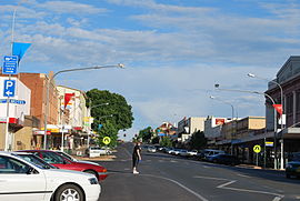
Main street of Cowra
 Cowra
CowraPopulation: 8,430[1] Established: 1849 Postcode: 2794 Coordinates: 33°49′59″S 148°40′59″E / 33.83306°S 148.68306°ECoordinates: 33°49′59″S 148°40′59″E / 33.83306°S 148.68306°E Elevation: 310 m (1,017 ft) Location: LGA: Cowra Shire County: Forbes, Bathurst State District: Burrinjuck Federal Division: Hume Mean max temp Mean min temp Annual rainfall 22.1 °C
72 °F10.0 °C
50 °F626.3 mm
24.7 inCowra is a town in the Central West region of New South Wales, Australia in the Cowra Shire. It is located on the Mid-Western Highway, 317 kilometres west of Sydney on the banks of the Lachlan River at an altitude of 310 metres above sea level. At the 2006 census Cowra had a population of 8,430 people.[1]
Contents
History
The area was originally inhabited by the Wiradjuri people. The first white explorer, George Wilson Evans, entered the Lachlan Valley in 1815. He named the area the Oxley Plains after his superior the surveyor-general, John Oxley. In 1817 he deemed the area "unfit for white settlement". A military depot was established not long after at Soldiers Flat near present day Billimari. Arthur Ranken and James Sloan, from Bathurst, were amongst the first white settlers on the Lachlan. They moved to the area in 1831.
The township of "Coura Rocks" had its beginnings in 1844. Around 1847, the township site became known as Cowra, and in 1849, was proclaimed a village.[6]
The origin of the town's name is unclear.[7] Sources claim that the name is aboriginal for "rocks",[8] although the local Wiradjuri language has no words for "rocks".[7]
In the 1850s the many gold prospectors passed through headed for gold fields at Lambing Flat (Young) and Grenfell. The first school was established in 1857. The first bridge over the Lachlan River was built in 1870. Gold was discovered at Mount McDonald in the 1880s. The rail head, from Sydney, reached Cowra in 1886. Local government was granted in 1888. The first telephone exchange was established in 1901. The town water supply was established in 1909, the gasworks in 1912 and town supplied electricity was introduced in 1924.
In 1922, a young Sir Charles Kingsford Smith flew under the Cowra Traffic Bridge with local man Ken Richards. The pair also attempted to fly under the railway bridge but Richards noticed telephone lines seconds before the attempt and they were able to pull the aircraft up and away from danger.[9]
Cowra is home to the Australian replica of the UN's World Peace Bell, an honour normally reserved for a nation's capital city, it was awarded to Cowra in recognition of its unique contribution to international understanding, promotion of peace and as a centre of world friendship.
Cowra also hosts an annual Festival of International Understanding, featuring street stalls, parades and events showcasing a particular foreign culture.[10] This year's event took place between the 10-13 March and focused on Turkey.
The Cowra breakout
During World War II Cowra was the site of a prisoner of war (POW) camp. Most of the detainees were captured Japanese and Italian military personnel, On 5 August 1944, at least 545 Japanese POWs attempted a mass breakout from the camp. Simultaneously, other Japanese prisoners committed suicide, or were killed by their countrymen, inside the camp.
The actions of the POWs in storming machine gun posts, armed only with improvised weapons, showed what Prime Minister John Curtin described as a "suicidal disregard of life", and had no chance of success.
During the breakout and subsequent recapture of POWs, four Australian guards and 231 Japanese died, and 108 prisoners were wounded. The dead Japanese were buried in Cowra in the specially created Japanese War Cemetery. This is the only such cemetery in Australia, and also holds some of the dead from the WWII air raids on Darwin.
An Avenue of Honour also commemorates those who died in World War I.
Climate
Cowra has a warm temperate climate with hot summers and cool winters.[citation needed]
Climate data for Cowra Month Jan Feb Mar Apr May Jun Jul Aug Sep Oct Nov Dec Year Average high °C (°F) 31.3
(88.3)30.4
(86.7)27.4
(81.3)22.5
(72.5)17.6
(63.7)13.9
(57.0)13.0
(55.4)14.7
(58.5)17.9
(64.2)21.9
(71.4)25.6
(78.1)29.4
(84.9)22.1 Average low °C (°F) 16.6
(61.9)16.6
(61.9)14.0
(57.2)10.2
(50.4)7.1
(44.8)4.8
(40.6)3.7
(38.7)4.6
(40.3)6.5
(43.7)9.2
(48.6)11.8
(53.2)14.6
(58.3)10.0 Precipitation mm (inches) 64.4
(2.535)53.1
(2.091)46.4
(1.827)42.4
(1.669)47.7
(1.878)45.6
(1.795)52.0
(2.047)51.4
(2.024)51.6
(2.031)60.9
(2.398)55.8
(2.197)55.2
(2.173)626.3
(24.657)Source: [11] Suburbs
The main suburbs of Cowra are; Cowra CBD, North Cowra, West Cowra, Taragala and Mulyan.
Education
Primary Schools
- Cowra Public
- Mulyan Public School
- Holman Place Public School
- St Raphaels Central School (K-10)
- Holmwood Public School
Secondary Schools
- Cowra High School (7-12)
- St Raphaels Central School (7-10)
Tertiary Education
A campus of TAFE is also located in Cowra.
Media
Broadcast radio from the following radio stations can be received in Cowra
- Rocky FM 99.5 FM
- Star FM 105.9 FM
- 2GZ FM 105.1 FM
- ABC Classic FM 102.7 FM
- ABC Radio National 104.3 FM
- Triple J (2JJJ) 101.9 FM
- ABC Local Radio 549 AM
Broadcast television from the ABC, SBS and affiliates of the Nine, Seven and Ten networks can be received in and nearby Cowra.
Subscription television service Austar is available in Cowra and the surrounding region via satellite and MMDS transmission.
The local newspaper is the Cowra Guardian
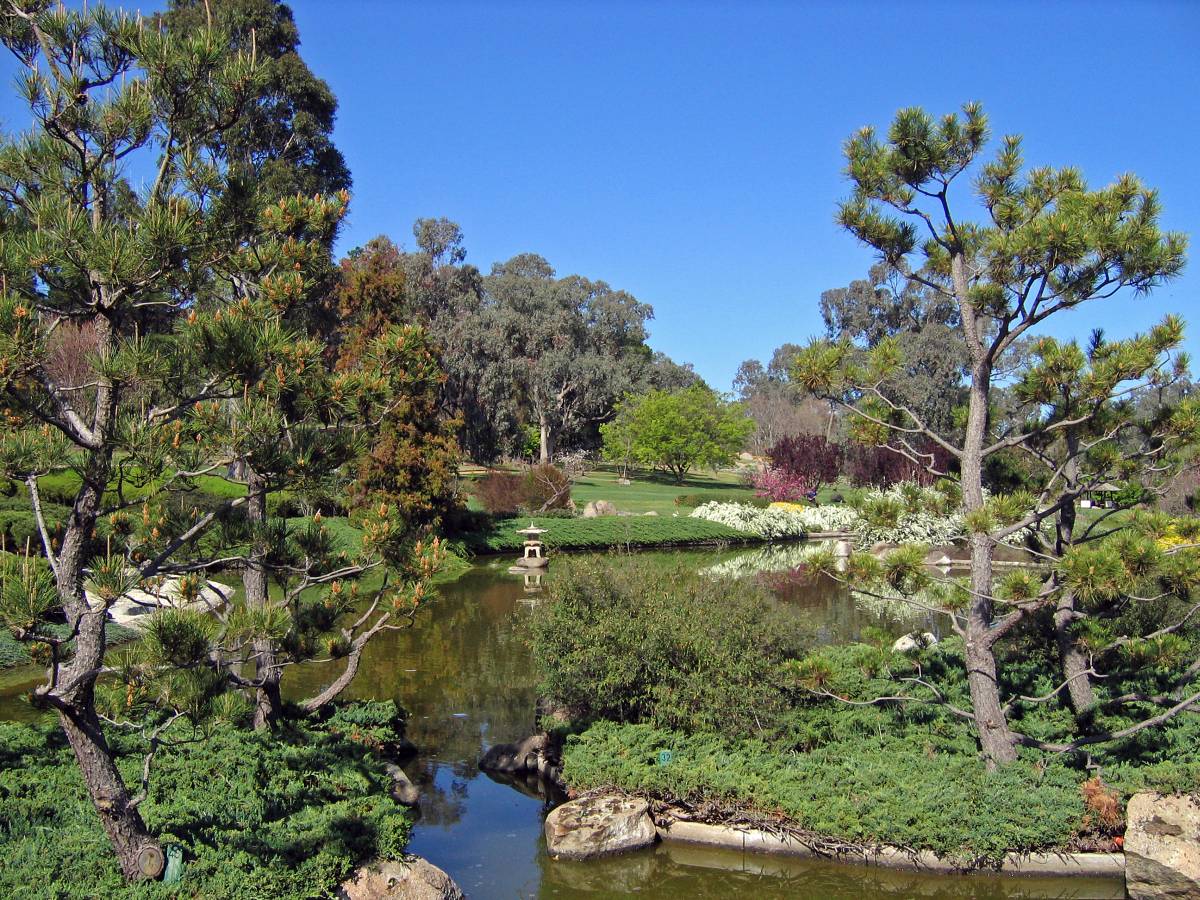
Japanese War Cemetery and Garden
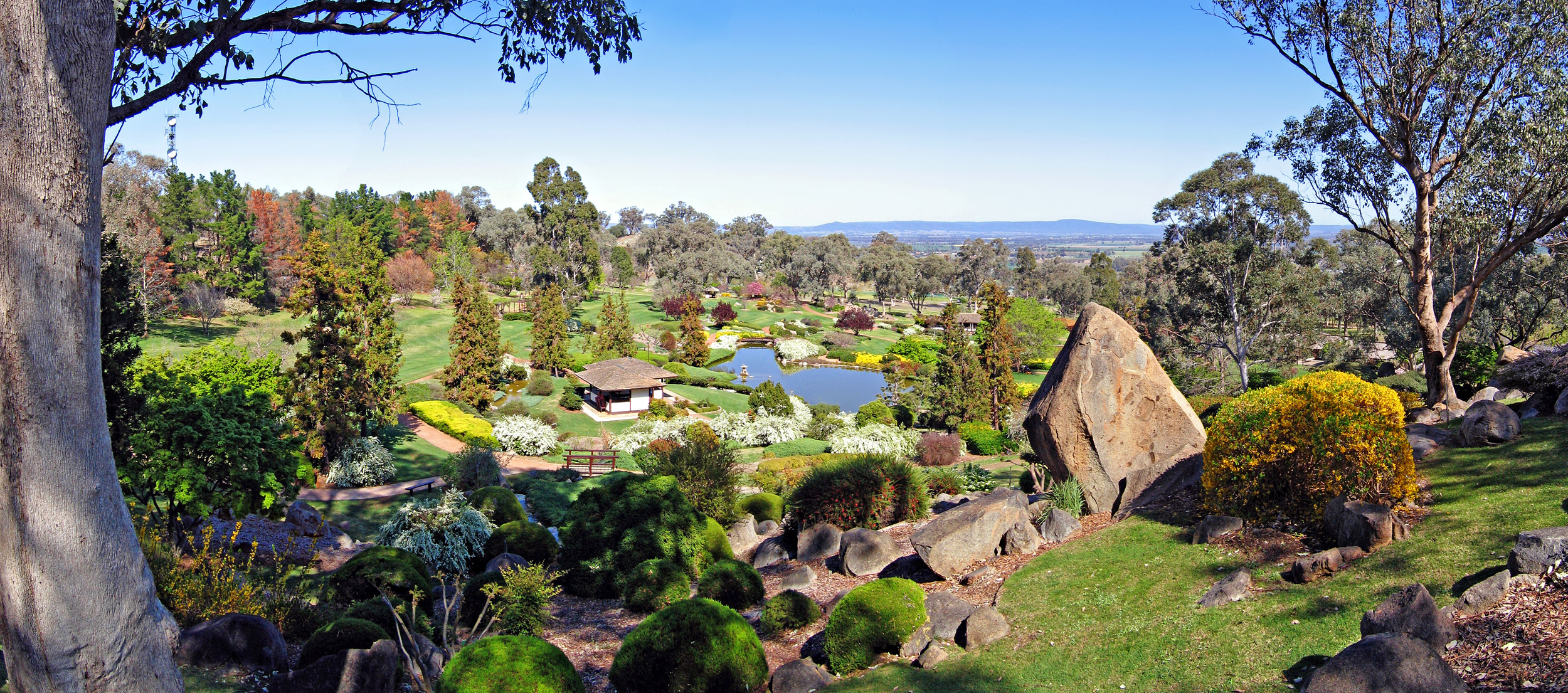
The Japanese War Cemetery holding the dead from the Cowra Breakout was tended to after WWII by members of the Cowra RSL and ceded to Japan in 1963. In 1971 the Cowra Tourism Development decided to celebrate this link to Japan, and proposed a Japanese Garden for the town. The Japanese government agreed to support this development as a sign of thanks for the respectful treatment of their war dead; the development also received funding from the Australian government and private entities.
The garden was designed by Ken Nakajima (1914–2000), a world-renowned designer of Japanese gardens at the time. The first stage was opened in 1979, with a second stage opened in 1986.
The gardens were designed in the style of the Edo period and are a kaiyū-shiki or strolling garden. They are designed to show all of the landscape types of Japan. At five hectares (12 acres), the Cowra Japanese Garden is the largest Japanese garden in the Southern Hemisphere. An annual Sakura Matsuri (cherry blossom festival) is a major event in Cowra's tourism calendar and is held in the gardens during September. The festival celebrates the birth of spring. It attracts performers from across Australia and around the world. Locals, Australian and International visitors alike have the opportunity to experience traditional elements of Japanese culture. Sakura at the Cowra Japanese Garden is celebrated annually when the cherry blossoms are at their peak. In 2011 the main festival date will be held on Saturday, 24 September.

 Looking across the lake to the teahouse
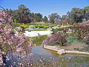 Lower lake with spring blossoms
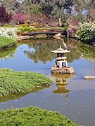 An egret rests on a stone lantern in the upper lake
Sporting clubs
- Cowra Eagles are a rugby union team playing in the Central West Rugby Union competition.
- Cowra Magpies are a rugby league team playing in the Group 10 competition.
- Cowra Blues are an Australian rules football team playing in the Central West AFL competition.
- Cowra Eagles are a soccer club playing in the Bathurst District Soccer Senior Mens (1st Grade) competition.
Recent events
Cowra hosted Triple J's One Night Stand Concert on 20 April 2007 with Silverchair leading a lineup of Behind Crimson Eyes, Midnight Juggernauts, and Funktrust, supported by Unearthed competition winners Flatline Drama.
In April 2006, the local abattoir retrenched 29 workers and rehired them the next day at a lower rate. This was just days after the Federal Government's industrial relations reforms, WorkChoices, were put in place, and the action attracted national media attention as one of the first employer actions under this new legislation. The workers were later reinstated at the old rate after pressure from all sides of Australian politics and media.[12] This abattoir later closed down in August 2006. It was reopened in March 2007 and is now operated by Breakout River Meats and produces beef, lamb, pork and goat meat.
References
- ^ a b Australian Bureau of Statistics (25 October 2007). "Cowra (Urban Centre/Locality)". 2006 Census QuickStats. http://www.censusdata.abs.gov.au/ABSNavigation/prenav/LocationSearch?collection=Census&period=2006&areacode=UCL123200&producttype=QuickStats&breadcrumb=PL&action=401. Retrieved 2009-09-11.
- ^ "Great Circle Distance between ORANGE and COWRA". Geosciences Australia website. Commonwealth of Australia. http://www.ga.gov.au/bin/distancedraw2?rec1=108333&placename=cowra&placetype=0&state=0&place1=ORANGE&place1long=149.101196&place1lat=-33.281799. Retrieved 16 August 2011.
- ^ "Great Circle Distance between BATHURST and COWRA". Geosciences Australia website. Commonwealth of Australia. http://www.ga.gov.au/bin/distancedraw2?rec1=108333&placename=cowra&placetype=0&state=0&place1=BATHURST&place1long=149.580704&place1lat=-33.416801. Retrieved 16 August 2011.
- ^ "Great Circle Distance between CANBERRA and COWRA". Geosciences Australia website. Commonwealth of Australia. http://www.ga.gov.au/bin/distancedraw2?rec1=108333&placename=cowra&placetype=0&state=0&place1=CANBERRA&place1long=149.133331&place1lat=-35.299999. Retrieved 16 August 2011.
- ^ "Great Circle Distance between SYDNEY and COWRA". Geosciences Australia website. Commonwealth of Australia. http://www.ga.gov.au/bin/distancedraw2?rec1=108333&placename=cowra&placetype=0&state=NSW&place1=SYDNEY&place1long=151.209595&place1lat=-33.873199. Retrieved 16 August 2011.
- ^ "Cowra". Sydney Morning Herald Travel. smh.com.au. http://www.smh.com.au/news/New-South-Wales/Cowra/2005/02/17/1108500193420.html. Retrieved 24 October 2011.
- ^ a b "Geographical Names Register Extract - Cowra". Geographical Names Register. Geographical Names Board of New South Wales. http://www.gnb.nsw.gov.au/name_search/extract?id=JPckXtKman. Retrieved 9 March 2011.
- ^ 185386 "PLACE NAMES.". The Australian Women's Weekly (1932-1982) (1932-1982: National Library of Australia): p. 61. 13 May 1964. http://nla.gov.au/nla.news-article55 185386. Retrieved 22 February 2011.
- ^ "Kingsford Smith flies under the Cowra traffic bridge". Cowra Tourism Corporation. February 2011. http://www.cowratourism.com.au/Experience_Cowra/History/Kingsford_Smith_Flight/. Retrieved 4 February 2011.
- ^ "Festival of International Understanding". Australian Broadcasting Corproation Central West NSW. 2010. http://www2b.abc.net.au/EventCentral/View/event.aspx?p=25&e=4380450. Retrieved 23 November 2010.
- ^ "Climate in Cowra". Bureau of Meteorology. http://www.bom.gov.au/climate/averages/tables/cw_063023.shtml.
- ^ Norington, Brad (3 June 2006). "Hard labour ahead". Features (The Australian). http://www.theaustralian.news.com.au/story/0,20867,19342116-28737,00.html. Retrieved 2006-06-21.[dead link]
External links
Categories:- Towns in New South Wales
- Towns in the Central West, New South Wales


Wikimedia Foundation. 2010.